

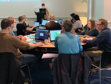
About the session
Do you want to improve your skills, knowledge and confidence in data analysis and statistics?
This three hour session run by the Field Studies Council (in partnership with the Royal Geographical Society) will cover a range of descriptive and statistical techniques to improve your delivery, with practical support and ideas to use with students.
Course Outline:
- Introduction to the importance of data analysis in geography.
- Brief overview of some differential analysis techniques e.g. range, central tendencies, and dispersion.
- Purpose of statistical analysis and how to choose the correct statistical analysis for different data types.
- Worked example of one test (student’s t-test).
- Opportunity to try any of the following tests through self-led worked examples, including Mann-Whitney U test, Chi-squared test, and Spearman’s Rank correlation coefficient.
- Round up of how to include more data analysis in your curriculum.
- Promotion of Field Studies Council courses and resources.
Spaces are limited to 20 teachers. Refreshments will be provided.
Royal Geographical Society (with IBG), 1 Kensington Gore, London, SW7 2AR
Making a booking
Making a booking on behalf of someone else
- Select group booking
- Additional attendees: insert number of people you want to book on behalf of
- Under group booking section:
- Are you personally attending this event? * NO
- Are you the organiser of the group? * YES
- Do you know the details of other attendee(s)? * YES
- Additional attendees – fill in details of the person/people you are booking on behalf of and click ‘Add’
- Click ‘Next’ once all additional attendee details have been added
- In your basket will be the tickets for the event. Proceed to checkout once you have added all the events you would like to book for.
- Workshop

Professional insights: mentoring
Mentors are invaluable sources of advice, guidance and support and are often suggested to support career development at all stages of professional development.
Open to allTuesday 21 May 2024 - Workshop
Going further with GIS - Manchester Metropolitan University
Please note this event has now been cancelled. Apologies for any inconvenience caused. This event is for teachers who have completed the Teach with GIS one-day CPD course and wish to further develop their knowledge and skills. Anyone who has previously attended Teach with GIS may sign up.
Open to allWednesday 22 May 2024 - Webinar

Geography in practice: analysing the Ethnic Group Deprivation Index
This second session on the Ethnic Group Deprivation Index (EGDI), includes a description of its creation, a demonstration of how the data can be used to understand ethnic inequalities in local areas, and hands on training on how to use the index.
Open to allWednesday 22 May 2024