
King’s College London (KCL) researchers have developed two open-access and user-friendly spatial policy support systems, WaterWorld and Co$tingNature, to analyse the various trade-offs between productive and protected land-use options. These tools have helped international conservation and development organisations – including Conservation International, UNEP’s World Conservation Monitoring Centre and the Inter-American Development Bank – support a range of governments, NGOs and businesses in their land-use decision-making and conservation investments.
Issue
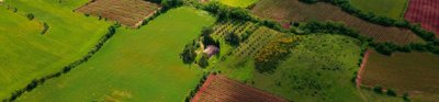
Since 2010, human population has increased by almost a billion, while terrestrial protected areas have increased globally from 17.5 million km2 to 29 million km2 under the UN Convention on Biological Diversity. These trends are leading to increasing pressures on land for agricultural, urban and extractive uses (such as mining and forestry) and nature conservation.
Incorporating environmental and ecological spatial data into land-use policy is critical to all high-profile sustainable development decisions. While good quality global data are now available on everything from population density to precipitation and deforestation, these are large-scale, and often complex datasets that need to be integrated and synthesised to be accessible to policymakers and the highly-specific decisions they make.
Approach
KCL research has developed two state-of-the-art spatial policy support systems, WaterWorld and Co$tingNature, that are user-friendly and freely-available as web-based tools. These combine spatial data with new models to produce local- to national-scale digital maps and analyses for any country or region. WaterWorld provides policy support for managing land to improve water resources, and Co$tingNature provides support for prioritising investments in nature conservation.
Both tools were developed through a series of competitively-funded EC and UKRI research projects.
Impact
WaterWorld and Co$tingNature have helped make complex spatial planning concepts and data sets easily accessible through a user-friendly and free online platform to support more effective land-use planning.
The tools have been used by more than 3500 organisations, including government, commercial and international organisations, as well as the non-governmental sector, across over 183 countries. The tools are now included in key sector and industry toolkits for example those of the World Business Council on Sustainable Development.
The international NGO Conservation International has used Co$tingNature to highlight the hitherto unrecognised (and hence unvalued) ecosystem services provided by existing protected areas.
More information
Institution: King's College London
Researcher: Professor Mark Mulligan
Share this resource
This is an open access article under the terms of the Creative Commons Attribution License (CC BY NC 4.0), which permits use, adaptation, distribution and reproduction in any medium or format, provided the original work is cited and it is for non-commercial purposes. Please contact us for other uses.
How to cite
Royal Geographical Society (with IBG) (2023) Spatial policy support systems. Available at https://rgs.org/spatialpolicysupportsystems Last accessed on: <date>