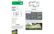
Mapping home
The Mapping home strand of the Stay Home Stories Project invites children and young people to map their home spaces. The project aims to:
-
explore how children and young people (aged 7-16) understand, renegotiate and articulate meanings of home as a result of repeated lock downs
-
encourage an engagement with changing sense of place and use hand drawn mapping as a tool for supporting children and young people in creating knowledge of their unique experiential expertise, inscribing their experiences of home on to paper
To get involved in the project please contact Jacqueline.Waldock@liverpool.ac.uk or visit Mapping home to access resources and instructions.
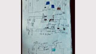
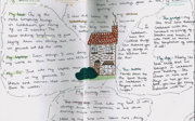
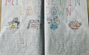
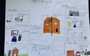
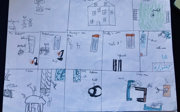
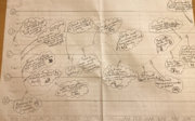
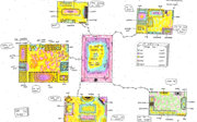
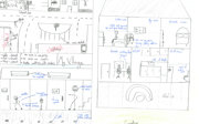
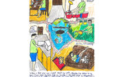
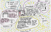
We’ve been delighted to receive so many different types and styles of maps and we’d like to say thank you to the children and young people who’ve taken part so far.
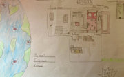
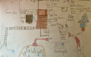
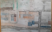
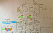
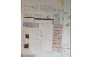
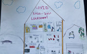
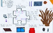
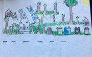
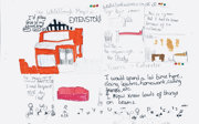
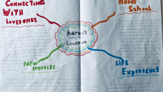
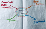
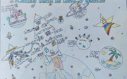
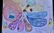
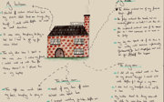
The gallery below shows a selection of their maps which illustrate a range of emerging themes and represents a cross section of the maps we have received so far from pupils in Key Stages 2 and 3. They highlight the variety of approaches taken and the creativity of responses we have received. From simple outlines of spaces to artistically and philosophically intricate representations of experience, every map has brought a personal and important aspect to the project.
The gallery has been divided in to themes which can be explored below.
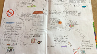
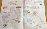
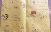
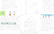
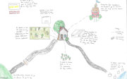
Mobility: Micro-scale of mobility in the home
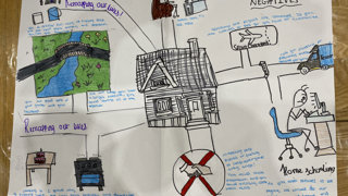
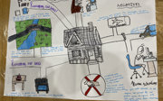
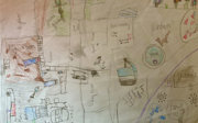
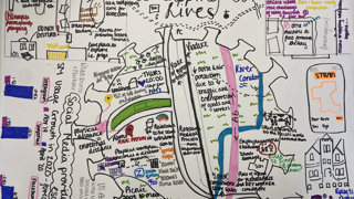
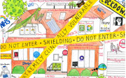
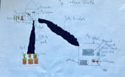
Maps of home drawn by children during the pandemic, showed stark boundaries, thick lines delineating safe and unsafe spaces. Sites of familiarity, and in some cases autonomy, such as cinemas, friend’s houses, grand-parents' homes and swimming pools were covered by crosses or scattered with cartoon viruses. These boundaries also articulate a restricted mobility, a remembering of places that were no longer able to be a part of children and young peoples’ quotidian rituals- schools, buses, streets, and parks that were out of reach due to exercise and travel restrictions. However, these sketches also highlighted the increased awareness, mobility, and sense of ownership that children and young people developed over their home space and the value they placed on access to green space.
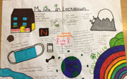


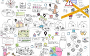

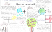
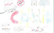
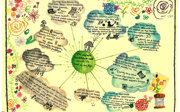
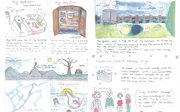
Emotion: The impact (both positive and negative) of the lockdown on children and young people’s emotional wellbeing
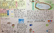
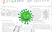
Maps also revealed the emotional responses to the pandemic, from the joy found spending quality time with parents, siblings, and pets, playing outside more, finding new spaces to walk, to the anxiety associated with uncertainty, and feeling distanced from friends, school, recreational opportunities, wider family, and larger support networks. The maps highlighted the importance of those connections. Several maps were accompanied by gradually saddening emojis, emphasising that it was not the restrictions on their own that were difficult, but the ability to sustain the shifts in relationships and constraints on freedoms over an undefined length of time.


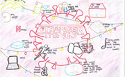
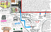
Technology
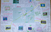
Terms such as “Zoom,” “Teams,” “Watch party,” became part of our everyday language during the pandemic. Technology played a significant role in keeping children connected to friends, family, school, and other significant support networks. Many of the maps drew our attention to the use of technology as form of connectivity. Technology in the home was a key defining feature of the lock downs for children and young people- staying connected. This use of technology, however, drew increasing attention to the digital divide experienced by many and the brought into relief inequalities in terms of access to the digital world.


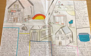
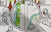
Hybrid spaces
Home has often been considered a way of separating inside and outside, however we now see how home overlaps with nature and the outside. The maps reveal how the outside spaces, whatever this is means to different homes and households, become central to or overlap into the home space. Gardens, balconies, the sky, the park and trees have taken a leading role in many of the maps.
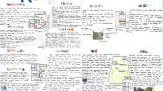


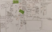


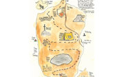
Boundaries
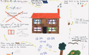
In many of the maps we've received so far, we see a destabilisation reflected in boundaries around, in or outside the home. COVID has led to boundaries at once being built and modified - places people can go, places they can’t - and the blurred boundaries – for example, between home, work, school.
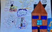

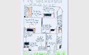

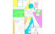
Spaces within spaces
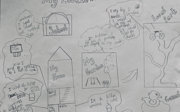
In many cases lockdown resulted in a negotiation of home - a reconfiguring of space. In the maps we see young people asserting ownership over particular spaces, with annotations such as ‘my bedroom’, ‘my den’, ‘my special hiding space’. We have also seen a how the maps have expressed a shift in usage or function, with kitchen tables becoming school desks, garages becoming offices, gardens becoming the new spaces for geography and PE lessons.