
Olive Powell talks about the Global Statistical Geospatial Framework
We’re starting a new series – Professional Spotlights - where you’ll hear from a variety of geographical experts and thought leaders in industry and government who work each day to safeguard, research, innovate and make a difference to our planet and society.
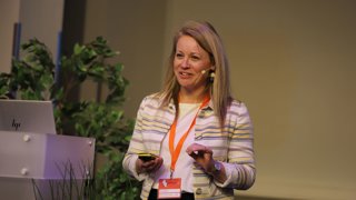
Following her Monday night lecture we speak to Olive Powell, who is Head of Geography and Geospatial at the UK Office for National Statistics (ONS) where she leads the unit which provides geospatial infrastructure, data sets, and spatial analytical services.
Olive is co‑chair of the United Nations Expert Group on the Integration of Statistical and Geospatial Information, representing the UK. She is a Chartered Geographer with over 20 years’ experience in environment, law enforcement, and government and is ideally positioned at the intersection of data, geography, policy, and global governance.
Can you tell us a bit more about your work with the Global Statistical Geospatial Framework (GSGF)?
The GSGF was first developed by a UN expert group which sits between the UN Statistical Commission and the UN Committee of Experts on Global Geospatial Information Management (UN‑GGIM). It’s a comprehensive framework designed to integrate statistical and geospatial information, facilitating data-driven decision-making for sustainable development.
My work with the GSGF is two-fold. As Head of Geospatial at the ONS, I am responsible for ensuring that the geospatial services provided adhere to GSGF principles. The ONS holds the tools, data and expertise needed to produce localised statistics for robust and effective UK policy.
As co-chair of the Expert Group that developed the GSGF, I also promote and lead the development of resources to support implementation across the world. The GSGF gives countries a standard method to integrate statistical information with geospatial data to support their statistical production process.
GSGF helps nations link 'what we know about people' to 'where those people are' in an accurate, consistent, and safe way. This enables evidenced-based policies and leads to real world change, whether these are interventions on living standards, health services, or education.
Many of the Sustainable Development Goals (SDG) need this evidence to measure progress, target action, and evidence impact.
"The Global Statistical Geospatial Framework (GSGF) provides an internationally agreed approach to integrating statistics to place using location data, and enabling countries to produce more accurate, consistent, and meaningful data at the local level. By setting out clear principles it helps statistical offices improve data quality, make hidden inequalities visible, and support better policy decisions."Olive Powell
What does the Global Statistical Geospatial Framework do?
The GSGF effectively provides a 'recipe' for countries and national statistical offices to produce quality statistics at local level, and support decision making.
To produce accurate, comparable, and non-disclosive statistics, for National Statistics Offices to follow there a steps that need to be taken:
- Use their national geospatial infrastructure to access core national geospatial data.
- Accurately geocode Unit record data in data management: Accurate geocoding is also important, making sure that every ‘record’ is tied to the most precise location possible.
- Have a set of Common geographies: Countries also need trusted boundary systems so that statistics can be aggregated and shared in a non-disclosive manner for true comparisons.
- Ensure statistical and geospatial interoperability in data standards, processes, and organisations. This facilitates data sharing and use.
- Provide accessible and usable geospatially enabled statistics: There’s no point in having those standards unless outputs are searchable and easily found on accessible and user-friendly platforms.
Can you give some examples of the principles in action?
There are many examples where the use of some of these principles made a real impact at local or regional level.
In Brazil, for example, administrative boundaries were hiding the stark conditions within favelas- high density, self-built settlements. The Brazilian Statistics Institute (IBGE) delineated and mapped each favela as a “bespoke” geography (Principle 3).
Over 12,000 favellas were mapped individually using imagery and other fundamental geospatial datasets (Principle 1). Combining data from census points taken at household level (Principle 2), they were able to gather data and report on the Sustainable Development Goals (SDG) indicator, which looks at the proportion of the urban population living in slums, informal settlements, or inadequate housing.
It also revealed critical inequalities, including the fact that only 1.3% residents living in one favela had attended a higher education institution compared to the perceived 42.9% at the higher administrative boundary level.
Enabling greater granular and localised information, helped to inform and support education and welfare policies like Bolsa Familia, which is a social welfare programme providing cash incentives for low-income families in exchange for regular school attendance.
"The main challenges are rarely just technical. They are often organisational and cultural. In many countries, responsibility for statistics and geospatial data also sits across different organisations, which can make collaboration and shared ownership harder."Olive Powell
What are the main challenges for statistical offices to achieve geo-statistical data integration and how may they overcome them?
Common issues include legacy systems that were not designed to work together, differences in standards and terminology between statistical and geospatial communities, data governance, confidentiality concerns, and limited geospatial skills or capacity.
Frameworks such as the Global Statistical Geospatial Framework (GSGF), supported by the Integrated Geospatial Information Framework (IGIF), provide practical guidance, assessment tools and training to help organisations take incremental, achievable steps. Forward-thinking collaboration is what ultimately enables better, more joined up decision making.
If you're a member, you can watch Olive's lecture!