This event was previously scheduled for 2 July.
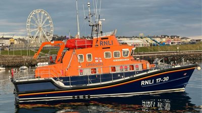
In this webinar, hear from the Royal National Lifeboat Institution (RNLI) geospatial team on the range of tools developed to support risk assessment and decision-making across the organisation.
These tools serve a wide range of functions – from assisting the Operations Room in understanding the impact of assets being off service, to enabling the Coast Risk team to evaluate whether lifeboat stations are optimally located and equipped with the appropriate assets.
Some of the tools explored in the webinar include the comprehensive Beach Safety Assessment application, designed to support lifeguard operations by enabling teams to proactively identify and assess risks in coastal environments and help create safer experiences for the public.
The webinar also explores The Climate Analysis app, which helps to drive smarter long-term decision-making, enabling organisations to confidently plan for future challenges and build greater resilience.
Booking information
- Advance booking for this event is required. In order to book you will need an account on our website. If you already have an account you will be prompted to log in when you click 'book now'. Please create an account if you do not have one yet (you do not need to be a member of the Society to create an account).
- This event will be held on Microsoft Teams and joining instructions will be included in your confirmation email.
If you have any questions or require assistance with your booking, please email events@rgs.org
- Webinar

Professional Pathway introductory webinar – August
Join this webinar to learn more about the Professional Pathway. We will discuss the programme’s framework, highlight key professional development activities and guide you through the application process.
OnlineProfessionalsWednesday 5 August 2026 - Webinar

Chartered Geographer introductory webinar - September
Join this webinar on 16 September to learn more about the benefits of becoming a Chartered Geographer.
OnlineProfessionalsWednesday 16 September 2026 - Webinar
Geography in practice: The open geography portal
Join this webinar to get an early look at the brand new Open Geography Portal being developed by the ONS Geography team. You’ll learn about the datasets available, see demonstrations of key features, and discover how the portal can support your work or research.
OnlineProfessionalsWednesday 16 September 2026