International Day for Disaster Risk Reduction 2026: interview with Matt Haasz
Held on October 13, International Day for Disaster Risk Reduction (IDDRR) is global day of awareness which promotes risk awareness and action to reduce the impact of disasters.
The 2026 theme, ‘Resilience Starts at Home’, highlights the vital role that homes play in disaster risk reduction, calling for stronger governance, greater investment in resilient housing, and increased awareness of how communities can better prepare for and respond to risks.
For IDDRR 2026, we speak to Matt Haasz, a Catastrophe Risk Analyst at Aon, who works within Reinsurance Property Analytics who talks about the importance of geographic location in disaster risk management.
Tell us about your role
I lead a research and development team focused on developing tools and datasets for property data enrichment, model interpretation, and process automation.
After studying geography at undergraduate level, and completing an MSc in Risk, I began my career in the insurance industry for six years and have valued how my geography background provided the foundation for applying a range of advanced analytics, like GIS and statistics, to data engineering, data science, and AI. It demonstrates how geography can underpin careers well beyond what many people traditionally associate with the subject.
How does geographic location influence disaster risk, vulnerability, and resilience, and why is it fundamental to effective disaster risk management (DRM)?
A common equation used in DRM to quantify risk is Risk = Hazard x Exposure x Vulnerability. Hazard relates to the magnitude and frequency of a physical hazard, exposure is the human component of the built environment and people, and vulnerability measures resilience and capacity to recover. For any analysis, inaccurate inputs lead to inaccurate results, and for hazard and exposure variables - accurate location data is fundamental.
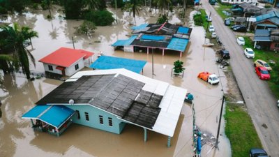
An example of this can be found in flood risk. A flood model representing elevation in five-metre grid cells will better capture details of a river channel and local topography than a one-kilometre grid. By understanding this flood model's impact on properties, representing houses by their building footprint would generate more representative results than if the only spatial information available is their postcode.
How do spatial factors such as hazard exposure, population distribution, infrastructure, and environmental conditions interact with other elements of DRM, including preparedness, mitigation, response, and recovery?
Vulnerability can exacerbate or completely negate the impacts of hazard on exposed assets and communities. My favourite example is that much of New Orleans sits below sea level and, without human intervention, would be highly susceptible to storm surge and riverine flooding. However, due to a system of levees and pumps much of this risk is managed. Failing to consider this fact would create a fundamental misunderstanding of the risk in the area.
While these levees are permanent, however, vulnerability and resilience can also vary temporally which adds a level of complexity to analysis. For example, the 2023 Türkiye-Syria occurred early in the morning when locals were sleeping, reducing preparedness and contributing to a deadlier event. This shows how a holistic view of hazard, exposure, and vulnerability is key to DRM - omitting one will never give the full picture.
How do you apply geographic knowledge, spatial analysis, GIS, or location-based data in your role to assess, communicate, or manage disaster risk?
Location data and spatial analysis are key to quantifying risk. In my role as a catastrophe analyst, I use Geographic Information Systems on a daily basis. Assessing risk can involve intersecting data layers of exposure and hazard to identify areas at risk. For example, using the footprint of an upcoming hurricane against a property portfolio to understand potential loss.
Communication and management of disaster risk can involve maps showing hazard/exposure/risk, similar those used in weather broadcasts, however the output of spatial analysis will also use tables and graphs.
What advice would you give to geography students who are interested in pursuing a career in disaster risk management, and what skills are most valuable in the field?
Following the news cycle in relation to natural hazards and geopolitics is very relevant for the insurance industry. This can be for event response, understanding recent catastrophes and their potential impact, or government legislation and how much capital is being invested to increase resilience. The models used in my role can always be improved or interpreted in new and innovative ways.
Key skills to thrive in this environment include being adaptable, ambitious, and having outside-the-box thinking.