Wherever you go, in town or countryside, it is very difficult to escape vegetation. Plants and trees are solar power factories processing air, water, solar energy and nutrient from the soil into vegetation growth. There are plenty of examples of small scale habitats around locally including the school grounds, woodlands, hedgerows, river corridors and ponds, roadside verges and various types of waste ground. Given such a wide variety of ecosystem types, there are a number of cross-curricular themes that can be introduced including sustainability and long term management of resources.
Local parks/school grounds
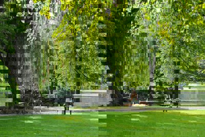
School grounds and local parks provide a range of possible routes to enquiry. In a study of contrasting local parks, students can devise their own sphere of influence survey based on basic questionnaires. They can also carry out a simple ecosystem diversity survey and look at the potential conflicts between users, for example by using a simple conflict matrix (this example can be adapted to suit your particular purpose and location).
The school grounds may also provide the opportunity to evaluate the existing use of the space. Seating areas and other spaces can be surveyed by students developing their own annotated base maps. Depending on the nature and extent of the school grounds, surveys may lead towards management plans and options for future development. This may form part of an existing Ecoschools project.
Woodland studies
The simplest types of survey make comparisons between two or more small areas of woodland. Differences can be based on types of tree (for example coniferous vs. deciduous), tree age or some other environmental consideration such as soil type, woodland orientation (aspect), relative position on a slope or drainage. Hedgerows can also be surveyed
An idea size for a woodland study area is to set up a large sampling frame (or quadrat) of 20 x 20m. Students can draw a base map using coordinates of the main tree species. Trees can be measured in terms of circumference and their height estimated with a clinometer (see Figure three). This allows the subsequent calculation of timber volumes in cubic metres. Students could then use smaller quadrats (0.5 x 0.5m) to record the distribution of ground plants. There should be a big difference in ground cover between deciduous and coniferous woodland, and the reasons for this form an interesting focus for further fieldwork investigation (soil PH, climate, drainage, etc).
Depending on the availability of equipment, additional technology can be used within woodland studies. For example, a GPS unit can be used to record the location of woodland plots, or even of individual trees and plants. This data can then be plotted on a free GIS system such as Google Earth. Alternatively a light meter can be used to study contrasting woodlands, these can be purchased relatively cheaply from electrical suppliers.