Highest-valued exports
This lesson helps students to understand how the human and physical geography of a country determines its highest-value export
Part one: What is each country’s most profitable export?
Part two: Assessment Quiz and Fairtrade Tea Party
In this lesson pupils investigate what a range of countries export. They consider patterns of global trade and the types of goods that more and less economically developed countries export. Pupils discover which export makes the country the most money and learn the term ‘highest-valued export’. They use an online map and match up the highest-value export of specific countries with the country name. Pupils also then consider the human and physical geographical reasons for a country’s highest-valued export.
The main activity in this lesson requires computer access.
If possible, upload the downloadable resource Instructions for Pupils to the school drive for pupils to access links directly and complete extension task table (if appropriate). Alternatively, this can be printed out and given to pupils in hard-copy for them to enter in website addresses manually and write in the extension task table.
Key questions
What is a highest-value export?
How does a country’s physical geography determine its highest-value export?
How does a country’s human geography determine its highest-value export?
Additional resources needed
-
Computer access
Additional links
Starter
Revisit previous learning by asking pupils to define the geographical terms ‘import’ and ‘export’.
Using Highest Value Exports PPT introduce the term ‘highest-value export’ and provide pupils with definition: the highest-valued export is the product that makes the country the most money through global trade.
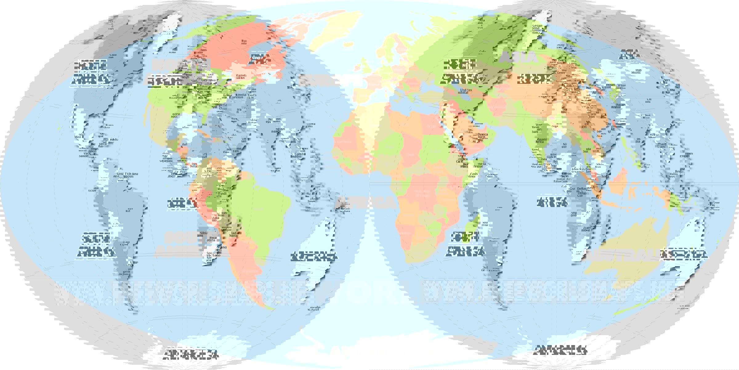
Go to the Business Insider website
Look at the first map (world map of countries highest-value exports).
Focus on three or four countries meaningful to children in the class (last holiday, where parents are from, where au pair is from etc.) and discover what the highest-value export is.
Main Activity
Explain that the physical geography of a country determines what it can produce and what it can export. Highlight three key physical geography features that effect what a country can export: natural resources, bodies of water (coasts, rivers, lakes), and climate.
Go through the photographs on slide four (Highest Value Exports PPT) related to each aspect of physical geography and discuss with the pupils.
-
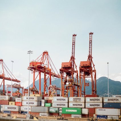
Natural resources and oil rig image: if a country owns the land or sea above an oil or natural gas reserve, they can extract the oil or natural gas from the rock deep under the earth’s crust and export it to other countries. Oil is a very valuable natural resource in the modern world and we are very dependent on it (fuels transportation, plastic products, and even lipstick). More than 90% of proven oil reserves are in just 15 countries (World Trade Organization 2012).
Pose the question: what other natural resources can you think of? (Copper, iron, wood, fish etc).
Tell pupils the fact: 1/5 of all global trade is in natural resources (World Trade Organization 2012). -
Bodies of water (coasts, rivers, lakes): whether a country is coastal or landlocked, or has rivers and lakes determine its exports. For example, Greenland is an island and highest value export is fish.
-
Climate: the weather and climate of a country determines what products can be grown there. For example, palm oil (vegetable oil) comes from oil palm trees which only grow in warm climates like those in Africa, and fruit such as mangoes only grow in tropical climates such as central and South America.
Explain the human geography of a country determines what the highest-value export is. The level of development of a country allows or limits the value of the products it exports and money that can be made from their exports. For example: the education and skills of the population, technology and communications, manufacturing facilities and high-tech machinery for production are all necessary to produce and export expensive and complex manufactured items.
Use the USA case study to demonstrate that products that require lots of knowledge skill from experts and are complex to make are valuable exports. E.g. computer products, cars, air crafts, space crafts etc. More developed countries have the transport links, technology, and communications to produce these products, which sell for high prices, making lots of money for the country and companies based in that country.
Introduce the contrasting case study of rubber farming in Liberia and explain the climate allows rubber to be produced there, and that the civil war and low level of education and literacy mean primary goods are the country’s highest-value export.
Assign table groups a focus area to research and become the ‘export expert’ from: North America, Central America & the Caribbean, South America, Europe, Middle East & Central Asia, Africa or Asia.
Pupils follow the instructions on the Instructions for Pupils (see downloadable resources) document. This document can either be uploaded to the school drive for pupils to access and follow links directly or be printed out and given to pupils in hard-copy.
First pupils go to the Business Insider website. They scroll down to their focus area’s zoomed-in map and choose 4 or 5 different highest-value exports to explore.
They then need to determine which country each highest-value export belongs to as country names are not included on the online highest valued export map.
To do this, they can either use an atlas / World Map (see downloadable resources) print outs or go to Google Earth website and practise zooming in on their focus area to see the smaller countries or go to the Google Maps World map.
Next, pupils consider the human and physical geography of each country: climate, natural resources, coastal, forests, level of development, education, transport and technology etc. and record on the Highest Valued Export (see downloadable resources) handout the reasons why the highest-valued export is what it is. Pupils can also be encouraged to do further research into the highest-value exports and country’s geography on appropriate search engines such as the Kids Britannica website.
Extension: pupils can read and discuss the detailed Case Study Fact cards (see downloadable resources) on the highest-valued exports of Liberia and USA. Pupils take one case study card each and read the information to their partner. They then create a table comparing the two countries exports and human/physical geography.
Plenary
Pupils create groups of seven made up of one export from each part of the world.
They teach their classmates what they have discovered about the countries in their focus area and the ways in which the physical and human geography of the area determines the highest-valued natural resource.
Listen to specific groups’ discussions and pose questions to extend the learning of high ability pupils’ learning such as:
-
Why is the country’s highest-value export electronic machinery when they export so much tropical fruit too? (Because the value and money made from electronic machinery is much greater than the money made from tropical fruit).
-
Can you find one country in your area that produces secondary goods (manufactured) and one that produces primary goods (raw materials)?
-
Do the countries that border each other have the same highest-value export as their neighbouring countries? Can you think of any reasons why or why not? (Perhaps global companies have plantations of specific crops in a country, perhaps the neighbouring country is coastal and so exports fish).
Assessment
Pupils complete a summative assessment quiz for the unit (see downloadable resources).
Fairtrade tea party
The lesson and unit ends with a fairtrade tea party to celebrate learning: pupils enjoy faitrade foods they have brought in and discuss the source of the items.
File nameFiles
File type
Size
Download