Map skills Year Four
This lesson focuses on Ordnance Survey maps and basic map reading skills
After examining a map of the local area and discussing what they can see on it, pupils are taught to read four-figure grid references. They are also introduced to the geographical concept of scale, and map symbols. The lesson ends with a game of bingo using the maps and symbols.
Key questions
How can we use maps to find out about the local area?
What is an Ordnance Survey map?
How are places, human and physical features represented on OS maps?
What symbols are used on OS maps?
How can we find places on OS maps?
Key ideas
Ordnance Survey is Britain’s mapping agency. OS create up to date and accurate maps depicting the landscape’s human and physical features.
All OS maps use the same symbols, which are included in a key so people using the map know what each symbol represents. The symbols represent human features e.g. information points and physical features e.g. forest.
Additional resources
-
A range of maps for different uses at a range of scales: bus, tube, road, rail etc.
-
Printed copies of the Bingo map symbols for one per pair (see downloadable resources)
Additional links
-
To use Google Maps to explore the local area
-
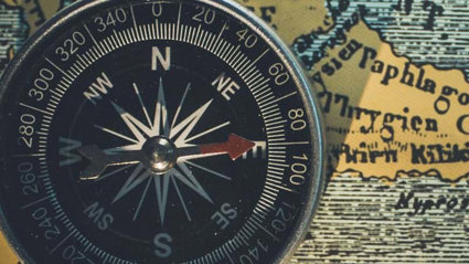
Go to the Ordnance Survey website to learn how to use a compass
Learning objective
To learn why map symbols are used and to recognise the OS map symbols.
Starter
Show the class different types of maps (road maps, tube maps, cycle maps, bus maps, etc.) Pose the questions:
-
Which map would you use if you were locating your house or the school?
-
Which map would you use if you were planning a journey on the underground?
-
Which map would be most useful if you were looking for the local post office or information centre?
-
Which maps depict human features and which depict both human and physical features of the environment?
Highlight that maps have a range of purposes and highlight certain human and physical features.
Main Activity
Show class an Ordnance Survey map of local area. This could either be the original one or from Digimap for Schools software package (see web links).
Explain what an Ordnance Survey (OS) map is. Ordnance Survey is Britain’s mapping agency. OS create up to date and accurate maps depicting the landscape. They show:
-
Topography: contour lines to show land height, hills, valleys, rivers, grassland, forest, marsh, lakes, etc.
-
Man-made features as canals, bridges, footpaths, roadways, etc.
-
OS maps are particularly useful for anyone wishing to navigate on foot, such as long-distance walkers.
Use Digimap for Schools to show a map of the local area. Give the class a chance to look at the extract for a while. Point out where their school is located and see if children can find their houses. What do they notice about the map? How does it differ from the maps they looked at the beginning of the lesson? If you are using Digimap or Google Maps this could be up on the interactive white board with the school marked on it.
Look at the key on an OS map and explain that the symbols are the same on every OS map. Show how the symbols are grouped together and colour-coded.
Explain that a grid on OS maps system helps people locate specific places and find their way. Draw pupils’ attention to the lines on the map and the numbers at the top, bottom and sides. Show Northings and Eastings either on Digimap or the PowerPoint presentation. Explain how grid references are read and go through a few examples by clicking a range of locations on the Digimap extract. Begin by focusing on four-figure, then move on to six if pupils are ready to do so.
Give pupils a grid square or reference and ask them to say one feature of the landscape they can see in that square (lake, building, house, road etc.) As a class, find the four-figure grid reference for the school and their house. Repeat with more grid references, until the class is confident.
Play Map Symbols Bingo (see downloadable resources). Pupils work in pairs and the teach calls out the list of symbols:
Camp site/caravan site
Museum
Viewpoint
Parking
Information centre
Picnic site
Building of historic interest
Telephone Recreation/Leisure/Sports centre
Cycle trail
Non-coniferous trees
Post Office
School
Parking Place of worship with tower
Place of worship
Railway Station
Site of Battle
Access Information point
Public Convenience Site of Battle
Access Information point
Public Convenience
Castle/Fort
Bus or Coach station
Youth Hostel
Contours
Quarry
Plenary
Review the symbols learned. Consider which are obvious and which are less obvious and require use of the map key. Play map symbols snap on the BBC website
Further study
This could be followed up with further map work (see lesson six). It could also be combined with work on land-use or human activities as well as work on using a compass. There are instructions for using a compass on the Ordnance Survey website or use the downloadable resource Map Ability Compass Bearings.
File nameFiles
File type
Size
Download