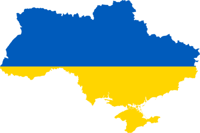
Maps of Ukraine with Cartographic Collections Manager, Katie Parker
Introduction: using maps to understand place
Maps are like looking at the stars in the night sky; every time you look at one, more is to be seen. They are an integral part of our society that help us understand and connect with places on many levels.
As they hold so much information, it is easy to forget that they only form part of the picture. Therefore, it is important to remember that when looking at the information found on a map, the biases they contain will depend on their intended purpose and the creator’s viewpoint. Like all sources, maps should be used alongside other resources to help put together our understanding of the places they represent. They are, after all, social constructs.
When taken in context and with a level of critical thinking, maps can reveal not only what the landscape is like, but also how people interact with it. That is why they have always been at the centre of exploration and combat throughout modern history and are now a method to understand geopolitical relationships.
a. Provide examples of map types (you can use the podcast list below to help if needed) which show different perspectives. Explain why each of your choices are a social construct.
The podcast
In the linked-podcast the following maps are discussed:
1. To Her Most Gracious Majesty Queen Victoria and the allied armies of France and England this military topographical map of the Krima Peninsula constructed ... / by Major General Mukhin ... 1816, is... inscribed by ... Thomas Best Jervis, Major. London, 1854. rgs531866, Ukraine S/D.6
2. Sketch of the British heights in rear of Sevastopol. London: Malby &Sons, 1854? rgs532019, Ukraine S/S.7
3. Sevastopol from a Russian Survey of 1836. Enlarged by J. C. Jones, second master H.M.S. Retribution... Corrected 6th January 1854. London: J. Arrowsmith, 1854. rgs532015, Ukraine S/S.8
4. Souvenir historique de la guerre de Crimée. / Dressée par A. Vuillemin. Gravé sur pierre par Erhard Schieble. Paris: Moucelot, 1856. rgs531863, Ukraine S/D.13
5. Carte de la Crimée. / Dressée par J. H. de Kinsbergen. Amsterdam: H. Frieseman, 1787. rgs531859, Ukraine S/D.10
6. Administrative Map of Ukraine. Kharhov: Cartographical Sections, People's Commissariat for Internal Affairs, 1925. rgs531809, Ukraine G.17
7. Ukrainskaya SSR i Moldavskaya SSR. Moscow: GUGK, 1947. rgs526452, Ukraine G.4
8. Ethnographic Map of the Southwestern Ukraine. by Volodymyr Kubijovyc. London: Association of Ukrainian Former Combatants in Great Britain, 1953. rgs531852, Europe Div.619.
9. Tourist map of the Crimea. Moscow: GUGK, 1964. rgs531875, Ukraine S/D.14
10. Road map of new independent countries of Azerbaijan, Armenia, Georgia; Ukraine, Moldova, Belarus, Lithuania. / Designed, provided (sic) & printed by Gita Shenasi Geographical & Cartographic Organization. Tehran: Gita Shenasi, 1994. rgs533970, Asia S.253
Ukrainian boundaries and borders: a geopolitical puzzle
Ukraine’s geographical location has made it an important part of European history and geopolitics. As the second-largest country in Europe, sharing borders with seven other nations, it serves as a rich melting pot of diverse cultures, ethnicities, languages, and traditions.
Like many of its neighbours, Ukraine’s borders have changed depending upon many different influences. A relatively new country in its current form, Ukraine sits at an intersection with the EU to the west and Russia to the east which, as a result still shapes its boundaries today.
Since its earliest origins in the seventh century, Kyiv, Ukraine’s capital has held strategic significance on a map. As part of a Norse trading route connecting the Baltic and Black Seas, its earliest settlers known as the Rus (Norse for Row) navigated the waterways chose the confluence between the Desna and Dnipro rivers as a suitable location for a settlement. After this time, Kyiv’s influence grew culminating in the Kyivan-Rus State which endured up until the area was conquered by the Mongols in 1237. From then until the 1500s, the borders of Kyiv and its surrounding regions shifted between its Polish and Lithuanian neighbours depending on the ebb and flow of dominance at the time.
The historical ties between Kyiv and Russia, rooted in similar ancestry, have played a pivotal role in shaping the region. As Russia grew in power and influence, Kyiv became part of the wider Russian state and later the USSR. Despite Ukraine's distinct identity, Russians always viewed it through a Russian lens. This, over the centuries, has caused discourse with borders, people, and politics.
One particularly contentious border issue is Crimea. Originally part of the Ottoman Empire. It was annexed by Catherine the Great in 1783 which enabled Russia to increase its green water navy ports particularly in the region of Sevastopol. In turn, this caused tensions to rise between other European stakeholders as they feared the threat of increased Russian influences in the region. This threat sparked one of many conflicts including the Crimean War (1853-1856) with dominance over this region being contested ever since.
During the collapse of the USSR in 1991, Ukraine was one of the countries to seek independence from the Soviets which was formally achieved in 1997. Russia agreed to Ukraine’s new boundaries largely due to the pro-Russian government at the time. However, after 2004, the focus for Ukraine moved away from Russia and towards the EU culminating in 2010 with offers of trade deals from both parties. Ukraine’s eye to the West poses a threat to Russian control and has led to repeated testing of Ukraine's boundaries. Specifically, the annexation of Crimea in 2014, unrest in the Donbas region of Ukraine, and the invasion of Ukraine by Russia which started in February 2022.
b. Create a brief timeline summarising the changes to Ukraine’s borders over time.
Challenge: identify points on your timeline which could pose challenges to political relationships. Add explanations as to why they could be challenges.
Further reading
This resource was first published in 2024.