Mapping mountains
This lesson looks at the location of mountains and mountain ranges throughout the world, focusing on mountains within the UK
Use the Mapping mountains PowerPoint presentation in conjunction with the Lesson Plan. The presentation contains photographs, images and maps and follows the sequence of the lesson. The Factsheet for teachers accompanying this lesson also explains some of the key points in more detail.
Key questions
What and where are the seven highest peaks in each continent?
What are the mountains of the UK, and where are they?
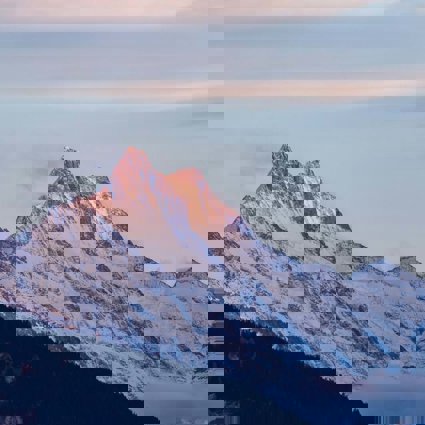
What is a mountain?
Is all high land a mountain?
What does an Ordnance Survey map represent?
How do you locate Snowdon on an OS map?
What are the key features of an OS map? Covering: compass directions, the key, four and six-figure grid references, grid squares, scale
How can you use an OS map to answer questions about a locality? Example: Snowdon
Starter
The whole class takes part in the Follow-Me Loop Card activity based on the teaching and learning from the previous lesson on Mount Everest. This activity is provided but will need to be cut up in advance of the lesson.
-
There are 30 cards in this pack. Each pupil is given one card.
-
Each card contains one answer (typed in black) and one question (typed in blue and italicised).
-
The teacher also has a card and starts the game by reading out the first question from it.
-
Only one pupil will have the card containing the correct answer. That pupil will read the answer aloud to the class and then read the question on the back of their card for another pupil to answer. And so on.
-
The loop activity will always finish with the teacher, who has the final answer.
These questions and answers have varying degrees of difficulty. This game should be fast-paced.
Main Activity
Ensure that pupils can name and locate the seven highest peaks in each continent. Show the map of their location.
Then, ask whether they can name the highest peaks in the UK. See the Factsheet for teachers for more information. Ask the pupils to use an atlas to locate these peaks.
Ask the pupils whether they think all high land is a mountain? It depends because definitions of a mountain vary. One convention, often used in the UK, is a peak above 3,000 feet.
Next, ask pupils what types of map there are. Pupils may come up with ideas such as street maps road maps or tube maps. Clarify that maps are all two-dimensional (2D) representations of the real world.
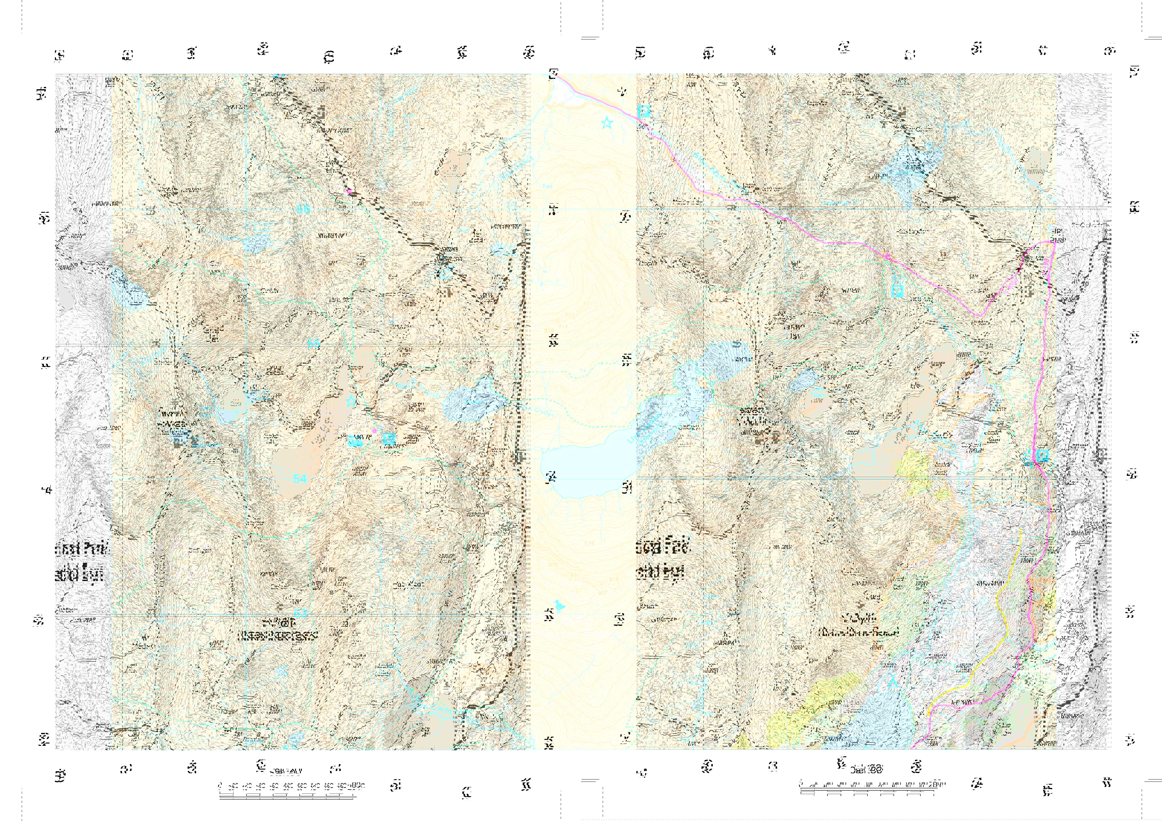
Ordnance Survey maps: This lesson specifically looks at Ordnance Survey maps (OS maps). These show topographical features (primarily maps of the landscape). The OS Map Extract of Snowdon shows, in detail, the height of land, the type of vegetation, the footpaths and other features of the landscape. This is a map that is used by hikers, fell runners, horse riders, climbers or anyone experiencing the ‘great outdoors.’
Locate Snowdon on Google Earth and ensure pupils know that it is located in Snowdonia National Park, north Wales. To download Google Earth go to the Google Earth website.
Then, using the extract from the OS Map Extract, or copies of the map itself, work through the maps skills detailed. A key is available from Ordnance Survey website.
Snowdon: First find the summit of Snowdon. The summit of Snowdon is located in grid square 6054.
Ask pupils how we know that we have found the summit. There are many ‘red herrings’ here.
The symbols for a tourist feature, visitor centre and train station are all highly visible. The summit itself is marked with the dot and blue triangle symbol demarking a trig point and the height of 1,085 (heights are in metres, although this unit of measure is not written on the map).
Ask pupils what other symbols and features they can see marked on the summit. Footpaths, railway lines, contour lines and crags are also evident. Allow pupils to familiarise themselves with the key and discover what these symbols mean.
Ask pupils what evidence there is on the map to indicate the shape of Snowdon’s summit. They may see that three footpaths meet at the summit. This is the convergence of three ridges, one to the north, one to the south east and one to the south west. This indicates that the summit is a pyramidal peak. This is the same shape as the summit of Mount Everest, although it is not as high!
Next look at the other main features marked on the map extract. There are three areas of water in the centre of the extract: Glaslyn, Llyn Llydaw and Llyn Teyrn. Llyn means lake in Welsh.
Ask the pupils which of the lakes is higher. Spot height markers are evident and are written in red. The answers are:
-
Glaslyn (to the north of the lake) 605 metres
-
Llyn Llydaw (to the north east of the lake, at the causeway ) 446 metres
-
Llyn Teyrn (to the east of the lake) 389 metres
Next, from Llyn Teyrn go north east to the location Pen-y-Pas.
Ask pupils to give you the four-figure and six-figure grid reference for Pen-y-Pas. (6455 and 647557).
Ask for the height. The spot height is clearly visible at 359 metres.
Using the key, ask pupils what they would find at Pen-y-Pas. The symbols for youth hostel, parking, public conveniences and telephone are all marked. The A4086 road also passes through Pen-y-Pas.
Snowdon: Moving back to the summit of Snowdon. Can pupils give the six-figure grid reference for the summit? (609544)
Contours are lines showing land of equal height. Contour lines that are close together show land that is steep, contour lines drawn further apart show land that is more gently sloped.
Ask pupils to interpret the map. Which of the walks below would be gentler? Why?
-
Walk one: Starting at Pen-y-Pas and taking the Miners’ track south to Llyn Llydaw.
-
Walk two: Starting at Glaslyn and taking the footpath west from spot height 605, via Bwlch Glas to the summit of Snowdon.
Walk one would be gentler and Walk two would be steeper. The evidence is in the relative proximity of the contour lines.
Using the OS map extract, pupils should complete the Mapping Snowdon worksheet. This covers compass directions, grid references, using the key and calculating distance using scale. The answer sheet is provided.
Plenary
Pose a question to the class to extend their understanding and interpretation of the OS map of Snowdon: ‘Can I see Clogwyn railway station from Glaslyn (lake)?’ (Clogwyn station lies to the north west of Glaslyn at grid reference 608562).
The answer is ‘no.’ To the north west of Glaslyn is a peak, with a trig point 1065. This would effectively block out a view of Clogwyn station as both Glaslyn and Clogwyn station are at lower elevations.
File nameFiles
File type
Size
Download