Geotagging photos to share fieldtrips with the world
Download the full article from the downloads box below
During the past few years, numerous new online tools for collaboration and community building have emerged, providing web-users with a tremendous capability to connect with and share a variety of resources. Coupled with this new technology is the ability to geotag photos, giving a digital photo a unique spatial location anywhere on the surface of the earth. More precisely geo-tagging is the process of adding geospatial identification or ‘metadata' to various media such as websites, RSS feeds, or images. This data usually consists of latitude and longitude coordinates, though it can also include altitude and place names as well. Therefore adding geotags to photographs means adding details as to where as well as when they were taken. Geotagging did not really used to be an easy thing to do, but now even adding GPS data to Google Earth is fairly straightforward.
The basics
Creating geotagged images is quite straightforward and there are various types of software or websites that will help you tag the photos (this is discussed later in the article). In essence, all you need to do is select a photo or group of photos, choose the Place on map command or similar. Most programs will then prompt for an address or postcode. Alternatively a GPS device can be used to store way points which represent coordinates of where images were taken. Some of the newest phones (Nokia N96 and i-Phone for instance) have automatic geotagging capabilities. These devices automatically add latitude and longitude metadata to the existing EXIF file which is already holds information about the picture such as camera, date, aperture settings etc.
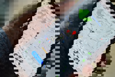
Once the photos are tagged it is possible to open up a digital mapping programme, for example Google Maps and all the photos will be represented with a push pin or image thumbnail. The map has tools for you to zoom in and out, pan the map, and move photos. You can choose to view a street map, a satellite map, or a hybrid of both. Photos can then be a catalogued and organised by location as well as date taken or subject.
Geotagging: a range of teaching and learning opportunities
There are a range of applications and instances when geotagged images can be used in geographical teaching and learning. The examples below are all linked to fieldwork and out of classroom activities.
-
Trip documentation - Places visited. This is really digital storytelling. Students use the photographs taken to document and describe the places visited. This can be a good way of personalising the trip and allowing expressions of feelings, perceptions etc to be documented alongside the tagged images. They can also be linked with writing and literacy work
-
Hide and seek - A trail of photos can be used to sequence a walk or geographical treasure hunt. Students can use tagged photos as navigational aids to help them find their way around unfamiliar or unusual landscapes and environments. At each location students can be asked to carry out a task, for example complete a field sketch, conduct an interview etc.
-
Risk Assessment - Geotagged photos can be used as part of a virtual trip set up by the by the teacher as a way of informing the students prior to the visit. Alternatively the students can make their own risk assessments/modify existing schemes based on photographic evidence from the trip
-
Presentation of features - A simple use for tagged images is as a series of located photos to describe a particular environment. It works especially well when a sequence of photos are taken as say a transect for instance, such as from a CBD to the outskirts. Geotagged images may also be used for recording river or glacial landscapes - images can then be linked to topographical features on a base map
-
Documenting field sites - An obvious use for the technology is to record exact locations where data was collected, for example particular sites for pedestrian counts or sites along a sand dune transect (such as typical plants). This can be used to support the analysis of fieldwork results, and is particularly useful for discussing small scale differences that may impact on the data collected. This is a good idea to support the use of GIS/digital maps etc in the new GCSE's. This technique is very useful for revision and also for students who may have missed the original trip due to illness etc.
-
Ethnography. Ethnography is the study and observation of people. Geotagged photos allow the students to become secret detectives, studying behaviour and taking photos of individuals and groups. Results can be displayed shared on digital maps and annotated as required
Geotagged technology and digital images can also be used to support geographical learning in a number of other ways. Examples may include:
-
Embedding photos into your school or class web space
-
Inspire creative writing
-
Creating a storybook using shared images
-
Creating a presentation using the photos, annotation and slideshow, for example in Flickr
-
Use tags to find photos of areas and events around the world for use in the classroom (link to Geography in the news slot)
-
Use photos to enhance students classroom work or for media and literacy projects
-
Promote and document school events in order to share photos with the school/local community
-
Combine geotagged photos with Google Earth for enhanced geography explorations
-
Create digital portfolios where students, peers, parents and teachers can comment on the photos that are included
The technology required: Hardware
There are three main methods for geotagging photos:
-
No GPS? Use the digital mapping facilities available on various sites (see software below) to manually locate the picture. This is a relatively straightforward procedure, but photos are difficult to locate precisely. In a school setting this can offer the most convenient method
-
Using a hand held GPS to tag photos. The GPS will keep a track-log of locations visited and the places where images were taken (if saved as way points). Software is available to upload this information directly into a computer, although it can be quite tricky to do. Alternatively the lat-long can be manually inputted or attached to the EXIF data. A hand-help GPS device can be purchased for about £70, but have limited connectivity to computer without buying additional leads etc. There is much better flexibility if you can afford £110+ units (these easily connect to computer and have the ability to upload digital map data therefore better for GIS etc). Cost is obviously and implication here some schools/colleges have set up consortiums to share a pool of kit
-
Using a dedicated GPS enabled device e.g. camera or mobile phone. Some products can automatically code the EXIF file with location data. At the moment however, the technology is restricted to a few expensive cameras and phones. In the future the equipment will be come more ubiquitous and affordable. This will then become the simplest option
The technology required: Software
There is a bewildering array of possible ways of geo-tagging and storing photos, such as Flickr. There are numerous other programs that will do the tagging for you, but these seem to be the most suggested by enthusiasts. Remember these are online storage solutions, so there is a limited number of photos that can be uploaded before you might exceed your storage space. The amount of free online storage space may be an important consideration for you.
Some final thoughts
Geotagged photos can be used to tell a story or to share experiences with peers, colleagues and friends. The most obvious application of this technology is to use it in the design of lessons and fieldwork that promote visual literacy skills in children and students. A wide variety of applications to learning exist by using geotagged images, from using single photographs as writing prompts (either creative or interpretive writing) to using multiple image sets in digital storytelling projects. There are lots of examples of how this technology can also be used to support the pre and post elements of a field course or trip.
Another compelling reason for adopting the technology is because it helps to modernise our approaches to fieldwork. In the future I suspect we will all storing our photos online and they will most likely be sorted by location as well as category. Pictures of people and places are important geographical aide-memoires. Geotagged images are another way of helping to reinforce spatial awareness which is fun and imperative to our 21st century geographers.
Written by David Holmes, Geography Advisor to the Field Studies Council and Senior Examiner for Edexcel.