Approaches and methodology
Geography is all around us. To observe the world, its people and its processes – and to navigate, record and interpret what you see – is to be a geographer.
From studying the physical Earth and its vast landscapes and ecosystems, to human interactions and their effects upon it – be they social, cultural, environmental or economic – geographers employ a vast array of methods, technologies and approaches to better understand the world we live in.
This could be undertaking fieldwork to collect information, working with numerical and geospatial data – like an earthquake, postcode or the spread of an infectious disease – or helping others to experience the outdoors and learn how we can build a better relationship with what surrounds us. Geography has many faces and here we present some of them.
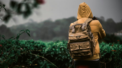
Dwayne Fields
Dwayne Fields is a presenter, naturalist, adventurer, explorer and OS Get Outside Champion. Born in Jamaica, Dwayne came to the UK aged six. His formative years were spent in inner-city London where, caught up in the world of street gangs, he became a victim of both knife and gun crime.
After a life-threatening incident he made the decision to change his life and embarked on a course that reawakened a love of nature and wildlife he recalled from his early life in the forests and hilltops of Jamaica.
Dwayne’s personal story and his wider work with young people are vivid examples of how engagement with the outdoors through expeditions can bring real benefits to people – particularly those who might traditionally be under-represented in the sector.
Dwayne is the recipient of the Society's 2018 Geographical Award, which is awarded to an organisation or individual that has provided outstanding support for individuals or groups learning through scientific expeditions; or for an expedition(s) that has had a significant impact in inspiring and raising the understanding of geographical issues among schools or the public.
"Having had the opportunity to travel and experience a wide range of terrains, environments and cultures around the world all in search of adventure, I’ve developed a greater understanding and respect for the discipline of geography and the power it has to bring people together as well as influence the world around us.
"Here in the UK we’re treated to some of the most beautiful landscapes in existence and through my efforts with a number of national organisations and young people in general, I’m raising awareness of geography through experiencing the outdoors.
"I’ve seen the emotional response a person can have as a result of climbing a mountain, that’s the power of geography!
"I’ve seen the ‘lightbulb’ moment a person can have when they orient a map to the terrain around them and the two finally come together and they get it, that’s geography! I’ve seen how a person of any age can gain masses of confidence in an outdoor space because they can apply what they learned as a child in a geography lesson to the landscape in front of them. All of these are the reasons I take inner city people (in particular young people) into our outdoor spaces.
"Though I’m not a traditional geographer, I rely heavily on the discipline and I believe we need geography and geographers from a broader range of backgrounds now more than ever before, as in my experience a variety of cultures has the potential to bring a variety of solutions, and goodness knows we need as many of those as we can possible get if we are going take on the challenges that our world is currently facing. The thing I love most about geography is how easy it is to take what you learn in a classroom environment and apply it to a real world, in the field setting. It just makes sense!"
Naa Sackeyfio
Naa Sackeyfio is a Geographical Information Systems (GIS) professional with about 10 years’ experience in the implementation of GIS for data management, analysis and reporting. Currently, she works as an Information Data Analyst at ITOPF, a maritime organisation, working mostly with the ESRI ArcGIS suite for the design and development of desktop, mobile and web applications. She actively promotes GIS capabilities in her organisation through training programmes and promotes the integration of GIS in the planning and delivery of oil spill response projects.
Prior to joining ITOPF, Naa worked in the construction industry for about six years, mostly on the HS2 project, at an ecology consultancy in London. She was involved in ecological mapping, biodiversity net gain (No Net Loss) calculations, and spatial and statistical data analysis to inform translocation/mitigation projects, landscape design and environmental management.
Naa graduated from the International Institute of Geo-information Science and Earth Observation (University of Twente) in The Netherlands with an MSc in Geo-information Science and Earth Observation. She also has a BSc in Natural Resources Management from the Kwame Nkrumah University of Science and Technology in Ghana.
Naa is also a Chartered Geographer.
Why have you chosen this career?
Early in my career, I worked in an environmental research role. I found the GPS and mapping software very useful for surveys and I produced outputs that revealed spatial relationships in my data and were very effective for communicating my results. I found this very intriguing and recognised the potential of GIS in transforming the way I manage and analyse data. I decided to pursue a course in GIS to support my environmental career but somewhere along the line, I realised that mapping and spatial analysis was what I really wanted to do.
What do you like the most about geography/being a geographer?
I enjoy creating beautiful maps and models and providing information through mensuration, geoprocessing etc, that are effective for analytical decision making and communication. This can be very rewarding because of the tangible benefits of GIS. I also think being a geographer offers great flexibility. There are office-based and field-based roles. GIS specialists qualify for jobs in various fields across industries.
What challenges have you encountered in your career?
The geospatial industry moves quite fast and as a GIS professional, I need to keep abreast of developments (new capabilities/functionalities). This can be challenging but comes with many benefits.
Where do you see your field going in the future?
GIS and remote sensing are making a difference. Web GIS is fostering collaboration and making timely data accessible globally. I think GIS is a growing field with very good prospects, not only for geographers, but for all.
What does geography mean to you?
Geography is everything in our world defined by its location and the spatial relationships and interactions between everything.
In our world today, any analysis that adds to the current knowledge and understanding of environmental, economic and social systems is crucial.
Dr Jazmin Scarlett
Dr Jazmin Scarlett is a British-Caribbean researcher, who is also disabled and queer. Her career path started with a BSc in Geography and Natural hazards at Coventry University, followed by an MSc in Volcanology and Geological Hazards at Lancaster University. Jazmin completed her PhD in Earth Science at the University of Hull, which investigated how the Caribbean colonial society of St. Vincent and the Grenadines came to adapt to the volcanic eruptions of La Soufrière. She has also been a visiting researcher at Aarhus University in Denmark exploring the geo-cultural heritage possibilities of volcanoes in aiding disaster risk reduction. For the last two years, Jazmin worked as a lecturer in physical geography at Newcastle University.
Jazmin found her experience in the field very rewarding, and she has enjoyed learning, teaching, and thinking about things through different perspectives. Unfortunately, due to the COVID-19 pandemic, Jazmin's career is currently on hold and she finds herself at a crossroads.
Why have you chosen this career?
I have always been fascinated by natural hazards since taking geography at school. Once I knew you could get a career in it during undergrad, I wanted to pursue it!
What do you like the most about geography/being a geographer?
The many ways (human and physical) geography is interconnected and applicable to society and the environment.
What do you find the most rewarding about your own research?
Uncovering new or forgotten stories about past events, as it makes me feel like I am understanding just how complex our interactions with natural hazards are.
What are the challenges you have encountered in your career?
Mainly balancing the pain and fatigue associated with my physical disability with the demands of keeping up with work, particularly fieldwork that had a high demand on foot travel.
Where do you see your field going in the future?
I see it being more inclusive and diverse, but that does depend on whether there will be enough funding and job positions for people who want to do research in volcanology.
What does geography mean to you?
It means thinking critically about the world we live in and how interconnected with others and the environment.
Francis Senyah
Francis Senyah works as part of the Geographical Information Systems (GIS) team at Public Health England (PHE), and over the past six years, his role has brought him a wealth of rewarding experiences, alongside opportunities for observing the benefits of applied geography and geospatial technology across the public health community, both within the UK and abroad. Francis' position of Senior GIS Scientist at PHE is interesting, varied and challenging, and provides him with a rare opportunity to support, influence and contribute towards public health projects through GIS software and spatial tools.
Francis is also a Chartered Geographer.
Each day my professional experience at PHE brings something different, from delivering training, technical workshops and support for public health colleagues across Africa and the UK Overseas Territories, to utilising open source GIS software to ensure sustainability or demonstrating how powerful geospatial technology is in monitoring and responding to infectious disease spread.
The COVID response has required a coordinated effort across government. Within the Emergency Response Department at PHE, where the GIS team is placed, this is particularly profound.
Geography, and crucially, location, has been critical in helping to understand and communicate key information regarding the COVID-19 pandemic.
Our GIS team, in collaboration with PHE colleagues and the private sector, have played a central role in providing vital resources and spatial intelligence for incident teams, government colleagues and the wider public through address management, analysis, mapping and visualisation, web based geospatial applications and dashboards.
Working within a public health emergency response and outbreak investigation is challenging and a privilege, certain to impact on my career going forward. The geospatial industry is a hub of innovation and has never been as relevant and visible as it is now. The discipline of geography is in a healthy position and this is reflected through the importance of geographical information across government and beyond – and my natural interest in geography, travel, technology and innovation, combined with the variation of ambitious work we carry out within the team makes this role well suited in terms of my personal and career aspirations.
Screenshot of the first generation public-facing coronavirus dashboard created by the Geographical Information Systems (GIS) team at Public Health England and replaced at https://coronavirus.data.gov.uk/.