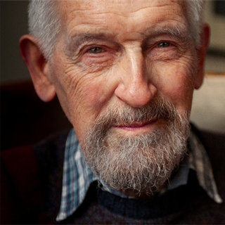
Edward Hatch – fondly known to all as Ted – joined the Society in September 1961 as a map draughtsman in the large drawing office on the second floor of Lowther Lodge. Mr George Holland was the chief draftsman, and Mr Lawrence Kirwan was the director at that time.
National Service and early mapping work
Ted left school at 15 and joined a quantity surveyors office in Wimbledon in 1951. He then joined the printing company Cook, Hammond & Kell Ltd., where his job included working on the Oxford Atlas.
Called up for National Service in March 1954, Ted was attached to the Royal Artillery and posted to Bielefeld in Germany to draw maps of a large military exercise named Battle Royal.
He seized this valuable opportunity to hone his climbing and winter skiing skills in Norway during his National Service. Eventually, he was ticked-off for overstaying his demobilisation date from Germany – he was busy climbing!
Return to civilian life and joining the Society
Ted resumed civilian life, working for a series of engineering companies, surveying, mapping and drawing maps, until he was invited to join the Queen Mary College surveying expedition to Iceland in 1961 for two months.
This trip made a profound impression on Ted, who then joined the Society producing hand-drawn maps, primarily for the Geographical Journal, and other maps published by the Society.
Blending scientific accuracy with visual storytelling
Ted had a distinctive style. Nigel Winser (and others) could recognise a Ted Hatch font, and his maps were known for their "precision, clarity and artistry – blending scientific accuracy with visual storytelling".
Ted noted: "I was amazed on the first day in the drawing office to find that the lettering was done with quills. The reason being was the Secretary at the time in 1926 wanted a new style for the Journal.
"The lettering I was shown to do was in the more traditional style called topping and tailing where you do all the downstrokes first and then top and tail the lettering. Drawn with a fine nib."
A friend in a neighbouring office recalled: "I will never forget Ted telling me how he would have to prepare his own goose quills. I cannot remember whether it was the left or right wing of the goose depending on whether one was right or left-handed."
First maps and early recognition at the Society
Ted’s first map was drawn to illustrate a lecture by the Society’s President, Sir Raymond Priestly. Sir Raymond was the eminent geologist and early Antarctic explorer (British Antarctic Surveys, Nimrod 1907-1909 Nimrod, and Terra Nova, 1910-1913) who took a great interest in the Ted’s recent geological expedition to Iceland.
Dr. John Hemming, CMG (RGS director 1975-1996) observed: "Ted's great contribution to the Society's map collection was that his original maps meant that the RGS was registered internationally as a creator of maps. Because of this we had a series of agreements with national mapping authorities around the world, to exchange all our original maps with all of theirs.
"Of course this was hugely imbalanced: swapping one or two a year for hundreds. This is the reason why our collection of maps is so vast - I don't think that we ever paid to buy any of our thousands of maps."
Landmark works and major collaborations
In 1980 Ted drew the RGS History of Exploration 1830-1980 map. This large (almost A0-sized) wall map illustrated global exploration routes and copies were sold at the time of the 150th anniversary. Lord Hunt (of Everest fame) was President and Ted was introduced to Her Majesty during the 1980 celebrations. (A copy was included in the Mulu Expedition re-union in April 2025, as the map included the Society's survey in Sarawak.)
Over the years, Ted enjoyed working with many distinguished geographers and explorers, who were either speaking at the Society and/or publishing in the Geographical Journal or Geographical magazine, and ‘The Mountains of Central Asia’ map and gazetteer, a collaboration by the Society and the Mount Everest Foundation.
He also created beautiful maps for authors. These include:
- Mike Ward ‘Everest book – a thousand years of exploration’
- Vivian Fuchs and the British Antarctic Expedition
- Robin Hanbury-Tenison and his South American Journeys
- Wally Herbert and his trans-Arctic expedition
- Ran Fiennes and his polar expeditions
- Tony Astill’s book ‘Mount Everest – The Reconnaissance 1935’
- Lucy Irvine’s ‘Castaway’ book
- Harish Kapadia’s several books on the Karakoram, Pakistan
- Leila Ingram’s book ‘Yemen Engraved’
In-house contributions to the Society
Ted also used his skills for numerous in-house projects, such as the redesign of the Society’s crest, to include Antarctica, working on exhibitions and displays and designing the Medallists’ boards.
The drawing office closed in 1990 owing to changes in map making. Ted was made redundant but provided with an office of his own to continue with his work.
A link between generations of geographers and explorers
He continued to serve the Society loyally all his life and to visit Lowther Lodge regularly long after his retirement. Here he could enjoy a hot lunch in the Tea Room, catch up with people and undertake research in the Foyle Reading Room.
A much-loved long staff member – one of the longest-serving in recent times – Ted Hatch provided a unique link between some legendary geographers, explorers and staff born in the late 19th century, and those born up to the early 21st century, providing the latter with inspiration from his tales, recollections and unquenchable zest for life.
DCP 15 January 2026.