Enabling international land managers to mitigate water contamination risks from wildfires
Geographers at Swansea University focused on identifying and mitigating water contamination risks from wildfire ash in collaboration with scientists, fire services, land managers, and water suppliers in the UK, Australia, Portugal, Spain, and the USA.
Issue
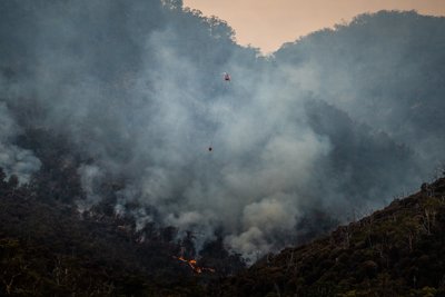
Wildfires burn approximately 4% of the Earth’s vegetated surface annually. The ash generated from these fires is rich in pollutants and highly susceptible to erosion and transport by water, which poses a significant threat to water quality.
Approach
Following a severe fire near Sydney, Australia, ash and its contaminants were quantified using field sampling in areas affected by different fire severities. In collaboration with West New South Wales, the researchers developed a new satellite-data-based method to scale up these measurements for the entire burned area.
The researchers initiated the development and testing of hillslope treatments in Spain aimed at mitigating post-fire erosion. This included quantifying the efficacy of these treatments on steep hillslopes following wildfires.
Impact
The 2019/2020 Australian wildfires resulted in most of Greater Sydney’s main domestic water supply catchments being burned. Outputs from this research directly guided mitigation measures, such as the installation of fabric curtains across the lake to capture sediment. A large rainfall event in March 2020 eroded most of the ash from the hillslopes, yet these mitigation measures enabled Water NSW to continue supplying safe drinking water to Sydney.
The Water Services Association of Australia (WSAA), who represent 20,000,000 urban water customers, adopted the decision-support framework for risk assessment and mitigation in its entirety into their national industry guidelines.
In 2018, England’s largest wildfire on Saddleworth Moor led to evacuations and burned 1,800 hectares of water-supply catchments managed by United Utilities. The fire burned deep into peat soils containing high levels of metal contaminants. Research findings guided the UK Fire and Rescue Services in determining where to focus hosing to extinguish the fire, thereby reducing peat loss and contaminant release from burning and erosion. These findings also assisted United Utilities in covering hillslopes adjacent to the reservoir with biodegradable netting which prevented ash and soil eroding into the reservoir. This was the first substantive on-site mitigation treatment for water-contamination risk following a UK wildfire.
More information
Institution: Swansea University
Researcher: Professor Stephen Doerr, Dr Cristina Santin, Jonay Neris
Share this resource
This is an open access article under the terms of the Creative Commons Attribution License (CC BY NC 4.0), which permits use, adaptation, distribution and reproduction in any medium or format, provided the original work is cited and it is for non-commercial purposes. Please contact us for other uses.
How to cite
Royal Geographical Society (with IBG) (2023) Enabling international land managers to mitigate water-contamination risks from wildfires. Available at https://rgs.org/watercontamination Last accessed on: <date>