How did you get to where you are now?
I started a Geology degree at Southampton University, during which time I did some work as a temp for the Ordnance Survey (OS) during university holidays. Due to a field-work accident that forced me to put my degree on hold for a year and not enjoying the course, I quit university after two years.
After a few odd office jobs, I ended up back at OS as a temp for a year before, before securing a permanent role at a GIS consultancy at Southampton University as a GIS Technician. I was trained from the ground up and by the time I left this role four years later I was one of the lead GIS trainers.
From there I went back to the Ordnance Survey to work as a Technical GIS Consultant in a number of teams for four years, before deciding that I was ready to run my own team and took a role as a Senior Data Specialist and GIS Manager at the Marine Management Organisation (MMO), where I am today.
Was there anything particularly useful that helped you get into this role?
The role I secured as a GIS Technician at the GeoData Institute at Southampton University got me to where I am today. Due to the small size of the institute, it was an ‘all hands-on-deck’ role, so I spent four years learning the industry and allowed me to learn a lot, so when I eventually left it was to take a high profile role.
What do you do as part of your role?
I manage a team of three GIS and Data Officers. On a typical week I oversee any project that has a GIS element to it to ensure it is aligned with Defra or MMO requirements. I regularly engage with other GIS colleagues in Defra to ensure we don’t duplicate work and I also provide technical support for my team. I unfortunately don’t spend as much time doing hands on GIS as I would like, but I am working on a number of projects to automate processes and upgrade GIS IT systems that should free up my time in the future so I can get involved with more hands-on GIS again.
What skills and characteristics do you need for this role, apart from geographical knowledge?
Good communication and patience are essential. A large proportion of this role is based around understanding the GIS needs of all teams within the MMO, who usually don’t have an understanding of what GIS can do and what benefits they will get from it, so I need to ‘sell’ the skills of the GIS team to the wider business.
Being approachable and trustworthy is also one of the most useful skills in a role like this - if people are aware of my knowledge and that my door is always open then it means that others know they can approach me at any time.
How does geography feature in your work/what difference does it make?
The MMO deliver marine planning, marine licencing and marine monitoring. All these things happen somewhere and using geography we can make sure that no activity will impact on another activity, for example a wind farm won’t be built in the middle of a busy shipping route. We can also ensure that we safeguard the environment by limiting certain activities to certain areas, such as not allowing dredging along fragile areas and not allowing fishing in protected areas.
What is the most interesting or enjoyable project you’ve worked on, and why?
For me personally, the EU Exit and Blue Belt projects have brought up some interesting pieces of analysis. Working on the Blue Belt project, which looks at all of our overseas territories is always extremely interesting as it is very far removed from our day to day job. EU Exit work has a very high focus on fisheries and has asked some interesting questions of us which have been fun problems to solve from a data/GIS point of view, for example “In the last year, how many times has the EU/UK marine boundary been crossed by fishing vessels and in what direction?”
What advice would you give to someone wanting to go in to this career?
Be prepared for a lot of variety and problem solving, especially if you go into the technical GIS end of the career. Everything happens somewhere and most businesses in most sectors have a need for geography skills, even if they don’t realise it yet. Geography is a rapidly growing sector as more and more businesses realise the value of geographers.
How do you maintain your knowledge and interest in geography outside of work?
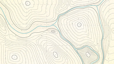
Social media is a good place to keep up to speed with the industry, especially twitter, as there are some great twitter accounts that share interesting projects. This is also a good place to find jobs; I applied for the job at the Ordnance Survey because I saw it advertised on my twitter feed! Outside of this, I do a lot of walking & mountaineering, this keeps my map reading skills sharp. Especially when I’m trying to navigate through thick fog or a blizzard and I can barely see my own feet!
* This interview was undertaken in 2019 and was correct at the time of publication. Please note that the featured individual may no longer be in role, but the profile has been kept for career pathway and informational purposes.