How did you get to where you are now?
My background is in catastrophe model development, having worked at both JBA Risk Management and at RMS as a Lead Model Developer early on in my career. I hold a PhD in Geomatic Engineering from UCL and retain close links with the academic community through my leadership role at the Learned Society RSPSoc (Remote Sensing and Photogrammetry Society), where I am fellow and also volunteer as Director and Honorary Treasurer. I frequently present at conferences and host industry events to promote knowledge transfer on the application of Earth Observation in re/insurance.
I have been working in the financial services sector in re/insurance for 10 years, making use of my scientific background and network throughout the various roles I held. Previously, I was Research Manager at MS Amlin, where I informed the Group’s view of catastrophe risk by evaluating and adjusting catastrophe models against latest science. I have also been responsible for the catastrophe analytics for the Property and Casualty insurance business in the first few years at MS Amlin as Modelling Manager and Business Partner; and more recently for the analytical service offering to a wide range of re/insurance clients across the West and South region of Europe, Middle East, and Africa (EMEA).
Was there anything particularly useful that helped you get into this role?
It has helped immensely to position myself for the various roles and opportunities through networking, pro-active participation at industry events, and continued professional development through courses like CCRA and fellowships.
What do you do as part of your role?
As Head of Catastrophe Analytics at Willis Re I am responsible for the analytical service offering to a wide range of re/insurance clients across the West and South region of Europe, Middle East, and Africa (EMEA). I am responsible for a team of over 30 staff from diverse backgrounds and different geographical locations including the UK, France and India. Most of my work is coordinating amongst stakeholders including brokers, actuaries, our catastrophe modelling teams, and clients across the region. A typical week will consist of team management, various internal and external client meetings, and developing our analytics service offering across the region.
What skills and characteristics do you need for this role, apart from geographical knowledge?
Essential skills are effective communication, project management, team management, delegation, leadership but also design and creativity to develop analytical solutions for our clients in assessing their catastrophe risk. This requires an understanding of re/insurance concepts, market and science trends, technical skills (e.g. understanding the probability of risk, data manipulation, automation, and results interpretation), and soft skills to engage with a wide range of technical experts, scientists, commercial teams, and individuals from across different cultural backgrounds.
How does geography feature in your work/what difference does it make?
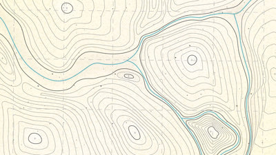
Our analytical work focuses on catastrophe modelling and risk management of natural and man-made hazards, where geographical skills such as spatial analysis, GIS and mapping are fundamental to quantify, visualise and communicate complex risk issues, in support of critical risk transfer decisions at every level, up to an including board level.
The geographical context and location information is central and requires geographical specialists to ensure that professional standards and best practice are applied, particularly where the end users and decision makers are often non-geographers and where correct interpretation of geographical information is critical.
What do you enjoy most about your job?
The job keeps me challenged, both on an interpersonal level working with such diverse teams but also intellectually through the wide range of client projects and technical subjects. There is always something new to learn, whether this is expanding into the various natural perils (e.g. seismology, hydrology, structural engineering, and atmospheric sciences), different lines of business such as property, life, and cyber amongst others, to the more commercial, presentation and client facing skills.
What advice would you give to someone wanting to go in to this career?
I started out not knowing exactly what I wanted to do professionally. Geography met my interests and has opened up a wealth of opportunities. The key is to explore different fields early on, try out internships during university to get an idea of which industry appeals to you and speak to professionals in the various fields, and don’t be afraid to ask for a mentor to help guide you. The best opportunity will be through joining a learned Society, networking with the student body and by attending meetings and conferences.
How do you maintain your knowledge and interest in geography outside of work?
Through membership and active participation in the Learned Societies, such as RSPSoc and RGS-IBG. I am serving as an Honorary Treasurer and Director on the Remote Sensing and Photogrammetry Society, and I get involved in many of the Societies activities, such as its journals or technical programme. I also keep myself interested by speaking at conferences, technical meetings and trying to keep publishing written materials such as blogs, articles and book chapters.
Why did you choose geography? Why should others choose geography?
Geography is fundamental to so many applications and industries; the skills you learn provide an excellent foundation for solving problems, understanding complex concepts (e.g. spatial and statistical analysis), and provides excellent opportunity to expand into different scientific aspects of both the human and physical processes.
* This interview was undertaken in 2019 and was correct at the time of publication. Please note that the featured individual may no longer be in role, but the profile has been kept for career pathway and informational purposes.