How did you get to where you are now?
Geography has always been my key interest which I carried through my GSCE, A Level and degree choices. It was whilst studying at the University of Plymouth that I first discovered GIS which ultimately led to me completing an MSc in GIS at the University of Nottingham.
I obtained a fantastic introduction to the GIS industry by spending five years working for Nottinghamshire Fire and Rescue Service. The job was extremely diverse and helped shape my career in developing many key skills that have become invaluable in later positions.
The opportunity to experience a new culture was embraced with a move to Qatar where I worked for Esri NEA and KEO International Consultants. Here I gained five years’ experience working in the private sector with highlights including implementing GIS into an organisation that had never previously used it, and developing 3D visualisation skills with 3DS Max/SketchUp/ArcScene.
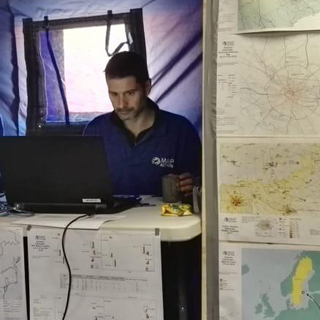
Since returning to the UK, I have been working for the National Trust. I have found working in the charitable sector an incredibly rewarding experience. The opportunities and experience I have had since working for the Trust has enabled me to become a Chartered Geographer in 2017 and started volunteering for MapAction in 2018.
What do you do as part of your role?
I am part of the Conservation Information team which is accountable for delivering a coordinated approach to conservation across the whole organisation. The team researches client needs and develops innovative tools that allow a wide range of staff the ability to interact with spatial data, make decisions and work more effectively.
The main responsibility in this role has been to administer ArcGIS Online (AGOL) and understand how the organisation can benefit and deliver mobile data collection apps, story maps and web apps - producing both internal and external facing tools. The role is also responsible for analysing a wide range of internal and external data that helps the Trust understand its assets, from land to coastlines, buildings to trees and to enable strategic management decisions to be made. Outputs include interactive spreadsheets, maps, reports and dashboards.
The great thing about the role is that it doesn’t encompass a typical week – I could be working on a project, dealing with ad-hoc queries, designing a dashboard or out at a property testing/training a new tool.
What skills and characteristics do you need for this role, apart from geographical knowledge?
Great communication is one of the main characteristics for any GIS Analyst, as understanding your audience and being able to effectively communicate their solution is vital to working efficiently. It is important that you can talk to a client and gather specific information about their requirements, including discussing any concerns. Outputs can range from maps and spreadsheets, apps and dashboards, to reports and presentations and each of these needs to be specifically designed for their intended audience who could range from other GIS analysts and non-technical staff, to directors or members of the public.
In order to progress the GIS discipline, it is also important that analysts share ideas, solutions and best practice tips as often as possible. The ability to demonstrate your work effectively through presentations, providing support or running training sessions is extremely beneficial.
The capability to problem solve, being curious, inquisitive and tenacious, and thinking outside the box are also key skills. Mixed in with sound IT knowledge and a clear understanding of GIS software/data/procedures/tools will allow innovate solutions to be developed.
You also need to be organised to work on multiple projects at the same time and be able to work calmly under pressure too.
How does geography feature in your work/what difference does it make?
There a number of teams operating within the Trust, such as archaeology, coast and marine, gardens and parks, countryside, environment and energy, farming, planning, nature and wildlife, legal, risk and compliance and operations. This list highlights that geography plays a diverse and fundamental part of this environmental/conservation charity. We could be focusing on coastal erosion one week to renewable energy sources the next.
Since joining MapAction, having an understanding of volcanoes, earthquakes or tsunami's has helped when dealing and responding to a disaster.
What advice would you give to someone wanting to go in to this career?
Get reading and playing! There is so much great material and opportunities available - take advantage of memberships with the AGI and RGS-IBG and the huge amounts of information now online in terms of journals, feeds and blogs.
From a GIS perspective, open source software has come on leaps and bounds and also includes a multitude of training material. Even major GIS suppliers such as Esri, now offer ‘Home’ editions and access to training material. A basic understanding of coding e.g. Python, as well as IT environments can also come in handy. Plus, getting involved with projects such as OpenStreetMap/Humanitarian OpenStreetMap will give valuable practical experience as well as benefiting the whole community who rely on the data.
The same could be said for most careers, but the more effort you put in, the more rewarding the experience. I have made an effort to keep my skills up to date, practiced how to create better outputs and kept up with developments in technology. This has allowed me to be involved with a wider range, more advanced technologically and more interesting types of projects.
Why did you choose geography? Why should others choose geography?
Geography has been ingrained in me from an early age due to the influence of my family who have a passion for the outdoors. Whether it was choosing GCSE’s, A Levels, a degree or a job, geography was always going to play a major part.
The diverse range of jobs available to those with a geographical background was one of the main reasons for studying the topic. Although I specialise in GIS, I have worked in the public, private and charity sectors, and lived in various parts of the UK as well as abroad. You are not restricted to one location or a specific type of job. Plus being involved with a subject that means you can help make the world a better place is an extremely rewarding experience.
I love the fact that when you stand back and look at the world, including your own transport, shopping, leisure activity and holiday choices, all have a strong link to core geographical principles. You realise that you interact with geography every day and it plays a massive part in all our lives – ranging from politics to wars to the environment.
* This interview was undertaken in 2019 and was correct at the time of publication. Please note that the featured individual may no longer be in role, but the profile has been kept for career pathway and informational purposes.