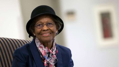
It has been said that Global Positioning Satellite (GPS) technology exists because of two people, namely Albert Einstein and Gladys West. Such a statement may be considered rhetorical but does convey the huge contribution that Gladys West made to geodesy that underpins all Global Navigation Satellite Systems.
Gladys West played a crucial role in developing mathematical models from early altimeter satellite missions that precisely described the Earth as a geoid rather than a perfect sphere. Her work involved complex calculations and early computer programming to process satellite data. These models made it possible to determine locations on Earth with high precision, a core requirement for GPS technology.
Modern GPS systems use Gladys West’s models through updated Earth‑shape and gravity frameworks that underpin satellite orbits, geoid corrections, and global reference coordinate without which today’s centimetre‑level accuracy is not possible.
As she said: “When you’re working every day, you’re not thinking, ‘What impact is this going to have on the world?’ You’re thinking, ‘I’ve got to get this right.’”
This year's EGR Taylor lecture seeks to do justice to Gladys West including her early life and studies, her time at Dahlgren, description of the scientific models she developed, the recognition she received later on and the impact of her work.
About the speaker
Philip Moore is Emeritus Professor of Space Geodesy at Newcastle University, where he spent over two decades as a leading member of the Geomatics group.
His research focused on the mathematical and computational foundations of satellite-based Earth observation, with particular emphasis on precise satellite orbit determination, satellite altimetry, gravity field recovery from missions such as GRACE and GOCE and applications of GNSS and altimetry to sea-level change, inland waters, hydrology, and cryospheric mass balance.
Moore’s contributions to satellite radar altimetry include improving the accuracy, calibration, and geophysical interpretation of altimeter measurements over oceans, coasts, inland waters, and ice‑covered regions. Much of this work is cross-disciplinary involving orbital mechanics, geodesy, and Earth system science.
Please note: The views of our speakers do not necessarily reflect the opinion of the Royal Geographical Society.
Note on captions
The Society aims to provide automatically-generated captions for all event recordings. The captions appear as text at the bottom of the video which you can toggle on and off.
The accuracy of automatically-generated captions varies depending on the audio quality, any specialist language used and the speaker. They are therefore are unlikely to be 100% accurate and the Society does not edit or correct automatically-generated captions.
- Webinar
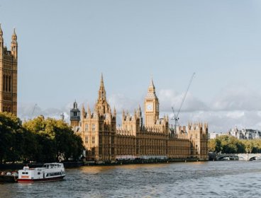
Use geography: careers in government
Join this webinar and hear directly from geography professionals working in government. They’ll share real world insights, personal career journeys, and practical advice to help you take your first steps into this exciting sector.
OnlineUndergraduatesWednesday 14 October 2026 - Collections event
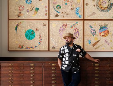
Tour of the archive and mural
Learn more about the mural Expanding Universe displayed in the Society’s Map Room at this engaging talk with the artist, Hormazd Narielwalla, and Dr Katherine Parker.
LondonOpen to allWednesday 14 October 2026 - Webinar
What do geographers actually do?
A webinar for secondary school students and teachers exploring careers with geography.
OnlineTeachersWednesday 14 October 2026