
This webinar explores the FRIDAS® checklist, a practical framework for improving Geographic Information System (GIS) data quality in Biodiversity Net Gain (BNG) submissions.
The introduction of Biodiversity Net Gain legislation in England marks a vital step toward ecological conservation. Yet, its success is hindered by inconsistent Geographic Information System data submissions and the absence of standardised requirements. This creates challenges for Local Planning Authorities, many of which are under-resourced and lack the technical capacity to manage data inaccuracies.
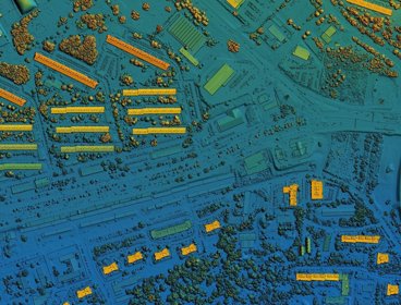
GIS data is central to calculating biodiversity metrics, but common issues, such as inconsistent red line boundaries, unaccounted slopes, and poor data quality (accuracy, precision, logical consistency), can compromise assessment reliability. These problems delay planning decisions and weaken BNG enforcement.
To address this, we developed the FRIDAS® checklist, a practical framework for improving GIS data quality in BNG submissions. FRIDAS® includes six categories:
- Format: Promotes standard GIS formats and spatial references to reduce conversion errors.
- Red Line Boundary: Ensures boundary consistency and alignment with land registry records.
- Identification: Focuses on accurate habitat classification, avoiding gaps and overlaps.
- Data and Metadata: Encourages documentation using GEMINI 2.3 standards for transparency.
- Attributes: Aligns with Natural England’s data standards for BNG.
- Slope: Accounts for topographical variation to improve ecological accuracy.
Despite its importance, GIS standardisation in BNG remains underexplored. By promoting robust data governance, we can enhance ecological assessments and support informed decision-making, ensuring BNG initiatives contribute meaningfully to long-term conservation goals.
About the speaker
Dr Katie Dawson is the Technical Director of EcoSpatial, a GIS consultancy and Esri partner specialising in environmental data, spatial analysis and Biodiversity Net Gain (BNG).
With over 10 years of experience in geospatial strategy and project delivery, Katie leads the development of digital tools and data standards to improve the quality and interoperability of spatial information in planning and conservation. She has recently co-founded the Biodiversity Net Gain Spatial Insights Group to support sector-wide collaboration.
Booking information
- Advance booking for this event is required. In order to book you will need an account on our website. If you already have an account you will be prompted to log in when you click 'book now'. Please create an account if you do not have one yet (you do not need to be a member of the Society to create an account).
- This event will be held on Zoom and joining instructions will be included in your confirmation email.
If you have any questions or require assistance with your booking, please email events@rgs.org
- Webinar

Geography in practice: WorldPop - how geospatial data puts people on the map
This webinar will explore how the WorldPop Research Group at the University of Southampton is combining traditional survey data with new geospatial data sources to develop innovative data science methods that can help us to better understand the spatial distribution of people across the globe.
OnlineOpen to allWednesday 3 September 2025 - Webinar

Geospatial transformation and the future of property valuation
Join us for an insightful webinar exploring the Valuation Office Agency’s (VOA) first enterprise-level Geographic Information System: Valuation Mapping System (VMS). This is a joint webinar with the Royal Institution of Chartered Surveyors (RICS) and the Government Geography Profession (GGP).
Open to allWednesday 10 September 2025 - Workshop
Empowering Level 4 students with geospatial skills - CPD
In this hands-on workshop we will look at ways that you can give your first-year students a gentle on-ramp to GIS which gives them the confidence to use GIS to solve geographical problems.
LondonOpen to allMonday 15 September 2025