Ethnographies of border mapping
Retracing the field through the geographical archive.
Research by Charuta Ghadyalpatil.
Start: to be confirmed. Durham University: PIs Philip Steinberg and Noah Leshem.
Overview
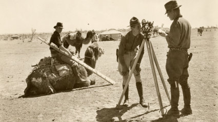
Many border treaties end with a map, defining and delimiting territory and sovereignty. But what lies behind the map? This proposal addresses this key question, focusing on the textual, visual, and epistemological practices that underpin the calculative fieldwork of border mapping. In so doing, it places ‘the field’ at the core of the research, as a site of encounter between surveyor and surveyed, between coloniser and colonised, between outsider and insider.
The negotiated process of border mapping is embedded in the archive: in the papers, notes, reports, and maps that document connections between field and office as boundaries are surveyed and demarcated on the ground, communicated on the map, and materialised through everyday practice.
To explore this multi-sited, multi-faceted archive, the proposed research will excavate ethnographies of border mapping through a studentship that fuses Durham University’s expertise in the technical practices of boundary delimitation and Queen’s Belfast’s expertise in the history of cartography with the rich collections of maps and other materials from boundary negotiations held at the Society.
Funded by .