Geographic Perspectives on Disaster Risk Management
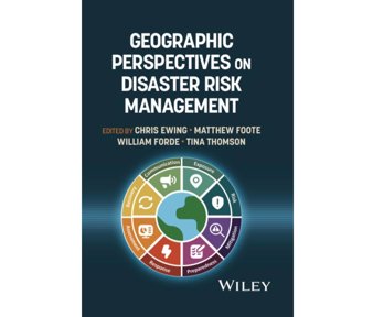
The Society held a four-part webinar series covering the launch of the book ‘Geographic Perspectives on Disaster Risk Management’, published by Wiley and co-authored by members of the Disaster Risk Management Professional Practice group committee.
The book demonstrates and compares approaches, data sources and tools used across a range of risk-focused sectors, including international development and disaster management, insurance and reinsurance, defence and governmental, and commercial.
The series featured leading risk professionals from the Society’s Disaster Risk Management Professional Practice Group who shared their insights on how geography informs real world decision making across the risk management lifecycle: preparation, response, recovery and mitigation.
The webinar spanned four sessions covering:
- Asset, infrastructure and exposure data
- Disaster preparedness and risk reduction
- Event monitoring, post-damage assessment and recovery
- Communicating and understanding risk
Session 1: Asset, infrastructure and exposure data
The first session focused on what’s at risk from disasters, such as assets, infrastructure and communities, and the importance of spatial data in asset management and land use planning.
The session was chaired by co-editor Matt Foote, Chief Insurance Strategy Officer, SPACE WARNER, who was joined by Anirudh Rao (Seismic Risk Modelling Lead, Global Earthquake Model), Charles K. Huyck (Executive Vice President, ImageCat, Inc) and Rashmin Gunasekera (Senior Disaster Risk Management Specialist, World Bank/GFDRR).
Session 2: Disaster preparedness and risk reduction
The second session looked at disaster preparedness and disaster risk reduction covering elements from the disaster risk management framework, including natural- and man-made hazards, political risks, pandemics and complex emergencies.
The session was chaired by Chris Ewing (Head of Business Development, Aon Impact Forecasting), who was joined by Michal Lorinc (Head of Catastrophe Insight, Aon Impact Forecasting), Stuart Fraser (Climate and disaster risk analytics specialist) and Maddie Ewbank (Consultant in DRR, Climate Adaptation and Anticipatory Action, UNRWA).
Session 3: Event monitoring, post-damage assessment and recovery
In this session, speakers discuss the role of geography in mobilising event response and logistics, real-time monitoring and communication to damage assessment, civil recovery and implementation of lessons learned.
The session was hosted by co-editor, Tina Thomson, Head of Analytics and Data, Willis Re, joined by David Heathcote (Head of Intelligence at McKenzie Intelligence Services), Alistair Norris (Independent disaster risk consultant), Matt Pennells (MapAction) and Richard Teeuw (Professor of Geoinformatics & Disaster Risk Reduction at the University of Portsmouth).
Session 4: Communicating and understanding risk
In this session, speakers discussed the importance of risk communication and understanding. Using examples such as spatially structured analytics, visualisations, reporting and digital mapping, the session explores the means to deliver increasingly sophisticated intelligence to decision makers in every field.
The session was hosted by co-editor, William Forde, joined by Alec Wild (Senior Catastrophe Research Analyst, View of Risk Advisory, Aon Reinsurance Solutions), Giacomo Favaron, Chief Technology Officer at Maximum Information and Josh Townsend (Lead Geospatial Engineer, National Grid)
Geographic perspectives on disaster risk management: asset, infrastructure and exposure data
Join us for the first of a four-part webinar series covering the launch of a new book 'Geographical Perspectives on Disaster Risk Management' featuring members of the RGS Disaster Risk Management Professional Practice Group.
Geographic perspectives on disaster risk management: disaster preparedness and risk reduction
This session covering 'Geographic perspectives on disaster risk management' explores disaster preparedness and disaster risk reduction covering elements from the disaster risk management framework.
Disaster risk: event monitoring and post damage assessment
In this session, speakers discuss the role of geography in mobilising event response and logistics, real-time monitoring and communication to damage assessment, civil recovery and implementation of lessons learned.