Remote sensing for disaster management - 2025 symposium review
In January 2025, the Disaster Risk Management Professional Practice Group hosted a symposium at the Society, in partnership with The Institute of Civil Protection & Emergency Management (ICPEM).
Titled, ‘Remote sensing in emergency and disaster management’, the symposium explored the use of remote sensing in different disaster management and response situations.
Chaired by Professor Richard Teuuw and Dr Ian Greatbatch guest speakers included:
- Ordnance Survey
- British Geological Survey
- Maritime Coast Guard Agency
- ICPEM
- AGI
- RSPSoc
- Humanitarian OpenStreetMap Team (HOT)
- MapAction
- ICEYE
Examples of remote sensing across various sectors
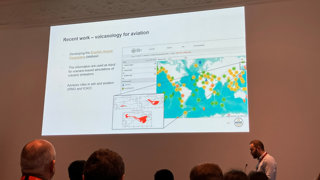
The symposium opened with a presentation from Richard Teeuw (Portsmouth University), who provided an overview of overview of satellite earth observation tools and sensors currently used for emergencies and disasters, with a review of the satellites and sensors currently in use or available during 2025-2026.
- James Armstrong (Ordnance Survey), then gave a presentation outlining many examples of UK ‘Mapping for Emergencies’, ranging from extreme weather events to the COVID-19 pandemic, as well as examples of geospatial 3-D visualisation.
- Alessandro Novellino (British Geological Survey) discussed disaster responses at the British Geological Survey, providing examples of geohazard mapping, monitoring and emergency response, highlighting the growing use of big data analysis.
- Dave Morris (Maritime & Coast Guard Agency) illustrated the types of geospatial data used in the maritime domain, discussing uses in both UK and international waters.
- Dewi Spijkerman & Paul Sowden (ICEYE) presented ICEYE’s high-resolution satellite radar imagery, showcasing ICEYE’s range of applications in the public sector, as well as insurance uses with flood events.
The final part of the symposium concluded with a set of presentations by representatives of professional organisations and the voluntary sector. This featured:
- Dr Frank Long provided an overview of the Institute of Civil Protection & Emergency Management (ICPEM)
- Fergus Craig summarised activities of the Association for Geographical Information (AGI)
- Richard Teeuw highlighted the Special Interest Group for Disaster Management within the Remote Sensing & Photogrammetry Society (RSPSoc)
- Kelvin Wong summarised activities of the RGS Professional Practice Group for Disaster Risk Management.
- Chris Ewing discussed the work of MapAction, highlighting its pioneering disaster response mapping.
- Pete Masters summarised activities of pioneering NGO: the Humanitarian OpenStreeetMap Team, which introduced ‘mapathons’ to disaster management.
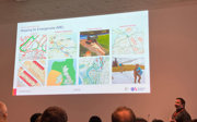
Posters from UCL and Portsmouth University were displayed throughout, featuring topics such as:
- ‘Assessing maritime Mass Rescue feasibility in the Northwest Passage’
- ‘Safety and security policy development for uses of drones in Search and Rescue’
- ‘Guiding hurricane resilience using remote sensing and digital twins’
- ‘Satellite remote sensing for detecting and monitoring illegal gold mining in Colombia’