A history of the Society's Collections catalogues
This resource, by Professor Felix Driver (Royal Holloway, University of London), Eugene Rae (Principal Librarian, RGS-IBG) and Dr Sarah L. Evans (Research and Collections Engagement Manager, RGS-IBG), provides information on how the Society's Collections have historically been organised, by describing the different card catalogues used over the course of the Society's history.
It also includes information about the digitisation of the Society's Collections catalogue as part of the HLF Unlocking the archives project. The card catalogues have now largely been superseded by the Collections Koha catalogue, although some are still available to consult in the Foyle Reading Room.
It should be read alongside our Hints and tips for using the Society's Collections resource..
What are the Collections
The Collections, as one might expect from the name, are the materials that the Society has collected since its foundation in 1830. This was in fulfilment of one of its founding principles, to bring together and collate the latest geographical information in a variety of different formats, including maps, printed books and periodicals, images, and more.
Initially this was solely for the benefit of the Society's Fellowship, a body that until 1913 was almost exclusively male. Today, the Collections are available for anyone who wishes to come and consult them, as part of the HLF Unlocking the archives project. You can find out more information about our Collections, and how to visit them.
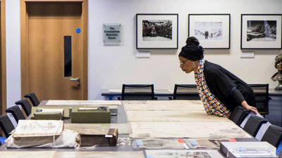
The Collections were originally dispersed across different rooms in the Society's building, particularly after its move to 1 Kensington Gore in 1913, organised by format (so the Library, the Map Room, and so on). Today, materials from across the Collections can all be consulted in the purpose-built Foyle Reading Room. You can find out more about the different types of material we hold, read our About our Collections page.
Card catalogues
At least from the 1890s, there were separate series of card catalogues for library items (books and journal articles) and for maps (in the Map Room). At some point during the twentieth century these were joined by further card series for photographs, lantern slides, museum artefacts and later manuscripts (post-1950).
Library
At least nine sequences of card catalogues have been identified. These included four primary sequences: an author catalogue in two sections (pre-1910 and post-1910), a corporate author catalogue (i.e. for items published by an organisation rather than an individual), and a periodicals title catalogue. In addition there were five secondary sequences: geographical area subjects, thematic subjects, biographical subjects, periodicals articles authors, and an index to portraits contained in the books held in the Library.
The author catalogue is divided into two sequences. The first sequence begins in the 1890s and ends in 1910 when the original set of 37 catalogue drawers was full. A new sequence was begun in 1910. By around 2000 the post-1910 sequence had 76 drawers of cards. The early cards were handwritten; in the early 20th century entries from the printed catalogue were cut and pasted onto cards, and in the second half of the 20th century entries were typed directly onto card.
- The corporate author catalogue had 13 drawers of cards by November 2002.
- The periodical title catalogue had seven drawers of cards by November 2002.
The library subject catalogue ran from the 1890s to 2000 in an unbroken sequence, and by November 2002 it had 312 drawers of cards. Like the author catalogue it began with handwritten cards, moved to cut and paste and then to directly typed cards. At some point in the early 20th century, in order to clearly distinguish monographs from periodical articles, the monograph entries were cut and pasted and later typed, onto pink cards. The cards for periodical articles remained white.
The periodical article author catalogue ran from the 1890s to 2000, although latterly not many articles were catalogued. In November 2002 it had 206 drawers of cards.
Map Room
There was one primary sequence in the Map Room card catalogue (arranged into four series, for post-1940 accessions: General; Division; District; and Special). This was supplemented by two secondary card sequences, arranged by name of cartographer and by G.S., G.S. (Geographical Section, General Staff) and similar numbering systems, and by separate card catalogues of pre-1800 material by author and geographical area/ thematic subject.
In addition, there were five large portfolios containing index diagrams to the series; and further separate catalogues and index diagrams covering such series as Hydrographic charts, published by the UK Hydrographic Office and others.
Photographs
By 2000, the photographs card catalogue had four primary sequences, arranged according to format (prints, transparencies, albums, and oversize and non-photographic material, that is, artworks) and four secondary sequences organised by geographical area, thematic subject, photographer/artist name and portraits.
There was a separate lantern slide card index, in four series catalogued by number, name, region and theme.
Museum artefacts
The card index of museum objects was compiled at some point (c.1917-early 20s) and contains accession information. During the late 1990s an electronic catalogue of 1,384 artefacts was created in the form of an Access database.
Manuscript archives
The card index of manuscripts was created at some point in the twentieth century and arranged by author, with a cross reference by geographical area. The format was designed as a finding aid and was less systematic and consistent than other card catalogues.
Film collection
It is not known if there was a card index for films – it seems possible though one has not been located. Entries for the surviving films in the Collections were added to the RGS-IBG Koha catalogue after they were digitised c.2017.
Microfiching of card catalogues
The Map Room catalogue cards were copied photographically onto 97 microfiches in the late 1990s/early 2000s by Chadwyck Healey. They formed part of unit 135 in the National Inventory of Documentary Sources: UK & Ireland (NIDS UK). This was the first ever microfiche catalogue of a collection produced by Chadwyck Healey (see Millea 2002).
Other cards for the Picture Library and archives were also microfiched by NIDS at some point prior to 2001.
Further library card catalogues (post-1910 author catalogue, subject catalogue, periodical article author catalogue, periodical title catalogue and corporate author catalogue) were microfiched from c.2003, again in consultation with NIDS.
Retroconversion of card catalogues
Most of these card catalogues – including library, maps, photos, lantern slides and museum artefacts – were ‘retroconverted’ into digital form 2001-2 as part of the HLF Unlocking the Archives project. In technical terms, retroconversion consisted of converting the content of index cards to MARC21 (a Machine Readable Catalogue format).
The contents of the manuscript index cards were an exception: too inconsistent for retroconversion on the same basis as the other collections, they were digitised as part of the A2A project and are now available through the National Archives Discovery portal. This is why the digital catalogues of the Society's Collections and of archives are separate today (though special collections are listed on the Koha catalogue at collection level).
There is remarkably little information in the public domain about the logistics of the retroconversion process. An article by Segell (2005) provides an account of the outcome of the project from the perspective of a user. The article is not entirely reliable (for example it says that all photographs were digitised) and it has little information about details of the what was a major logistical exercise.
Concerning the actual mechanics of retroconversion, Segell states that 210,000 index cards went to India for retroconversion and came back as a CD ROM. In reality, the process did not involve the sending of the original cards and was in fact much more complex logistically. Initial decisions had to be made (from December 2000) on which MARC fields were appropriate and how the information in the card catalogues was to be assigned to these fields.
Librarian Eugene Rae, map curator David McNeill and Keeper Andrew Tatham devised the specifications for the Library, Map Room and Picture Library respectively. Information from the artefacts database was also added. This exercise formed the basis of an invitation to tender document and then the appointment in 2001 of a specialist company named Lason (then working through their DIT subsidiary in Barbados) to undertake the work.
The retroconversion work was finally begun with the Picture Library cards in spring 2002. By the end of 2002, all the Library and Map Room cards had been photocopied. A3 photocopies, 12 cards to a page (marked up to indicate which information was to be used in the MARC fields), were shipped to Lason for retroconversion to digital format. This involved a large labour force rekeying the information into Word documents arranged according to the required fields.
However the process was significantly affected by changes in the structure and geography of Lason’s global operations. In November 2002, the company moved its base for this project from DIT (their subsidiary company in Barbados) to Vetri (another subsidiary company in India) with the project overseen in Chennai (Madras) by staff member Sherifer Bartholomew.
Society Collections staff maintained regular communications with Lason staff in Barbados, India and in the USA throughout the period of retroconversion to ensure quality control, checking and where necessary adjustment of specifications. Subsequently, much work had to be done on the design of the online catalogue or OPAC (Online Public Access Catalogue), the storage of the data and the user interface.
Eventually the Society's catalogue was made available to users when the Foyle Reading Room opened in 2004. Initially hosted by SIRSI/Dynis, the catalogue was moved to Koha at a later date.
Printed catalogues
A series of printed Library Catalogues (and supplements) were published from 1852 onwards. Supplements were necessary because of the sheer scale of library acquisitions. Dates mentioned by H.R. Mill in his 1930 history of the Society are: 1852, 1865, first supplement 1871, second supplement 1881, third supplement incorporated into a new catalogue 1893, subject index late 1890s.
Although long advocated, a printed Catalogue of the Map Room of the Society was not published until 1882. Mill says that the map collection was only properly organised from the 1870s and this was the first and only map catalogue (including scale information, arranged hierarchically). At this point the map curator was John Coles and his Assistant EA Reeves, who later succeeded him. It's significant that these were also the men who led the Society's training in surveying courses, and wrote for Hints to Travellers.
Concerning map catalogues generally and the way they worked: whether in card or print, they were arranged by geography/scale rather than by author (See Janes 2012 on the evolution of the TNA map catalogue).
There was a printed Museum Catalogue (listing the object and art collection of the Society), c.1914. There is a second annotated version of this showing later accessions (to 1930s).
Note that the Society’s Journal listed accessions to the library (including maps) in various forms, especially from 1870s onwards.
There are extensive typed Handlists of Archives at collection (for example Special Collections, Society Committees) and sometimes item level (for instance the Everest Collection). These are available from the Foyle Reading Room Enquiries desk for consultation.
Manuscript registers and lists
Mill states that in 1930 there were three separate lists of maps, photos and lantern slides at the Society. It is not clear if these were printed or manuscript.
The library operated a working MS library catalogue in some form. Some libraries (for instance BL or Cambridge) maintained an alphabetically organised series of 'guard books' into which movable slips would be pasted into the spaces between other slips. At the Society, it is likely that librarians inserted manuscript additions into the printed catalogue until a new edition was produced (as we can see from the museum catalogue: see above).
There is a detailed manuscript Maps Accessions Register (which also includes artefacts and picture library materials including photos and drawings).
There is an MS Register of Photos, watercolours and drawings, uncertain date and updated incrementally (X series).
There is a MS Register of Museum Objects, compiled c.1914-1964.
There are two typed listings of the contents of the film collection drawn up in the 2000s.
Sources
Society histories of the Library, Map Room, Drawing Office and Archive collections
-
Crone, G (1954) ‘The library of the Royal Geographical Society’ Geog Journal 121: 27-32.
-
Crone, G & Day, E (1960) ‘The map room of the Royal Geographical Society’ Geog Journal 126: 12-17.
-
Freeman, M & Longbotham, J (1980) ‘The Fordham Collection at the RGS: an introduction’ Geog Journal 146: 218-231.
-
Holland, G (1980) ‘The centenary of the Society's drawing office’ Geog Journal 146: 210-217.
-
Kelly, C (1975-1988) ‘The RGS archives’, six-part series of articles, Geog Journal.
-
Mill, HR (1930) The Record of the Royal Geographical Society, 1830-1930.
-
Middleton, D (1978) ‘Guide to the publications of the Royal Geographical Society 1830-1892’ Geog Journal 144: 99-116.
-
Reeves, EA (1935) Recollections of a Geographer.
-
Markham, C (1881) The Fifty Years' Work of the Royal Geographical Society.
-
Markham, C (1899) ‘Address to the RGS’, Geog Journal 14:1-14.
-
Walker, L (1980) ‘The Royal Geographical Society’s house: an. architectural history’ Geog Journal 146: 178-189.
Sources on microfiching and retroconversion of RGS catalogues, c1998-2002
-
Tatham, A (2003), ‘RGS-IBG card catalogues: production of microfiche copies of non-automated elements of the catalogues’ (internal RGS document).
-
Rae, E (2002) ‘Unlocking the Archives: computerisation of the collections card catalogues’, internal Society document).
-
Millea, N (2002), ‘Report of UK Map Curators Group’, British Cartographic Society (2002).
-
Segell, G (2005) ‘Unlocking the Royal Geographical Society archives: the experiences of a Fellow of the Society as a teacher and as a researcher on retroconversion of RGS catalogue’, Program: Electronic Library and Information Systems 39: 353-65.
General histories of library catalogues
-
Reichmann, F (1964) ‘The Catalog in European libraries’ The Library Quarterly 34: 34-56.
-
Bowman, J (2006) ‘The decline of the printed catalogue in Britain’ Library History 22: 67-99.
-
Bowman, J (2007) ‘Retrospective conversion: the early years’ Library History 23: 331-40.
-
Krajewski, M (2011) Paper Machines: About Cards & Catalogs, 1548-1929, MIT Press.
-
Janes, A (2012) ‘Of maps and meta-records: eighty-five years of map cataloguing at the National Archives of the United Kingdom’ Archivaria 74: 119-165.
Selected academic histories of RGS Collections
-
Driver, F (2001) Geography Militant: Cultures of Exploration and Empire.
-
Driver, F & Jones, LM (2009) Hidden Histories: Researching the RGS-IBG Collections.
-
Faull, J (2019) Climbing Mount Everest: expeditionary film, geographical science and media culture, 1922-1953, PhD Royal Holloway, University of London.
-
Hayes, E (2016) Geographical projections: lantern-slides and the making of geographical knowledge at the Royal Geographical Society c.1885 – 1924, PhD University of Exeter.
-
Jones, L M (2000) Local knowledge and indigenous agency in the history of exploration: studies from the RGS-IBG collections, PhD Royal Holloway, University of London.
-
Jones, M (2005) ‘Measuring the world: exploration, empire and the reform of the Royal Geographical Society, c.1874-1893’ in M Daunton (ed) The organisation of knowledge in Victorian Britain.
-
Newman, B (2019) Geography in print: cultures of periodical publishing at the Royal Geographical Society, 1830–1900, PhD Royal Holloway, University of London.
-
Ryan, J (1994) Photography, geography and the British Empire, PhD Royal Holloway, University of London.
-
Wess, J (2017) The role of instruments in exploration: a study of the Royal Geographical Society, 1830-1900 PhD University of Edinburgh.