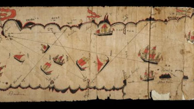
Indigenous mapping and colonial cartography
During the colonial era, British explorers, colonial officials and settlers often depended on Indigenous people to supply them with geographical information about the places they were exploring and colonising.
Sometimes, the British commissioned, collected or seized maps from Indigenous peoples. When these maps were accessioned into European collections, their uses and meanings changed as they became sources of 'native information', ethnographic objects or exotic curiosities.
About the activities
This 30-minute workshop provides an introduction to Indigenous maps in the Society's Collections and addresses themes such as the diversity of mapping traditions around the world, the importance of Indigenous maps for European cartography, and the history of our map collection.
There are two different versions of this workshop, one for students with limited archival experience, and one for students with moderate archival experience.
These activities were created by Joy Slappnig. Based at Royal Holloway, University of London, Joy has researched the extent of Indigenous contributions to the maps held in our Collections, in order to explore the historical significance of maps of indigenous origin and their purpose as a source of geographic information.
This research was undertaken with funding from the Arts and Humanities Research Council’s Collaborative Doctoral Awards, in collaboration with the Society.
Workshop for students with limited archival experience
This workshop is intended for students with little or no experience working with historical archives or collections. Using images of selected maps from the Society's collections, this workshop is structured around group activities using question sheets.
To give students an overview about the themes discussed in this workshop, the workshop leader may want to give a brief introduction (5 minutes) using the images in the PowerPoint presentation, which can be downloaded below.
Then, the students will be divided into three groups, each working with one of three case studies of maps and a set of questions. Images of the map case studies and question sheets can be downloaded below.
There is also information about the individual case studies, which the workshop leader might give to the students after the initial group discussion. After 7-10 minutes of group discussion, the class will come together for the final discussion, which will last about 10 minutes.
It might be useful to structure the final discussion in the following way:
- Part one: every group introduces 'their' maps, making reference to the questions they discussed if they want (the purpose of this is to give everyone an overview of the different maps discussed).
- Part two: the class will collectively discuss more general questions relating to the workshop theme.
Materials available to download
- Photographs of maps from Society's Collections (PPT);
- Information about these maps (DOC);
- Introductory information about the themes of this workshop (DOC);
- Images of maps to illustrate themes of this workshop (PPT);
- Handout with questions for group activities (DOC);
- Key texts about workshop themes (DOC).
Workshop for students with moderate archival experience
This workshop takes place in the Foyle Reading Room in the Society's building in London and is directed at students who have some knowledge of historical archives and collections, and who might consider using them for their dissertations. The workshop is structured around a display of maps and students will work in groups or independently using question sheets.
To give students an overview about the themes discussed in this workshop, the workshop leader might want to give a brief introduction (5 minutes) using the images in the PowerPoint presentation, which can be downloaded below.
There is information about the items on display also available to download below; the workshop leader may decide whether to distribute this to students or present it as part of the introduction. The questions sheets can either be handed out to students for discussions amongst smaller groups, or the workshop leader may use them to lead a discussion about the display with the whole group.
Materials available to download
- List of maps that will be consulted in the Foyle Reading Room (DOC);
- Images of maps to illustrate themes of this workshop (PPT);
- Information about the maps used in this workshop (DOC);
- Introductory information on the themes of this workshop (DOC);
- Handout with questions for group activities (DOC);
- Key texts about workshop themes (DOC).