For over a decade, an international team of geographers from the UK, Vietnam and Cambodia have been studying the Mekong River, observing how the river and Tonle Sap lake systems function and the relationships that local people have with these water resources.
The team has seen a huge increase in sand mining (the removal of sand from the bed of the river by mechanical extraction) during this period, driven by a global boom in construction which means that sand is now the world’s second most used natural resource, behind only water.
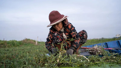
Cambodia’s appetite for sand has come at a cost for the communities that live on and around the Mekong. These are already vulnerable communities who have been subject to the compounding effects of climate change and upstream hydro dams.
Research by the team has shown how, locally, sand mining lowers the river bed and increases river bank instability, leading to bank collapse. Studies have also shown impacts further afield, resulting in reduced sediment supply to the delta and a shrinking of the Tonle Sap lake, which supplies an estimated 70% of Cambodia’s protein through fish.
This collaboration between the team and a Cambodia-based photojournalist seeks to document the nature and scale of sand mining activity and give a voice to some of the individuals who are impacted by it, shining a light on the hidden stories behind the global headlines of sand mining.
View the exhibition
Tip: For the best experience, we recommend viewing the content below on a desktop in full screen mode - press F11 on Windows (press F11 to exit) or Ctr+Cmd+F on OS X (Apple) to enter full screen mode.

Having trouble viewing this online exhibition?