Using Citizen Science to monitor habitat conditions of estuaries in the UK
By Geraldene Wharton, Queen Mary University of London et al.
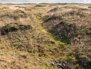
Estuaries are vitally important habitats. They are rich in biodiversity and provide essential ecosystem services including the storage of carbon, filtering of pollutants, and breeding and nursery grounds for fish. UK estuaries are also globally important by providing a refuge for wintering birds from across the northern hemisphere. But over decades and centuries many estuaries have been heavily modified and impacted by pollution, and now they are increasingly vulnerable to rising sea levels and coastal erosion caused by climate change.
In the absence of an approach for assessing and monitoring the habitat condition of UK estuaries to inform conservation and restoration initiatives we developed MoRPh Estuaries CSci. This is a field-based method designed for trained Citizen Scientists working with professionals to record the physical habitat characteristics of estuary margins. The Citizen Science approach enables habitat data to be collected at more locations, more frequently, and at a much lower cost than would be possible by statutory organisations and importantly helps connect communities to share their knowledge and build evidence to inform local decision-making. MoRPh Estuaries CSci complements MoRPh Rivers and together the tools provide an integrated approach to surveying a river’s physical habitat from source to sea (Modular River Survey). Data collected in the field using a standardised survey form are stored, analysed to calculate a set of indices, and visualised in the online GIS-based platform, Cartographer.
The development of MoRPh Estuaries CSci has been funded through Queen Mary University of London Impact Funds and The Championing Coastal Coordination (3Cs) initiative. 3Cs is a programme of work led by the Environment Agency with support from Natural England, the Marine Management Organisation (MMO) and the Association of Inshore Fisheries and Conservation Authorities (IFCAs) seeking to improve the coordination for coastal sustainability and resilience in England. For our Championing MoRPh Estuaries project, 3Cs funding enabled a group of stakeholders to come together: School of Geography, QMUL; Cartographer; Environment Agency; The Rivers Trust; National Trust; Wyre Rivers Trust; Thames21; and the Institute of Fisheries Management.
In the 3Cs Pilot Study (2021-22) we tested the field survey forms and training materials through local trials in the Thames and Wyre estuaries working with Wyre Rivers Trust and Thames21. We worked with local Citizen Scientists, many of whom already had experience conducting other Citizen Science surveys such as BioBlitz and Plasticblitz. And we disseminated evidence of physical habitat condition and pressures to local stakeholders and shared information on how to access the method and tool through the Coastal Partnership Network communities. This dissemination has been aided by an online Storymap created by The Rivers Trust as a publicly available knowledge resource (MoRPh Estuaries Storymap). In the Wyre catchment, a team of 12 trained Citizen Scientists are working with the Wyre Rivers Trust team and other partners (RSPB, Lancashire Wildlife Trust, Fylde Bird Club, Environment Agency, Natural England, Wyre Council, Lancaster University and the Royal Society of Biology) and using MoRPh Estuaries CSci to monitor the saltmarsh restoration project at Arm Hill and assess the benefits for saltmarsh habitat. Further integrated research supported by 3Cs in the Wyre Estuary with the Institute of Fisheries Management will be exploring the associations between juvenile fish populations and habitat availability.
In 3Cs Phase 1 (2022-23) we began the process of extending the reach of MoRPh Estuaries CSci to become a national survey. We launched a questionnaire to assess the needs and opportunities of groups working in estuaries and shared the questionnaire through The Rivers Trust and CaBA Newsletters, Coastal Partnership Network, and the Modular River Survey website. Feedback from 60 respondents representing 36 organisations across all sectors is informing the next stages and a national webinar (April 2023) provided further information on the survey tool and training opportunities. In the same month we also presented MoRPh Estuaries CSci at the UK River Restoration Conference Annual Network Conference. Our aim foing forward is to identify MoRPh Estuaries CSci “champions” to work with us to grow a national network of trained Citizen Scientists and build support through regional hubs. Future MoRPh Estuary CSci field surveys will also help create a national database in Cartographer across the eight recognized estuary types in the UK (Bar Built, Coastal Plain, Ria, Barrier Beach, Fjord, Fjard, Embayment, and Complex) to build evidence on estuary habitat condition.
In parallel, we are developing a professional version (MoRPh Estuaries Pro) for use by statutory organisations and environmental consultants. This has been informed and made possible by the 3Cs pilot study and Phase 1 activities for MoRPh Estuaries. MoRPh Estuaries Pro calculates a greater number of indices and has an Estuary Condition Assessment. And through on-going consultations with Natural England and the Environment Agency we are working to align the survey with the government’s Biodiversity Net Gain approach.
Summary
-
MoRPh Estuaries CSci is a field survey-based tool developed for trained Citizen Scientists working alongside professionals from third sector organisations to assess and monitor the physical habitat condition of estuary margins in the UK.
-
Citizen Science brings invaluable local knowledge, allows surveys to be undertaken at a spatial and temporal frequency than would otherwise be possible, connects communities with an interest in their local estuaries, and builds evidence to inform local decision-making.
-
Our next steps are to work with (a) MoRPh Estuaries CSci champions to grow regional hubs as the basis for establishing a national network of trained surveyors and (b) statutory organisations and environmental consultants to support the uptake of MoRPh Estuaries Pro nationally. For further information and updates please see www.modularriversurvey.org.
Authored by Geraldene Wharton, Queen Mary University of London, Lucy Shuker, Queen Mary University of London & Cartographer Studios Ltd, Richard Charman, Environment Agency, Kate Spencer, Queen Mary University of London, Ryan Smith, Queen Mary University of London, Tom Myerscough, Wyre Rivers Trust, Heather Stott, Wyre Rivers Trust, John Bryden, Thames21, AJ McConville, Thames21, Hannah Reid, Thames21, Rob Collins, The Rivers Trust, Heather Bell, The Rivers Trust, Steve Colclough, Institute of Fisheries Management, Stewart Clarke, National Trust, & Helen Jay, National Trust.
Banner photo: Morecombe Bay upper estuary, NW England (taken by Jacqueline Greef)
How to cite
Wharton, G., Shuker, L., Charman, R., Spencer, K., Smith, R., Myerscough, Tom., Stott, H., Bryden, J., McConville, AJ., Reid, H., Collins, R., Bell, H., Colclough, S., Clarke, S., and Jay, H. (2023) Using Citizen Science to monitor habitat conditions of estuaries in the UK. Working with voluntary and community groups. Royal Geographical Society (with IBG) Guide. Available at: https://doi.org/10.55203/JTOL5914
About this guide
Working with voluntary and community organisations for some is a very important way to do geography. These organisation come in various shapes and sizes and may also often be referred to as the third sector, the voluntary sector, not-for-profit organisations, community groups or the civic sector. In this guide, we share the experiences of researchers doing geography in collaboration with community and voluntary organisations. A range of topics and issues are explored from health, disability and care, through to austerity, violence, and craft, amongst others. We learn about the approaches taken by geographers in their work with community and voluntary organisations, and some of the challenges they have negotiated in the process.