Teaching Geography with Sustainable Practices and Creativity
I went to a school where traditional didactic teaching practices were quite visible, textbook based teaching with three common equipment such as, wall maps, atlas and a globe, remained as my memories of geography classes. As a child, my broad understanding of geography was centered around location, latitude and longitude, time differences and related calculations, a few strangely named places and some random information around those places. Being a child born and brought up in a flood prone area of alluvial plain, for me, it was difficult to understand what drought meant, what a desert or snow-covered area might have looked like, and many such aspects never seen before. Probably the children born in a dry area or desert fringe, or drought prone area face similar challenge while learning about perennial rivers, floods, and snow-covered areas with glaciers.
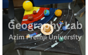
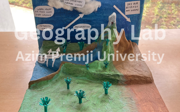
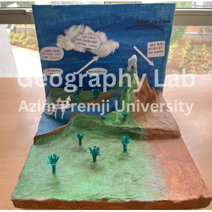
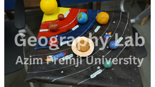
Geography as a subject, keeps on encouraging imagination. One must imagine many aspects presented in geography textbooks e.g. our planet earth is huge, sun is very far, interior part of earth is very hot, volcanic eruption coming from interior part of the earth, unreal lines like latitude, longitude, international date lines, and many more. To make these abstract features understandable, I have conceptualised a few three-dimensional (3D) models which are prepared by my students. These models are kept in a space called “Geography Lab” in Azim Premji University, Bengaluru (India). The 3D models are created out of re-used or waste materials such as packaging materials, waste papers from printers, used plastic bottles etc. In this small space, one can experience and understand a variety of concepts ranging from features associated with the galaxy and earth’s movement (such as solar system, eclipses, phases of moon) to earth’s features visible, felt or experienced. A person can see miniature of multiple landforms such as arid landforms, fluvial landforms, glacial landforms and karst topography.
The basic purpose of this lab is to introduce abstract concepts of geography in a simpler manner with the help of miniature models. This lab is open to potential learners of any age who are interested to know the earth’s features (natural and human made) and relate the same with their own life. These are more useful to the children studying in schools with limited financial and material resources. The teachers can easily learn and replicate such models using indigenous materials. If the concepts are taught in the classroom along with some audio-visual materials, the learners may gain more clarity about the concepts.
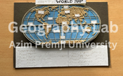
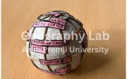
Whatever models are useful for visual learners, may not be useful to learners having visual impairment. I realised it while a student having partial visual impairment expressed this concern to me. Hence, my next journey of making tactile 3D models started. Right now, the lab has tactile maps, globes, and a few models with labels in Braille script which are again made of recycled materials.
All such models are the outcomes of my students’ creativity. I am sure that creativity of children in schools can give such a project a great momentum. Imagine the teachers teaching the concepts and guiding the children to make their own models with local materials. It will be so much fun! Geography taught by using the approach of “learning by doing” will make the learning journey exciting and memorable forever, to both the teachers and the learners.
Dr Saswati Paik
Faculty, School of Education,
Azim Premji University,
Bengaluru (India)
