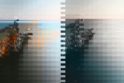
Coasts
How will climate change impact on erosional processes and landforms in British waters?
How will climate change impact on depositional processes and landforms? What impact will climate change have on salt marsh and sand dune ecosystems in the UK? What issues arise from climate change for how the UK coastline is used and managed?
Landforms of coastal deposition
Coastal deposition is the laying down of material on the coast by the sea. It occurs when waves lose energy or when large inputs of sediment are made into the coastal system - perhaps due to the arrival of fluvial sediment at a river estuary. Wave refraction in bays also encourages deposition due to the dispersal of wave energy. Lower-frequency constructive waves often contribute to deposition due to their strong swash, moving beach material inland.
In addition to beaches, a range of unique depositional landforms exist, including the bar, spit, tombolo and cuspate foreland. The formation of these landforms additionally depends upon the process of longshore drift. This occurs when waves approach a coast-line at an angle, due to the dominant wind. There is thus a sideways component to the swash which helps move beach material diagonally up the beach (it travels laterally as well as inshore). Backwash under gravity returns water and beach material directly to the sea (perpendicularly to the beach profile). The net result is a zig-zag or saw-tooth motion that can carry material past the end of a headland.
Depositional landforms can be highly vulnerable to erosion during extreme storm events unless vegetation colonisation has taken place. Plant roots can help anchor sediments, making them more resistant to the action of destructive waves.
How will climate change impact on depositional processes and landforms?
Climate change threatens depositional landforms in two main ways:
1. Rising waters mean that landforms such as beaches and bars will be increasingly at risk of day-to-day erosion and submergence. Beaches in Miami already need to be artificially replenished at regular intervals using deposits dredged from further offshore. Similar actions could soon be needed in many other places, especially where expensive developments have taken place. On the Studland Peninsula in Dorset, the six kilometres of sandy beach (which attracts over a million visitors a year) is being eroded by two to three metres a year. The cafes, toilets, a shop, car parking and beach huts on the eroding southern section are under threat. The Trust has moved the beach huts twice and is now seeking a way to relocate many of the other buildings and infrastructure.
2. Extreme weather events have become more common as a result of climate change and these can wreak sudden havoc on depositional landforms such as spits and bars. Rising sea temperatures provide greater energy for hurricanes and depressions (as moist water becomes even more unstable when it is warmed). The combination of wind and low atmospheric pressure forces sea levels upwards by many centimetres or even metres in some cases. This can lead to the breaching of bars and spits. For instance, in 2004, Hurricane Charley was one of a series of hurricanes that devastated the coast of Florida. The North Captiva spit was breached by the high tides and strong winds, leaving a 450m gap between a newly created island and the mainland.
Fluvial depositional landforms are also vulnerable to these same effects where they are found close to the coastline. The devastation caused by Hurricane Katrina in New Orleans in 2005 was partly due to the breaching of river levees. Elsewhere, many of the world's major deltas are at risk of submersion and erosion. Already, several small islands in the Indian ocean have been partially submerged and 30,000 km2 of land in Bangladesh and India is expected to disappear in the event of a 1-metre rise in sea-levels overwhelming parts the Ganges delta. This could lead to the displacement of tens of millions of people.
Student Practice Question:
Analyse the factors influencing the development of depositional coastal landforms
Day-to-day factors include wave energy, supply of sediment and the direction of dominant and prevailing winds. However, the time factor is also important. Extreme weather events and tsunamis can entirely re-shape depositional environments overnight, but their influence can only be discerned when studying an environment over longer time-scales - as they occur infrequently. Students can ask whether climate change may increase the regularity of high-impact storm surges or hurricanes, causing a step-change in the development of depositional landforms (spits may breach, for instance).
Landforms of coastal erosion
Landforms of coastal erosion include cliffs, wave-cut platforms, arches, stacks, headlands and coves (amongst others). The existence of many of these features depends upon the maintenance of a vertical cliff-face through an on-going cycle of undercutting, collapse and retreat.
When waves break at the foot of a rock face, a wave-cut notch is created by marine erosion processes. Over time, a section of rock is removed from the bottom of the cliff face, leading ultimately to the collapse of the un-supported section above. Every time this process is repeated, a new near-vertical cliff-face is created.
Without marine erosion operating in this way, sub-aerial processes (normal atmospheric weathering processes such as carbonation or hydrolysis) would degrade the cliff face, creating a gentle slope where the upper element has been worn away by weathering while fallen material collects at the bottom of the cliff. Vegetation can colonies such slopes over time, leading to greater stability.
Wherever land has risen from the sea in the past as a result of isostatic processes (when land subsides, rises or tilts), degraded cliffs can often be seen that are no longer reached by the sea. Instead of boasting a dramatic near-vertical profile, gentle vegetated slopes are apparent on account of marine erosion no longer attacking and undermining the landform. Plenty of these abandoned (or relict) cliffs can be seen in the north-west of Scotland.
How will climate change impact on erosional processes and landforms in British waters?
Waves erode via a number of processes. These are wave pounding, hydraulic action, abrasion and corrosion. The effectiveness of the first three of these depends upon wave energy. With climate change, stormier weather could increase rates of marine erosion and the UK has already been reported as becoming twice as stormy in the past 50 years! According to new Hadley Centre research, climate change has modified the North Atlantic oscillation and forced deep depressions that used to hit Ireland further south, causing more of them to pass over southern parts of the UK where there are many cliffed coastlines (for instance, the world-famous Jurassic Coastline).
In addition, climate change is likely to bring about significant eustatic rises in sea level, initially because of thermal expansion of sea water and later due to the increased volume of melt-water as a result of glaciers melting. In the event of major land-based ice sheets in Greenland and Antarctica melting, sea levels could rise by many tens of metres - although this is not a change anyone alive today is likely to live to see. The impact that rising sea-levels will have on cliff erosion depends upon existing conditions and also on the operation of isostatic processes (where the land is rising or sinking independently or any change in ocean water levels). In general:
-
Areas where cliffs are currently subject to undercutting and collapse will continue to retreat, although the position of the wave-cut notch and the level and gradient of the wave-cut platform may begin to change over time as waves will attack the cliff face at a higher point.
-
Abandoned or relict cliffs may find themselves subject to retreat once more as sea levels may rise to a point where waves can reach the bottom of the cliff face.
-
In northern Scotland, isostatic changes may continue to take place at the same rate as eustatic rises occur. There will therefore be no net change in the observed sea level and little change may be witnessed in coastal morphology.
-
Rates of erosion and retreat will increase in any area that appears to be experiencing a higher frequency of stormy weather, especially in areas of softer clay.
Student Practice Question:
Explain why rates of coastal erosion vary.
A large part of the discussion will look at spatial variations in rates of erosion, linked to factors such as rock type and structure, wave energy and the presence of defences. However, a good response will also consider temporal changes and the impact that climate change can have on whether or not waves are reaching the base of a cliffed coastline (as sea-levels rise or fall).
Coastal ecosystems
Coastal environments provide niches for vegetation and animal species to exist in that are not found elsewhere. Firstly, there is salt marsh. Stagnant or slow-moving water found behind a spit, or in a lagoon, can provide the perfect conditions for deposition of sediment to form mud-flats. Once enough material has been laid down for land to become exposed at low-tide, specialist plants can colonise the site. Known as pioneer species, they are specially adapted to the extreme conditions found in the inter-tidal zone. plants such as eel grass and salicornia can survive regular submersion by salt water, whilst are also tolerant of the drying effect of strong winds at low tide.
Over time, these pioneers help to trap sediments, allowing the height of the mudflats to increase. This is the start of a process of plant succession where less tolerant but more complex species can now invade as conditions ameliorate (improve) further. Moving inland, one can normally observe a series of changes as older, higher land is encountered where more time for change has passed. The sequence of changes is called a halosere and may often end, at some distance inland, with a mature deciduous forest - the climatic climax community of the UK.
Similar changes can be observed in coastal sand-dunes, known as a psammosere. Here, plants such as marram grass that can survive life in the fore-dunes are tolerant of extreme aridity and have long tap roots that can reach the water table. Further inland, the addition of humus (organic matter) from previous generations of marram has allowed species such as gorse or small trees to colonise wherever a stable, water-retentive soil has developed. Sand dunes also provide one additional niche for rare species - in between the dunes lie damp hollows known as dune slacks that can support hydrophytes (water-loving species), including insects and animals. For instance, the natterjack toad lives in the dune slacks at Formby and Ainsdale in Lancashire.
What impact will climate change have on salt marsh and sand dune ecosystems in the UK?
Halosere environments are at risk of submersion, especially along the south coast (e.g. the Solent) where geological processes are causing the land to sink at the same time as sea-levels are starting to rise. If salt marsh vegetation cannot trap new sediments at a rate that keeps pace with the net rise in sea level, then it may be completely overwhelmed and be lost to the sea.
However, a new strategy of managed retreat is being adopted by some land-owners. This involves farmland further inland being abandoned to the sea in order to provide a new 'buffer' against the rising tides. This means that halosere communities will not be lost in many places - they will instead migrate further inland as previously dry agricultural land changes into mud flats. For instance, along National Trust land in Porlock (in Somerset) the sea has been allowed to breach the shingle ridge. Now that it floods behind the shingle, a new saltmarsh is rapidly developing.
Psammosere environments may become more at risk of extreme storms which can cause blow-outs and destroy dunes. Recently, the sand dunes at Formby and Ainsdale have suffered as the result of a series of severe winter weather events. Severe storms can take twelve to fifteen metres from the front of the dunes. In January 2007, a major storm blew sand 25 metres inland over 48 hours, covering over tourist facilities such as the car park. Formby may have to contend with such extreme conditions on a more regular basis in the future. Over the next 100 years, the dunes may recede by more than 400 metres, a change which the National Trust says it will allow to occur naturally.
Student Practice Question:
Examine the factors influencing the development of a named coastal ecosystem
One criticism of the model of plant succession leading to climatic climax is that it assumes a stable geological and climatic environment for autogenic (plant-driven) changes to take place within. A good answer to this essay will describe and explain the general changes that have thus far been observed for either a psammosere of halosere. However, it may then question whether these processes will continue to operate effectively if sea-level change is also occurring: for instance, can the relative level of mud flats continue to be raised through deposition, if the height of the water is also starting to rise?
Management and use of the UK coastline
The coastline is used in multiple ways, including:
-
settlement
-
tourism
-
agriculture
-
other uses (power, industry, defence)
Much of our use of the coastline was originally grounded in a belief that the coastline is essentially fixed. Thus, highly sensitive structures such as nuclear power stations are often found close to the water's edge while millions of people have invested serious money in property with a sea-view! For this reason, the traditional approach to any threat of coastal erosion or flooding has involved "shoring up" the coastline with hard engineering sea defences such as sea walls.
However, scientists now appreciate that the coastline is far more dynamic that had been suspected in the past and that engineering may not always be the best solution. Only 8,000 years ago, for instance, Great Britain was still joined to continental Europe as a result of lower sea levels. Early Britons lived in the middle of what is now the North Sea and the English Channel was entirely dry! In the space of just several decades centuries, sea-levels rose to create the coastline we know today (all of this was a result of ice melting at the end of the Pleistocene ice age).
Could such significant changes take place over such a relatively short time-scale once again? If so, what kind of defences or management techniques will we need to protect us in the future?
What issues arise from climate change for how the UK coastline is used and managed?
The National Trust recently made an assessment of the threat posed to coastal sites under its ownership in a report called Shifting Shores. Using Flood Risk Maps provided by the Environment Agency in conjunction with predictions of sea-level rise due to climate change, the National Trust Coastal Risk Assessment indicates that over the next century:
-
169 sites along some 608 kilometres (60%) of National Trust-owned coastline could lose land by erosion
-
10% of this loss could take place between 100 - 200 metres inland
-
Another 5% could take place more than 200 metres inland
-
126 sites with land covering 40 square km are currently at risk from tidal flooding
-
33 further low-lying sites are at risk of combined tidal and river flooding within the next 100 years
What can be done? Holding the line and resisting change through hard defences, often in the form of rock or concrete, have been the National Trust’s traditional responses to coastal change. However, during the last few years the charity has changed its outlook. The Trust is arguing that “through evidence and experience we now have a better understanding of the forces of nature and the consequences of working against them. Our policy is to take a long-term view, working with natural coastal change wherever possible.” Recognising that some changes cannot be prevented, the new report concludes that “we favour adaptation.”
In practice, this now means abandoning land to the sea wherever possible as part of a policy called managed retreat. In June 2004, DEFRA - the government department responsible for sustainable development - published their own consultation paper titled Making Space for Water. The very title will make coastal dwellers extremely nervous, especially when the content reads: “the government proposals that solutions for flood management and coastal erosion that work with natural processes to make more space for water should be identified and pursued wherever possible.”
Student Practice Question:
Examine the reasons for and the consequences of coastal management strategies
The reasons for management should encompass both the value of the coastline (why there is a case for conserving it) as well as the nature of the threat (and here, climate change / sea-level rise should be discussed). The consequences of any strategy are that some measure of success may be achieved while substantial costs are incurred. However, students may additionally take a long-view and look at the way that continued sea-level rises mean that no strategy can ever be hailed as a "complete success" - as current levels of protection may soon become inadequate. This essay is thus a good showcase for a discussion of managed retreat. A case study with further information about Slapton Sands, a shingle beach, can be found here – provided by Geography South West.
Fieldwork and practical suggestions
The study of coastlines presents many opportunities for students to undertake personal research or group fieldwork. Traditionally, work has often concentrated on:
-
Aspects of coastal geomorphology such as cliff retreat or beach profile mapping and sediment analysis
-
Coastal ecosystems and the way that they change along a transect directed inland
-
Competition between different user groups
The predicted dire consequences of climate change and sea-level rise mean that there are now plenty of opportunities to incorporate this theme when undertaking a coastal study. For instance:
-
Students could look at historical tidal data to see if there is any significant statistical evidence of an increase in extremely high tides. Have return periods for extreme events remained constant over time or are they occurring more frequently? Many coastal settlements have public monuments (or similar) that show the height of record breaking tides in the past, perhaps stretching as far back as the Middle Ages, or even earlier.
-
Students working along the south coast could survey the inter-tidal zone for evidence of ancient settlement. Many studies have shown that evidence of Viking, Roman and earlier occupation can be found along the lower shoreline around the Solent, for instance. What do these tell us about changing sea levels in the area? What possible explanations are there?
-
The Norfolk coast similarly offers opportunities for historical investigations looking at old maps to see previous shoreline positions and charting the extent of lost or abandoned land and properties.
-
A study might look at the impact of rising tides and shifting shores on local property markets - what happens to house prices in threatened areas? Alternatively, what happens to prices when defenses are introduced or improved?
The Edexcel examination suggests that coasts provide plenty of opportunities for practical work/GIS, including satellite images to show coastal change, maps to calculate coastal erosion, shoreline management and statistics for coastal retreat and flooding. They suggest that students could use primary and secondary sources to investigate and analyse the pace and impacts of coastal erosion at Towyn, Start Bay or Holderness, for instance.