Grand Alpine Tour - Lesson two
Key questions
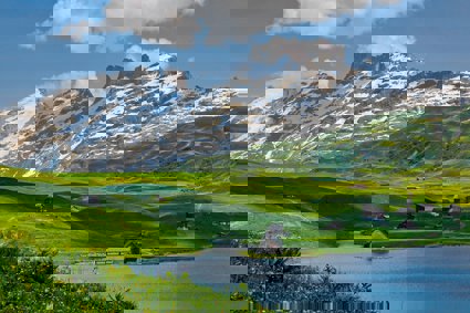
How do we connect to the Alps as a place?
How might our management of the Alps be handled?
How might researchers work in an Alpine environment?
How has our portrayal of the Alps changed over time?
Starter
Explain to students that tourism (as studied in the last lesson) is just one way that people might connect to their environment.
Give small groups of students (or individuals if it is a small cohort) a piece of flipchart paper, a chunky marker pen and a set of images (pre-cut) from ‘How are we linked to our environment? Handout’
Students can place the pictures on their flipchart page and draw connections between them to create a mind map, explaining how the images connect people to their environment in general.
From top left and moving clockwise, the images are representing food and farming; tourism; research; conservation; settlements; water supply; mined resources and climate.
Students can then feedback their ideas to their peers via a whole class discussion.
Main Activity
If it has not been mentioned already by students in the starter activity, open up the idea to them that an underrepresented group in discussions is often researchers.
Show ‘Designing a Piece of Fieldwork in the Alps Presentation’. In groups, students should decide on:
-
What data they might need
-
How they might use this data to inform the local authorities
Give out ‘Fieldwork Equipment Handout’ to students, printed on A3 paper.
Students should identify the different fieldwork equipment items by annotating the central picture. They might also want to think about why they might need each piece of equipment in a mountain terrain.
Staff can use the next PowerPoint slide as a check that they have included everything.
Staff should also show the students the three additional pieces of equipment they have: a Land Rover Discovery, a tripod and an Unmanned Aerial Vehicle (Drone).
Remaining in groups, students should design a piece of fieldwork that takes into account:
-
The management problem
-
The aims of the study
-
The possible ways the raw data can be used
-
The fieldwork equipment available
This could be done via notes and mind maps made on flip chart paper. If tablet computers are available, students could produce a short presentation outlining their ideas for feedback to their peers.
Students can feedback their ideas to the group, possibly with questions to reflect on from their peers and staff.
Staff can then explain how the real Grand Alpine Tour team carried out their research using ‘Collecting Data in the Alps Presentation’
Plenary
Show slide with historic depictions of the Alps from ‘Comparing Depictions of the Alps Presentation’.
It may be worth reminding students that these are only depictions of the Alps – not real representations of them.
On the next slide of the presentation, using sticky notes, each student (or group of students depending on numbers) can write three adjectives on each of three notes describing each image (i.e. six notes in total) sticking them on the projected images from the PowerPoint.
Staff can then go through some or all of the descriptors – asking individuals why they chose those particular words.
The students should have picked up on the idea that one is highly artistic and the other scientific – if not this is an area of discussion before moving the class on.
Show students the final slide of the presentation and ask them to complete a ‘Think, Pair, Share’ exercise (one minute to think on their own; two minutes to discuss their ideas with a peer and then five minutes open discussion as a class) on the question.
Commend students who go beyond the ideas of just historical contexts and improvements in technology – instead try to tease out of students how our inherent perception of the Alps has changed and that this had led to a changing cultural geography of the place.