Global deltas
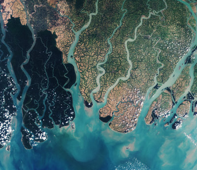
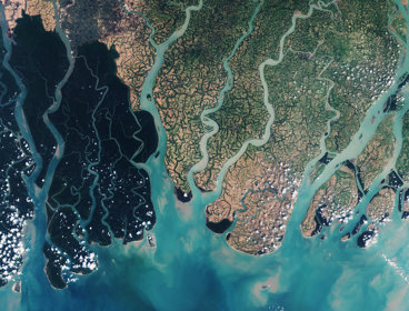
Delta systems are riverine zones found at river mouths where water and sediment are discharged into another body of water i.e., a sea or ocean. They are wetlands. The shape of a delta landscape is wide and low-lying.
A delta is a feature of deposition. In the lower course of a river, at the river mouth, the velocity and therefore the sediment carrying capacity of the river decreases due to a lack of energy. As a result, material is deposited because the rate of deposition is greater than the rate of erosion. When this sediment settles at the river mouth the river breaks up into multiple channels to reach the sea.
This land formation is described as “active”. Over time, water and sediment can be funnelled through different parts of the delta and new channels form. It is a dynamic process leading to smaller ephemeral subdeltas forming and changing over the short term (years to decades). This can cause the whole delta to migrate over the long term.
A delta is not only the river mouth, but also a riverine zone which surrounds the river mouth. The sediment which collects here is called alluvium. Alluvium is a nutrient-rich material consisting largely of silt, sand, clay, gravel, and organic matter which has washed through the river basin. The delta region therefore has a rich supply of nutrients making the soil very fertile for agriculture. This has led to the development of intensive agriculture and, due to transportation and trade, the growth of cities on deltas. An example is the city of Shanghai, home to 26 million inhabitants, at the mouth of the Yangtze River in China.
The Yangtze River
The Yangtze River is the longest river in Asia and is the third longest river in the world. It is one of the three main rivers in China. The river is clearly visible in the satellite imagery in Figure 1, meandering eastwards through ‘the bulge’ of China and out into the East China Sea.
Figure 1 satellite imagery of the Yangtze River from east to west © RGS-IBG
In the lower course the river cuts through the lowland plains of east-central China, with the Three Gorges Dam near Yichang, and 3 major tributaries (the Yuan, Xiang, and Han rivers) converging in the lakes region near Wuhan.
The Yangtze delta begins after the city of Zhenjiang. From this point onwards the land is an incredibly fertile, intensively farmed, agricultural region. The river basin, which covers 448 million acres, provides approximately two-thirds of the rice consumed in the whole country, and half of all the fish eaten. The basin also produces just under half of total crop production in China. It is therefore an essential region for Chinese food security, in a country which has experienced periodic food shortages for centuries – the most recent of which was the 1959 Great Chinese Famine.
Figure 2 illustrates the variety of crops grown in eastern China, almost entirely by intensive agriculture. In the south and central areas of China rainfall is plentiful and sunshine is abundant providing very suitable conditions for crop farming. East-central Chinese deltas are spared the sandstorms of the north as the dust originates from Mongolia.
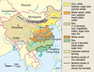
Figure 2 an agricultural map of China © Diercke International Atlas
Rice production is the dominant form of agriculture in east-central and south, followed by sugar cane, tea, peanuts, and vegetables. Water buffalo play a significant role in the livestock industry and are indispensable for ploughing the flooded paddy fields in the Yangtze delta. From November to March the most common overwintered crop is wheat.
The Yangtze delta region is also a very important economic area. It is described as the gateway to the Asia-Pacific region and, in reverse, the global manufacturing centre of the world. Rapid urbanisation has led to six major urban centres developing on the delta, listed below in Table 1.
|
The top 6 urban centres |
Population in millions |
Rank by population size |
|
Shanghai |
26 |
1 |
|
Nanjing |
8 |
8 |
|
Nantong |
2 |
49 |
|
Changzhou |
3 |
34 |
|
Wuxi |
3 |
38 |
|
Zhengzhou |
5 |
19 |
Table 1 major cities on the Yangtze River delta
As ‘liquid landscapes’ climate change is adversely impacting delta landscapes. Asian mega-deltas are facing unprecedented threats with local populations at risk. Environmental change threats livelihoods. In 2019 the IPCC report stated that “non-climatic anthropogenic drivers, including recent demographic and settlement trends” have increasingly impacted low-lying communities by exposing them to sea level rise.
Deltas are now home to over 500 million people, who face the existential threat of global warming and, crucially, a declining level of sediment (silt and sand). River sediment is increasingly being trapped by the 50,000 major dams around the world (such as the Three Gorges Dam in China), lowering sediment levels and rendering them vulnerable to rising sea levels.
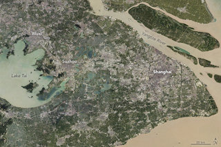
Figure 3 the Yangtze delta in 1988 © NASA MODIS
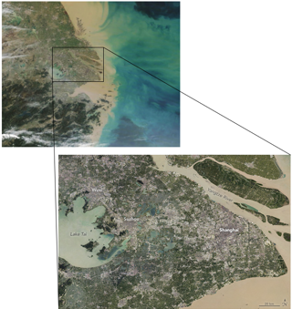
Figure 4 heavy sediment flow 2019 © NASA MODIS and Shanghai 2017 © Visible Earth
The Yangtze delta has experienced rapid urbanisation since the 1980s. In 1984 Shanghai had 308 km² rapid growing to 1,302 km² by 2014. In 2022 the city was recorded as covering 6,340 km². The greatest expansion occurred over a 4-year period between 2000 and 2004, when 243 km² of urban area was added to the city. Watch this animation of Shanghai’s growth over the last 4 decades which is described as “unprecedented”.
Activity
-
Why are deltas “active”?
-
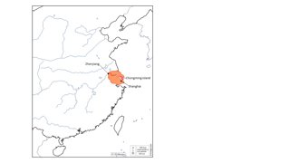
Annotate the city of Zhenjiang (the start of the delta region for the Yangtze River), Shanghai, and Chongming Island onto the map below.
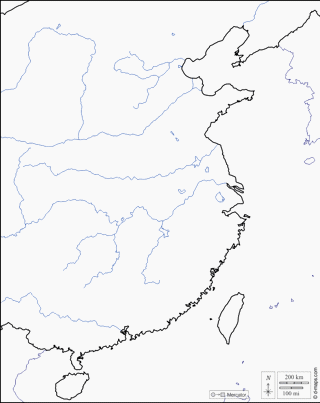
Figure 5 the Yangtze delta © Map East China d-maps.com
3. Go to ArcGIS Online (www.arcgis.com) and complete the following steps.
a. Click “Map” in the ribbon at the top of the page
b. The Layers tab will open automatically on the left of the screen, click + Add layer
c. Change the dropdown arrow (at the top) from “Living Atlas” to “ArcGIS Online”
d. In the Search box, search for “Yangtze delta”
e. Select the feature titled “all_delta_shape” by annanusca_UPenn (click the ⨁ sign)
f. Navigate to China and locate the river delta polygon outlining the Yangtze delta
g. Select the “Map tools” function in the ribbon to the right of the screen (spanner sign)
h. Click “Measurement” then “Measure area” in the small pop-up tool bar
i. Measure the area of the Yangtze delta by clicking around the outline
Further reading
-
National Geographic Society Deltas
-
NASA the Yangtze River Delta March 2019, and Sprawling Shanghai 1984 to 2017
-
Living Deltas research hub
-
Nature articles Decline of Yangtze River water and sediment discharge: Impact from natural and anthropogenic changes
-
Geography Directions Sea levels are rising fastest in big cities – here’s why
-
Delta Alliance the Yangtze delta
-
2019 IPCC report Technical Summary
Answers
-
The Yangtze delta is described as “active” because it is a dynamic landscape i.e., all deltas change by the processes of sediment transport, deposition, and erosion. As a result, a delta develops depositional features at the mouth of a river. These features are influenced by heavy sediment flow, or by high rates of erosion. If these riverine zones are particularly exposed, they are also subjected to coastal processes, with waves, tides and other currents.
-
Annotated map below.
3. The area of the Yangtze delta is approximately 39,465.43 km2.
This resource was first published in 2022.