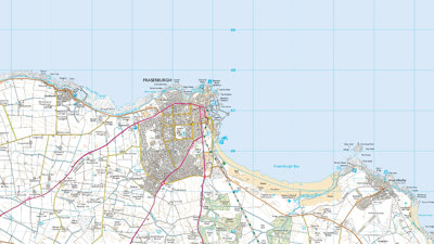
Magnetic north continues to move across Britain
In November 2022, the three norths; grid north; magnetic north; and true north, all aligned over Britain for the first time in history. This alignment made landfall over the village of Langton Matravers, in Dorset. It will gradually move across the country until 2025, and is described by Dr Susan Macmillan from the British Geological Survey as ‘a once in a lifetime occurrence.’
The specification
AQA A Level 3.4.2.2 Cartographic skills.
Edexcel A Level Study must emphasise the use of quantitative geographical skills, including developing observation skills, measurement and geospatial mapping skills.
OCR A Level 4.1. Geographical information.
WJEC A Level Unit 1 Geographical skills. Learners should use quantitative approaches including developing observation skills, measurement and geo-spatial mapping skills.
The three norths
There are three norths available for you to use for orientation and navigation. They are:
-
True north (TN) *
-
Grid north (GN) |
-
Magnetic north (MN) ⥜
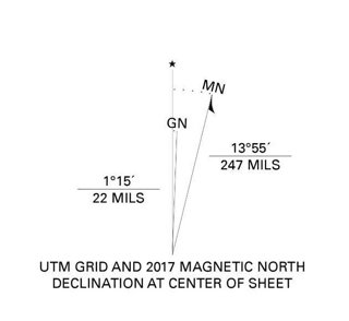
Figure 1: The star is True north, GN is Grid north, MN is Magnetic north
True north is abbreviated as ‘TN’ standing for Geographic North, describing a longitudinal line that runs through the middle of Britain. All longitude lines converge to points at the north and south poles.
Grid north or ‘GN’ is one of a number of lines which make a grid across Britain and Ireland. Across maps, true north bends away from grid north because true north reflects the Earth's curved surface.
Magnetic north is the third north, known as ‘MN’. This north is the direction a compass needle points to when it aligns with the Earth’s magnetic field. The line can move over time, and has been moving, due to forces (electric currents) which alter the Earth’s magnetic field.
What has been happening since 2014?
In 2014, there was a significant event in the changing direction of magnetic north. From this year onwards Magnetic north has been slowly moving from west to east, across Britain.
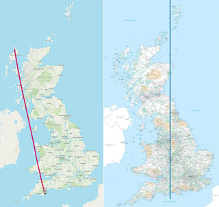
Figure 2: The approaching magnetic north (red line) in 2019, now moving across Britain, and grid north
Teaching ideas
Watch this summary video from the Ordnance Survey to understand more: What happens when the three 'norths' collide?
1. Visit the British Geological Survey’s webpage to use the Grid Magnetic Angle Calculator.
a. Enter the Easting Value and Northing Value for your school. How many degrees, and minutes are you from the moving magnetic north line? Is MN west or east?
2. Study Table 1 below. It shows 11 locations on the true north line stretching up central Britain.
a. Using the Grid Magnetic Angle Calculator, enter the Eastings and Northings data for each row, e.g., Hebden Bridge, 400000, 427500.
b. Use the calculator to fill in column 4 Difference GNàMN (west of east of GN, difference, and difference in minutes), for these 11 locations.

3. Print off a map of Britain with grid north drawn on it. Mark the 11 locations above to get a better sense of the alignment.
Return to this task over time to check progress! Convergence for Hebden Bridge is expected in August 2024.
Further reading
-
USGS What do the different north arrows on a USGS topographic map mean?
-
Why do we have a magnetic field? American astrophysicist Neil deGrasse Tyson answers
-
Read Mark Greaves’ blog from OS Magnetic north, true north and grid north align over Great Britain for the first time in history for more detailed information on this historic triple alignment
-
A 2-minute read from OS Magnetic north continues its march to the east
-
A 1-minute from OS The three ‘norths’ combine over Great Britain for the first time in history
-
Daily Mail The three 'norths' combine over Britain for the first time in history!
-
Newsweek Earth's Magnetic North Pole Follows 'Unusual' Path, Races Towards Siberia
-
BBC News Map norths converge on Dorset village in historic first

This resource was first published in 2023.