Part 3: Setting out from South Georgia
These resources for primary pupils compliment the online book resource ‘Shackleton’s Endurance’ which, tells the story of Shackleton’s famous Trans- Antarctica Expedition. On this expedition, Shackleton’s ship the Endurance was lost to the ice, yet Shackleton eventually got all of her crew home without a single loss of life. The book has six sections, and each is supported by a suite of teaching resources, teacher notes and ideas for assemblies.
The resources also draw on the contemporary Expedition ‘Endurance22’, sailing aboard the Agulhas II, with historian and media personality Dan Snow, which left Cape Town in February 2022 for the Weddell Sea to search for the wreck of Endurance. Through the ‘Parallel Lives’ strand, pupils can explore some of the differences between the two voyages, then and now.
There will be opportunities to dip in and sample resources from different lessons or start at the beginning and work your way through to build a coherent and longer unit of work. Ideas will be provided for both KS1 and KS2.
Setting out
Key Questions
-
Where in the world is South Georgia? The Weddell Sea?
-
What kind of a place is this?
-
How and why are these places changing?
-
Why does the ice grow and shrink around Antarctica?
Getting Started
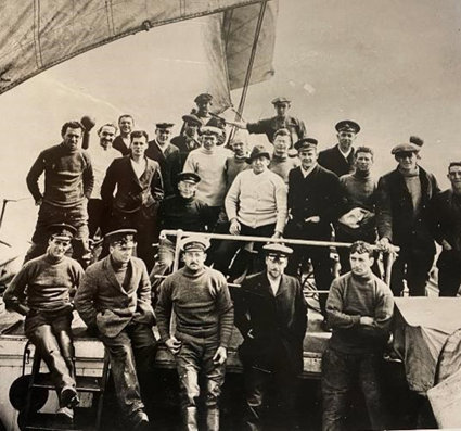
Recap the story so far. Section 3 tells the story from when Endurance leaves South Georgia but the first page of the story is entitled ‘Proceed!’ Can pupils remember why? It refers to the important telegram from the First Lord of the Admiralty at that time, Sir Winston Churchill, which contained just that one word. World War 1 had broken out early August 1914 as Shackleton was just about to set sail and so he immediately offered the service of his boat and crew to the country for the war effort. However, Churchill decided they could manage without Shackleton, his crew and Endurance, and ordered him to set sail. The “Endurance” expedition departed British waters on 8 August 1914.
(Slide 3) Ask pupils how they think Shackleton felt when he received that telegram? After all his planning and ambitious yearning to reach the South Pole he would probably have been bitterly disappointed had Churchill recalled him, yet he still offered his services. Why do they think that was?
Which word might best describe Shackleton’s feelings when he was ordered to ‘proceed!’? Elation? Relief?
Why do pupils think Churchill decided to let Shackleton continue on his expedition when he could have had the extra ship and men for the war effort? Can they think of any reasons? Perhaps if was the glory for the country should Shackleton succeed? One idea may be that Churchill decided the expedition could bring hope to people at home and provide a welcome diversion in the papers should they receive news of a successful outcome, especially if the war dragged on for a long time.
Possible Activities
Where is …? (Slides 4 and 5)
-
Buenos Aires?
-
South Georgia?
-
Grytviken?
-
Weddell Sea
Shackleton meets the ship at Buenos Aires and it sails from there to Grytviken, South Georgia, before heading for the Weddell Sea. Ask pupils if they know anything about these places. Do they have any idea where they might be? Find out any ideas and thoughts before using globes, atlases, Google Earth or other maps to locate them. Ask pupils to work in pairs of small groups to prepare a statement about location for each one of these locations with as much relevant information as possible. Pupils could research the location of every place or each group could be allocated one location. Pupils could use their information to draw and annotate a sketch map showing their relative locations. Older pupils could use latitude and longitude to reference location too. Each group could then present their work to the rest of the class.
- Buenos Aires
The capital city of Argentina, a country in the continent of South America, The city is located on the estuary of Río de la Plata, which flows into the South Atlantic Ocean.
- South Georgia
An island in the South Atlantic Ocean, (and part of the British Overseas Territory of South Georgia and the South Sandwich Islands). South Georgia is located about 1,400 kilometres east of the Falkland Islands. It is about 170 km long up to about 35 km wide. It lies almost entirely between latitudes 54 and 55 degrees South. And between 35 degrees 45 minutes West and 38 degrees and 30 minutes West.
- Grytviken
Located on the north coast of the island, and chosen as it provided flat land for settlement, fresh water and a safe harbour, the settlement at Grytviken was established in 1904 by a Norwegian sea captain, as a whaling station. At that time, whales were much prized for meat and other resources. Nearly 200 whales were processed there in the first season. Today, the whaling station is abandoned and only visited by tourists. Whale populations were seriously depleted and public opinion mainly turned against the hunting of this creature. There are also modern alternatives for some of the resources that whales provided.
- Weddell Sea
The Weddell Sea is part of the Southern Ocean. Its land boundaries are defined by the bay formed from the coasts of Coats Land and the Antarctic Peninsula. Much of the southern part of the sea is covered by a permanent, massive ice shelf field, the Filchner-Ronne Ice Shelf.
Use a globe to explore the land south of 55 degrees South. Apart from the enormous continent of Antarctica which lies around the South Pole, and the tip of the continent of South America, there are no large land masses evident. Challenge pupils to find other signs of land, such as the rest of the South Sandwich islands.
A map of Antarctica showing features including the Weddell Sea can be downloaded here
Did you know …
Weddell seals were named for the British Antarctic explorer James Weddell, who commanded British expeditions into the Weddell Sea (which is also named for him). They live farther south than any other mammal.
Did you know …
In Coats Land, there are rocks that probably pinned together East Antarctica and North America when they were joined in the supercontinent Rodina some one billion years in the past.
What is South Georgia like? (Slides 6,7,8)
Using Google earth and / or Google Street View, zoom into the island of South Georgia to explore its features. The island is largely covered in ice fields and glaciers, which are responding to climate change and show signs of retreat. By Zooming into Grytviken, you can identify mountains, bays, harbour and other geographical features. You can also compare the differences between the image taken by Hurley in 1914, which showed several boats in the bay along with Endurance, and the image captured from Google Earth. The whaling station is no more, but there is a museum and the church still remains.
You could ask the children what they think the large rusty containers might be used for – they were used to collect whale oil, once a very valuable resource used in lamps, for soap and even in margarine.
Ask pupils to grab screen shots and paste into a presentation or a Word document along with descriptive and naming vocabulary. They could research other information such as annual weather data.
The two images on slide 8 appear to show more snow and ice in the image from 1914 than in the more modern image in 2022. You might discuss this but get pupils to think about the time of year too. The 1914 image was taken in November, so, two months on from what is usually ‘peak ice’ conditions in September after southern hemisphere winter. Mid- summer day in the southern hemisphere is December 21 or 22, which is winter solstice in the northern hemisphere. Maximum ice retreat is usually evident towards the end of the southern hemisphere summer, in February.
Do pupils think the difference is worth noting and if so, is it due to seasonal variation or climate change or both?
The seasons are opposite in the southern hemisphere to those in the northern hemisphere because of the tilt of the Earth. When the North Pole tilts toward the Sun, it's summer in the Northern Hemisphere. And when the South Pole tilts toward the Sun, it's summer in the southern hemisphere and winter in the Northern Hemisphere. Places on or near the Equator receive the most direct sunlight, but because of the Earth’s tilt, the energy from the sun is spread over a wider area nearer the Poles. This means that the energy is not so concentrated and the same amount of energy has to warm up a bigger surface area. This causes a temperature imbalance – hotter towards the Equator and cooler towards the Poles. Altitude, topography and oceans also influence temperature distribution and difference.
In the Northern hemisphere, the summer solstice occurs in mid- June and the northern polar regions experience ‘continuous day’ for a while. After the solstice, the days gradually get shorter. In the southern hemisphere, the opposite happens. In June, the south polar regions are experiencing their winter and have a period of ‘continuous night’ before the days begin to lengthen again.
What do we know about this place? (Slides 9, 10, 11)
Slide 9 shows an image from the Endurance 22 expedition showing Grytviken. Using maps and Google Earth to explore Grytviken, pupils could create their own sketch map and label the suggested places and features. It’s worth noting that King Edward Point is the home of a permanent British Antarctic Survey research station on South Georgia island and is the capital of the British Overseas Territory of South Georgia and the South Sandwich Islands.
Using the downloadable map of Antarctica – a section of which is shown on slide 10, challenge pupils to locate some of the features suggested on slide 11 – on a satellite image of East Antarctica and the Weddell Sea.
Journeying South (Slide 12)
Ask pupils to use what they have learnt about the location of the points of this stage of the journey and latitude to give a verbal and / or written account of the journey from Buenos Aires to the Weddell Sea.
Will there be ice? (Slide 13)
One effect of seasonal change in both the Arctic and the Antarctic is the growing and shrinking of seasonal sea ice. Antarctic sea ice peaks in September (the end of Southern Hemisphere winter) and usually retreats to a minimum in February after southern hemisphere summer. Within Antarctic sea ice, there is also variation from place to place around the continent. Slide 13 shows the seasonal difference around Antarctica in terms of the amount of sea ice. The link will play a short animation of this seasonal variation and change in recent years.
First ensure pupils can identify the Weddell Sea on the animated maps. Then play it through, stopping as necessary to talk about what can be seen. Explain this doesn’t show the year Shackleton sailed as records weren’t kept in the same way then but it does show how the ice grows and shrinks each season. There is a little variation over the years.
Shackleton was hoping to set out to reach the Weddell Sea as the ice was retreating, to be able to reach the landing point he had set himself. However, Whalers warned Shackleton that the ice was late in retreating that year. Despite this warning he still set out.
Ask pupils for their observations after watching the animation. They might be surprised how much the size of the continent changes when the ice grows. Ask them to estimate how much the sea ice grows in a year then look at the graph on the weblink. In 2020 for example, the maximum ice extent is shown as about 19 million km2 and the minimum at about 3 million km2 suggesting that the winter ice growth that year is about 16 million km2! That’s nearly twice the area of Brazil!
Do pupils think Shackleton chose a good time of year to leave South Georgia if he was hoping for a mainly ice-free voyage? Can pupils explain why?
The whalers tried to warn Shackleton that the ice was unusually far north that year. Why do you think he didn’t want to listen to them? Ask pupils what they would have done if they were in Shackleton’s shoes and why.
Later, the crew encountered crab- eater seals headed for warmer waters, going the opposite direction to them. Should they have heeded the sign from the animals?
You could set up a debate in class about Shackleton’s decision, we know in hindsight that it was a poor one but at the time, do you think he made a reasonable and justified choice or not?
Why was it harder for Shackleton to make a decision about the ice extent in 1914 rather than now? Discuss the ice records you have been looking at as evidence that developments in weather forecasting and recording mean that explorers have access to a better picture of what is happening in remote places. Scientists and explorers can also signal for help more easily because of modern communications.
Did you know …?
At its winter maximum, Antarctic sea ice covers an area of around 11 million square miles (18 million sq.km): almost twice the size of the United States of America, and larger than Antarctica itself.
Dear Diary (Slide 14)
Slide 14 shows three photographs taken between December 11 1914 and January 25 1915 which between them, detail the build-up of ice in the Weddell Sea. Ask pupils to image that they are one of the crew and to imagine how they are feeling as each day brings more ice to surround the boat. Write three short diary entries in the first person, one for each of the photograph dates.
See additional resource links at end.
Taking it further
-
Investigate the video clip embedded in ‘3. Then and Now’ to see how the modern day vessel Agulhas II travels through pack ice in 2022. Watch the clip from Youtube (first two minutes) and ask pupils how confident the captain seems about his ship and why.
-
Does the pack ice look the same as that in the photographs from 1914?
-
Explain how fast the vessel Agulhas can go and what depth ice it can break without slowing down.
-
What does the ship have to do to tackle thick ice?
-
Slide 4 gives some reasons why the Agulhas might not be in danger of getting stuck in the ice as Endurance did. Discuss the reasons given and ask pupils if they can think of any more. Which reasons seems the likeliest?
-
What is the difference between pack ice and an iceberg? Ask pupils to explain this.
Vocabulary
-
See the Book glossary and encourage pupils to develop this with their own collected vocabulary.
-
Develop specific ice vocabulary with as many different names and types of ice as pupils can find out.
Curriculum Links
Key stage 1
Pupils should develop knowledge about the world, the United Kingdom and their locality. They should understand basic subject-specific vocabulary relating to human and physical geography and begin to use geographical skills, including mapping, to enhance their locational awareness.
Pupils should be taught to:
Locational knowledge
-
name and locate the world’s seven continents and five oceans
Human and physical geography
-
Identify the location of hot and cold areas of the world in relation to the Equator and the North and South Poles.
-
use basic geographical vocabulary
-
understand that there are different patterns of weather associated with seasons.
Key Stage 2
Locational knowledge
-
identify the position and significance of latitude, longitude, Equator, Northern Hemisphere, Southern Hemisphere, Arctic and Antarctic Circle.
History
Key stage 1
Pupils should develop an awareness of the past, using common words and phrases
relating to the passing of time.
-
know where the people and events they study fit within a chronological framework and identify similarities and differences between ways of life in different periods.
-
use a wide vocabulary of everyday historical terms.
-
ask and answer questions, choosing and using parts of stories and other sources to show that they know and understand key features of events.
-
understand some of the ways in which we find out about the past and identify different ways in which it is represented.
Pupils should be taught about:
-
events beyond living memory that are significant nationally or globally
-
the lives of significant individuals in the past who have contributed to national and international achievements. Some should be used to compare aspects of life in different periods.
Key Stage 2
Pupils should continue to develop a chronologically secure knowledge and understanding of British, local and world history, establishing clear narratives within and across the periods they study. They should note connections, contrasts and trends over time and develop the appropriate use of historical terms. They should regularly address and sometimes devise historically valid questions about change, cause, similarity and difference, and significance. They should construct informed responses that involve thoughtful selection and organisation of relevant historical information. They should understand how our knowledge of the past is constructed from a range of sources.
Pupils should be taught about:
-
a study of an aspect or theme in British history that extends pupils’ chronological knowledge beyond 1066
Links to other Areas of learning
English: speaking and listening, opportunities for reports, creative writing and descriptive writing, diaries, letters, lists and labels.
Mathematics: opportunities to measure, record, and to create and present data
Web Links