Introduction
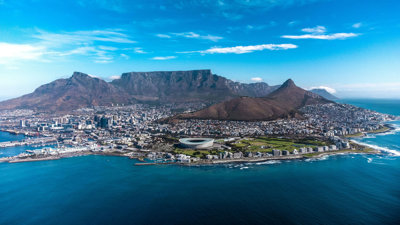
Located at the southernmost tip of the African continent, South Africa is a nation of remarkable diversity and natural beauty. By land, it shares borders with Namibia, Botswana, Mozambique, Eswatini, and Lesotho. By sea, it is bordered by both the Atlantic and Indian Oceans.
Home to nearly 65 million people, South Africa is a vibrant mixture of cultures and traditions. Around 81% of its population are Black Africans, and the country officially recognises 12 languages, including Afrikaans, English, isiZulu, isiXhosa, and South African Sign Language (SASL).
This rich blend of people, languages, and landscapes gives South Africa its distinctive spirit - a place where heritage, unity, and diversity come together to shape a truly unique national identity.
Curriculum links
This learning resource and accompanying teaching and learning suggestions has been designed to support the Key Stage 3 Geography National Curriculum, specifically:
Locational knowledge
Extend locational knowledge and deepen spatial awareness of the world’s
countries using maps of the world to focus on Africa…focusing on their environmental regions, including…hot deserts, key physical and human characteristics, countries and major cities
Place Knowledge
Understand geographical similarities, differences and links between places through the study of human and physical geography of a region within Africa.
Geographical skills and fieldwork
Build on knowledge of globes, maps and atlases and apply and develop this
knowledge routinely in the classroom and in the field
Interpret maps in the classroom…including…scale, topographical and other thematic mapping, and aerial…photographs.
Use Geographical Information Systems (GIS) to view, analyse and interpret places and data.
File nameFiles
File type
Size
Download