Curriculum links
The aim of this work is to challenge the perhaps-widely-held view that Jamaica is just a country of beaches and Bob Marley. Jamaica has a strong Caribbean identity stretching back to the island’s first inhabitants, the Arawaks (also know as the Tainos), through Spanish and British colonialism to independence in 1962.
This resource focuses on the concept of changing places; how people experience a place, the factors which impact upon places and how they change over time, and the physical geography of Jamaica; the major elements of the natural environment, island topography and the riverine system.
This is an opportunity for students to contemplate the interconnected relationship of people, diverse places, and the physical landscape through a study of the Jamaican maroons.
You may wish to teach this topic as part of a unit on population, the geography of colonial British history, the Caribbean, or as a Key Stage 3 case study on Jamaica.
The Royal Geographical Society with IBG (RGS-IBG) has worked with Professor Pat Noxolo on a separate Caribbean geography project, called CARICUK. You can read more about the project and the Creative ways to Approach Race and In/security in the Caribbean and the UK.
Maroon communities, changing places
Colonialism began in 1494 in Jamaica with the arrival of Christopher Columbus. Beginning two centuries of Spanish rule. Due to exploitation, the native Arawaks died out from hard labour and foreign disease, and African slaves were used to fulfill the large labour force required for growing tobacco, indigo, and cocoa on the island. During British colonial rule slaves were brought to Jamaica to work the sugarcane fields between 1707 and 1808. Slavery was officially abolished in the British Commonwealth in 1834.
Multiple slave revolts broke out across the Americas and, over time, individual rebels banded together to form mountain communities called the maroons. The word has a contested meaning. In Spanish maroon is derived from “Cimarron” meaning fierce or unruly. Others reject this description of the Spanish-originated word (saying it is also associated with savage) and believe it originates from the idea that the people were marooned from mainstream Jamaican society.
Today the maroons are not an ethnic group, nor are they a race of people separate from Black Caribbean or AfroCaribbean identities. They are an isolation group who refuse to be cowed and believe strongly in rebellion. In modern day Jamaica this has evolved into a culture of resistance and community action, modelled by Lomorra Dillon.
In 1655 the British, led by Admiral Sir William Penn, conquered Jamaica and began to expel the Spanish until 1660. During this time huge numbers of Spanish slaves escaped to the mountainous interior of the island. The maroon numbers grew with each runaway slave. An uneasy alliance between the maroons and the British deteriorated and by 1720 the maroons began mounting raids from their mountain fortresses. After two Maroon Wars (1728-1739 and 1795-1796), the British signed peace treaties, enabling the maroons to remain free and self-governing within Jamaica.
The mountainous, hard-to-reach, landscape of Jamaica’s interior influenced the success of the rebel slaves. Two guerilla warriors emerged to lead the maroons to victory (Captain Quao of the Windward Maroons and Cudjoe of the Leeward Maroons) culminating in the 1739 Leeward and Windward Treaties which ended the Maroon-British wars.
The maroon communities became permanently free six decades before the Haitian Revolution, and over a hundred years before the Emancipation Proclamation. They were the forerunners of the independence movement in the region.
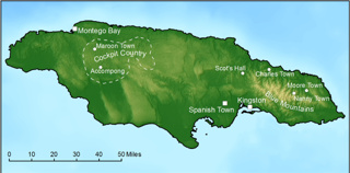
Figure 1 shows the maroon settlements of the early 1800s, located in the mountains inland. The largest maroon village was Trelawny Town, labelled in the figure as Maroon Town. Until a peace treaty was signed in 1738 between the British official Colonel John Guthrie and the Trelawny Town leader, Captain Cudjoe, the rebels were a source of fear and apprehension among the colonial plantocracy, especially around Cockpit Country. After the Second Maroon War of 1795-96 many of the Trelawny inhabitants were deported.
Over hundreds of years, these mountainous upland areas have now become semi-autonomous enclaves with nine distinct communities evolving. The most well-known districts are Flagstaff in St James, Accompong in St Elizabeth (and Maroon Town in Saint James), Scotts Hall in St Mary (mispelt in Figure 2), Charles Town and Moore Town both in the parish of Portland.
To this day, the Jamaican government continues to respect the centuries-old maroon agreements, although they have never been ratified. The government supports the community through infrastructure investment (in roads, schools, clinics, and bridges), by not collecting taxes, and by stipulating that maroon land cannot be sold or used for collateral at a bank.
Each maroon area is run by a Colonel. This decentralised, autonomous, approach has created crime-free communities, who elect a council to govern the community alongside the Colonel (although maroons can also access Jamaica’s judicial system if needed).
Over time the maroon communities have modernised and evolved. The nine communities are now sustained by agriculture and tourism with tourists arriving for nature day trips, to meet maroon herbalists (or bush doctors), and – for those that know their whereabouts – to enjoy the secluded rivers of the island.
The global pandemic has acted as an exogenous influence on the maroon community of Charles Town. Charles Town is an hour-and-a-half away from the Ocho Rios cruise port, at the foot of the Blue Mountains, and has increasingly become reliant on tourism. Unfortunately COVID-19 has severely impacted the secluded maroons communities as international air traffic was grounded throughout 2020 and in the first half of 2021. This was culturally damaging to the maroons because they run tourist services as a means of generating income and to tell the story of their foreparents. For example, the Charles Town “Quao Day” celebration (every 23 June), which marks the signing of the peace treaty between the British and Colonel Quao in 1739, was missed.
Surrey County, coffee production
Jamaica has three historic counties, one of which is Surrey. It is the smallest county and is split into 4 parishes: Portland, Saint Andrew, Saint Thomas, and the capital Kingston.
The Blue Mountains are an endogenous factor affecting place. The mountain chain, which lies to the east of Jamaica, is a UNESCO World Heritage site and is particularly important to the island due to the volcanic deposits of potassium and magnesium which have created extremely fertile soil (the rest of Jamaica is limestone). The soils are productive and well-drained allowing subsistence and small scale farming to flourish.
As a result, the Blue Mountains of Surrey county, with some of the highest mountains in the Caribbean, are famous for coffee. The highest point on the island is Blue Mountain Peak at 2256m, boasting several coffee plantations which produce a unique and vibrant flavour. To be called Blue Mountain coffee it must grow at altitudes of around 1800m in the parishes of Portland, St Andrew, St Mary, or St Thomas.
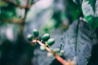
Figure 2 Arabica coffee plants in the perfect growing conditions of the Blue Mountains © Marc Babin Unsplash
Coffee growing thrives due to the rich combination of nutrients on the mountain slopes. With sharp inclined valleys and regular rainfall the whole island benefits from misty cloud cover, shading the coffee plants from the burning sun. Jamaica claims the best quality coffee Arabica in the world, two-thirds of which is exported directly to Japan. Blue Mountain coffee farming is mostly done on a small scale with 15,000 small holders alongside estates which support maroon livelihoods across Surrey. Although geographically small, Surrey county has four out of the twelve main rivers in Jamaica, called the Yallahs, Morant, Plantain Garden, and Rio-Grande. All these rivers originate in the Blue Mountains.
The Blue Mountains in Surrey county are home to three of the four maroon villages: Scotts Hall, Charles Town, and Moore Town (formed in 1734 when Nanny Town was abandoned due to repeated British attacks).
Nanny Town was named after Nanny of the Maroons, one of the founding rebels who first resisted slavery in Jamaica. Before slavery, Nanny was a member of the Ashanti nation in what is now Ghana, West Africa. She is one of the first four great maroon leaders credited with freeing hundreds of slaves in Jamaica.
The new maroon town remains close to the important Blue Mountain waterways, on the banks of the Rio Grande, continuing a tradition of proximity to Jamaica’s rivers.
Blue Mountain rivers
Whilst tourists associate Jamaica with white sandy beaches and luxury tourism locals see the island’s natural wealth in its rivers.
There are as many as 120 rivers in Jamaica, with 22 main waterways, all over 5 kilometres in length. The largest river is the Rio Minho which begins in the Mocho Mountains. The distances of the top 22 rivers are listed in Table 1 below.
Of the 22 main rivers 6 are found to the east of the island in Surrey county, all with the Blue mountains as their source. Weathering and erosion of the volcanic Blue Mountain bedrock, high up in the interior, moves nutrient rich silt and sediment downstream.
|
River |
Length km |
Parish |
|
Rio Minho |
92.5 |
Clarendon |
|
Black river |
53.4 |
Saint Elizabeth |
|
Rio Cobre |
50.9 |
Saint Catherine |
|
Great River |
46 |
Saint James |
|
Cabaritta River |
39.7 |
Westmoreland |
|
Yallahs River |
36.9 |
Saint Thomas |
|
Milk River |
36.4 |
Clarendon |
|
Wag Water River |
36.2 |
Saint Mary |
|
Plantain Garden River |
34.9 |
Saint Thomas |
|
Rio Grande |
34.3 |
Portland |
|
Martha Brae River |
32.5 |
Trelawny |
|
White River |
27.4 |
Saint Ann |
|
Morant River |
25.9 |
Saint Thomas |
|
Montego River |
24.1 |
Saint James |
|
Rio Nueve |
24 |
Saint Mary |
|
Buff Bay River |
22.2 |
Portland |
|
Hope River |
19.6 |
Saint Andrew |
|
Dean’s River |
17.1 |
Westmoreland |
|
Negril River |
15.3 |
Westmoreland |
|
Lucea West River |
14 |
Hanover |
|
Lucea East River |
12.9 |
Hanover |
|
Hector’s River |
5.1 |
Portland |
Table 1 compiled using my-island-jamaica.com data
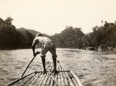
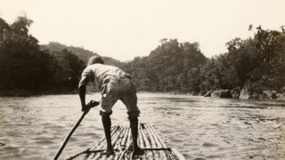
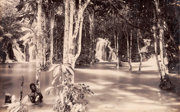
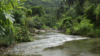
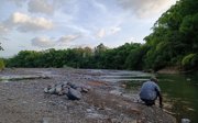
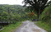
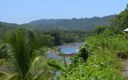
Blue Mountain rivers feature on many tourist itineraries. The remote springs and waterfalls shown in the Society archive imagery (of Elfin Grotto, Blue Hole, Rio Grande, and Wild Cane River) now have well established roads and amenities, which are increasingly shared by locals and tourists.
Both the coffee production and the island’s water features (springs, rivers, waterfalls) rely on the island’s misty cloud cover. Moisture is caught from ocean winds which blow onto the island’s windward side, along the northern coast. This is because the predominant gusts are the trade winds, blowing across the West Indies from the north east.
Rainfall reaches the island as orographic (relief) rainfall. This rainfall occurs when the moisture-laden winds are forced upwards over elevated ground, such as the Blue Mountains. As the air rises, it cools, condenses, and forms rain.
Maroon resistance today
To this day the maroons remain active in Jamaican society and still maintain 9 autonomous communities. In 2022 the two major groups are found in Accompong and Moore Town in Portland.
Recent events in Moore Town exemplify the continued active resistance of the maroons. Lomorra Dillon is a 19-year old political activist in the town who is challenging the incumbent Colonel, Wallace Sterling, for leadership of the Portland community. It is described as a controversial and bold move.
In a recent declaration Lomorra has said she wants to hold the position of chieftainess of the Moore Town maroons, effectively usurping Colonel Sterling. Whilst there has been some discontent over how young the new challenger is, the support for Lomorra from the Rio Grande valley has been strong.
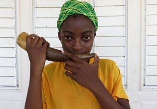
Figure 3 Lomorra Dillon blows the Abeng, to pay respect to the maroon ancestors © Jamaica Beacon
If successful in her campaign to be chieftainess Lomorra will be the first woman since Nanny of the Maroons to hold the seat.
Lomorra has garnered support by arguing for change in Moore Town. If elected, she promises to fight for investment in infrastructure, and says she will stem the outflow of migration from the maroon community (often to the US and UK). However, because maroon communities do not pay tax on communal lands (they still interact both inside and outside established Jamaican society), funding is limited.
Activity
1. Explain the multiple meanings behind the term “maroon”.
2. Below is a hand drawn elevation map of Jamaica. Colour code the key and shade the map to complete the figure.
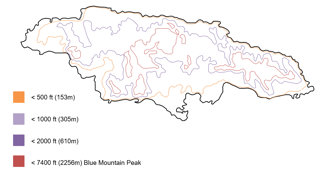
3. Find and annotate the three highest peaks of the island: Catherine’s Peak (1507m), Blue Mountain Peak (2256m), and Gossomer Peak (1003m).
4. Go to ArcGIS Online www.arcgis.com. This is free for school teachers and students. Open the Map titled The Jamaican Maroons and answer the following questions.
-
Describe the topography of Jamaica.
-
Drag and drop the .csv file titled Maroon_towns_for_students onto the map to mark where the four original maroon settlements.
-
Explain why the maroons located in Moore Town (previously Nanny), Charles Town, Scotts Hall, and Maroon Town (previously Trelawny).
-
Unclick the layers on your ArcGIS map, retaining only Jamaica_Rivers and Maroon_towns_for_students. Which rivers are the old maroon towns located on?
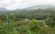
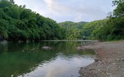
5. Compare the imagery taken from the Royal Geographical Society’s archives against the photographs captured in 2022. What are the similarilities and differences?
Further reading
-
The National Geographic Meet the legendary community that fought for its freedom in Jamaica
-
Jamaica Global Maroon is not a race, it’s a description: conversation with a modern-day Maroon
-
Havard education Maroon history
-
Blue Mountain Coffee Group Ltd History and background
-
National Geographic Is Jamaica the ultimate travel destination for coffee-lovers?
-
Brill publishing house Jamaica’s Windward Maroon ‘Slaveholders’
-
The British Library The peace treaty of 1738-39, Old Cudjoe making peace
-
Geography Directions The loss of territory and the impact of Covid-19 on Afro-descendant communities in Latin America (a maroon leader of San Basilio de Palenque, Colombia)
-
The Morphology of Marronage, Annals of the American Association of Geographers, by Dr Willie Wright
-
Jamaica Observer A Maroon vision of ‘Hope’ for teenager Lomorra Dillon
-
Cultural Survival Maroon Autonomy In Jamaica
The Maroons of Jamaica archive images from 1920
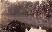
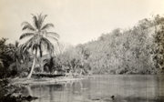
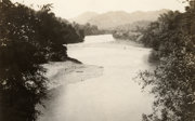
The Maroons of Jamaica images from 2022
Answers
1. The word ‘maroon’ can be interpreted as “unruly” because it describes the resistance of African slaves to colonial rule and servitude. Escaped maroons formed a resistance and engaged in guerilla warfare. There were two Maroon wars, between 1728-1739 (when Captain Cudjoe negotiated peace), and the Second Maroon War of 1795-96. The term can also mean “marooned” describing the isolation and separation of the four original maroon villages: Nanny Town, Charles Town, Scotts Hall, and Trelawny Town. These settlements were protected by the geography of the island, allowing escapees to hide in the mountainous interior.
2. The elevation map is shown below.
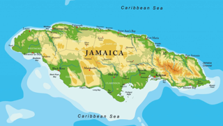
3. The highest mountain peaks of Jamaica are shown on the webpage freeworldmaps.
4. Access ArcGIS Online and open the map The Jamaican Maroons (as shown above)
- The topography of Jamaica has elevated central ground across the island. The highest of which is the Blue Mountains in the parishes of Portland and Saint Thomas. The highest point is Blue Mountain Peak at 2256m. Naturally, elevation decreases towards the coast with the largest area of low altitude in the south around Port Bight and Port Royal. Due to this low lying land, Old Harbour, Spanish Town, and the capital Kingston have all grown along this stretch of coastline.
- With the exception of Charles Town the original maroon setllements were located on high ground either in Cockpit Country (Maroon) or the Blue Mountains (Scotts Hall and Moore Town). High elevation ground provided safety from attack and had close proximitity to fresh water sources. Today the maroons still use the island’s rivers for bathing, socialising, and for water supply.
- Maroon Town – Martha Brae River, Scotts Hall – Wagwater River, Charles Town – Buff Bay River, and Moore Town – Negro River (a tributary of the Rio Grande).
5. The similarities between the photographs taken in 1920 and 2022 are that the rivers in Jamaica appear largely undeveloped. The vegetation remains lush and well-established and the island’s interior looks untouched. In all the images water is present. Jamaica is a country with approximately 120 rivers 3 of which are shown in these pictures. The natural winding course of the Rio Grande is evident, with sedimentation occuring on the slip-off slopes of the river, creating what maroons called “a river beach”. There are some clear differences, such as new infrastructure like Moore Town Bridge, and additional roads. There is plastic pollution in the foreground of the Rio Grande photograph.
This resource was first published in 2022.