A selection of posters that demonstrate the use of GIS in investigating the following:
-
Shoreline sinuosity and geology. Both primary and secondary data can be used to measure and calculate sinuosity at different scales. In this example we use secondary data to evaluate two differing geologies on the south-west Pembrokeshire coastline near to two FSC field centres.
-
Investigating the carbon cycle. This example explores a practical approach to investigating the carbon cycle. It integrates primary and secondary data and has a lot of potential for further development.
-
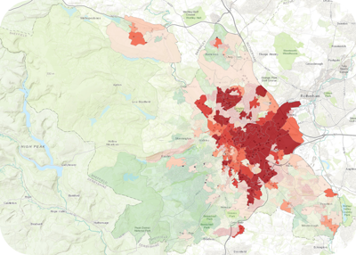
Brownfield land and deprivation in Sheffield. This example investigates the relationship between brownfield sites and deprivation using secondary data from the local authority and central government.
-
Trams and house prices in Manchester. This example investigates the spatial relationship between tram stops in the Bury district of Manchester, and the price paid for houses sold in the first half of 2016.