Locating Australia
This lesson helps pupils to discover where Australia is located and compare its size to other countries and continents
As an introduction to the module, pupils locate Australia on a globe (3D) and world map (2D projection). They learn where Australia is located in relation to the world’s oceans, continents, countries and hemispheres. Pupils explore the relational size of Australia, making comparisons with other countries and continents.
Key questions
Where is Australia located on a world map?
Is Australia a country or a continent?
Which oceans surround the island Australia?
How large is Australia?
How does the size of Australia compare to other countries and continents?
Key ideas
-
Australia is both a country and a continent.
-
It is located in the Southern Hemisphere and is an island country, surrounded by the Pacific and Indian Oceans.
-
Australia is the sixth largest country in the world.
-
Australia’s size has both positive and negative impacts.
Additional resources
-
Large world map
-
Globe
-
Post-it notes
-
Colouring pencils
Starter
Use the Locating Australia PowerPoint presentation (see downloadable resources) to follow the sequence of the lesson.
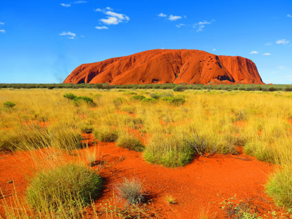
Introduce the new geography topic ‘Australia’ to pupils. Highlight that Australia’s size, location, changing population and huge range of different landscapes and physical features make it a fascinating country to study geographically.
Australia is located on almost the opposite side of the Earth to the United Kingdom. Play the Locating Australia video (see downloadable resources). Point out the location of Australia on the class globe and world map.
Main Activity
Australia is both a country and a continent. It is located in the Southern Hemisphere and surrounded by the Indian and Pacific Oceans. Revise the seven continents with the class and locate each continent on a large world map or using slide four of the Locating Australia PowerPoint presentation (Europe, Asia, Africa, North America, South America, Antarctica and Australia).
Explain this lesson involves comparing the size (surface area) of Australia with other countries and continents. Ask pupils to look at the size of each continent on the map shown on slide five; remind them maps are drawn to scale which means we can compare the size of the continents accurately using a map. Pupils use post-it notes and write a continent name on each, they then order them from smallest to largest and save this for the main activity.
Highlight the size of Australia in relation to the size of the UK using the information on slides six and seven the Locating Australia PowerPoint presentation. At its widest point Australia is 4100km wide, which is over four times the length of the United Kingdom. Australia’s area is 7,692,024 km², and the UK’s area is 243,610 km².
Explain to pupils both the positives and negatives of Australia’s size:
-
The space is a great asset especially for arable (crops) and pastoral (rearing animals) farming on a large scale.
-
However, the distances in Australia make it expensive to deliver resources to people in isolated inland areas, particularly water during periods of drought.
-
The inland isolated areas are depopulating (losing population), and people are moving to urban areas on the coast. This process of moving to urban areas from rural areas is called ‘urbanisation’.
-
Many country towns are depopulating and this is leading to the closure of services which puts further pressure on the communities left in these areas.
Before pupils complete the Comparing Continent Area activity (see downloadable resources), pose the question: what information does the bar chart tell us about the size of each continent? Discuss this as a whole class.
On Comparing Continent Area activity highlight that bar charts are a useful way of presenting geographical information as they show information very clearly. Also highlight that the areas of each continent are so large they are written in millions of square kilometres and rounded either up or down to the nearest million.
Extension: Pupils complete page three of the Comparing Continent Area activity sheet and read the values on the bar chart to complete the table. Pupils can then move on to answer questions that encourage them to consider and analyse the geographical data shown.
Plenary
Ask questions to assess pupils’ understanding of Australia’s size and location as compared with other countries and continents.
-
Which continent is the largest?
-
Which continent is the smallest?
-
Which continent is larger- Australia or Europe?
-
Is Australia in the Northern or Southern Hemisphere?
File nameFiles
File type
Size
Download