Colour blind friendly mapping
In the UK, colour blindness affects around 1 in 12 men and 1 in 200 women. There are several different types of colour blindness – most people with CVD (colour vision deficiency) struggle to distinguish between reds and greens, but others find it hard to tell the difference between blue and yellow shades.
The UK charity Colour Blind Awareness estimates that on average 1 child in every classroom suffers with colour blindness.
All GCSE Geography exams in the UK currently include a map reading extract, which currently has no alternative supplement for students with CVD. Following feedback from teachers, Ordnance Survey have been talking to exam boards and their cartography team to look at supplying extracts which are tailored to red-green and blue-yellow CVD as well as a monochrome alternative. They are also in the process of testing colour schemes used for other OS products to see how accessible they are, and will be looking into implementing more CVD friendly styles where these could be helpful.
Read more about Ordnance Survey's work to create accessible mapping products.
Create your own CVD accessible maps
The Team at Ordnance Survey have kindly created a step-by-step guide to creating some accessible maps for your students using the freely available QGIS product and OS Open Zoomstack.
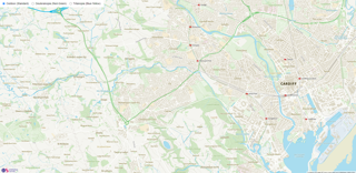
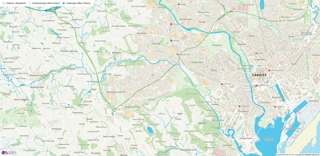
Map of Cardiff in Standard Style

Map of Cardiff in Deuteranopia (Red-Green) Style
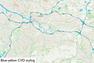
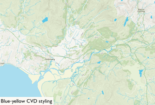
Map of Cardiff in Tritanopia (Blue-Yellow) Style
Find out more about colour blindness from myvision.org