Lesson two: Data analysis
Key questions
How do researchers know where to look for glacial evidence?
How can study of glacial and periglacial features help us to reconstruct past climate?
Aims
To gain experience of how images and sketch maps can be interpreted to identify previously glaciated areas, and to work with some data linking glaciers and climate. To include:
-
Comparing the Leqooa area of Lesotho with the Mount Enterprise area of the Eastern Cape
-
Reviewing the concept of the equilibrium line altitude (ELA) of a glacier
-
Setting a hypothesis and undertaking correlation analysis of data linking ELA with climate
-
Applying the ELA/climate relationship to reconstructing past climate of the High Drakensberg
This lesson supports teaching of practical aspects of studying past glaciation and reconstructing past climates. It also provides a geographical skills exercise on correlation.
Starter
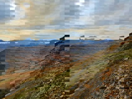
Look at the following images and sketch maps in these PowerPoint slides. Some are from the Leqooa Valley area of Lesotho (29⁰44’S, 29⁰06’E) and some are from the Mount Enterprise area of the Eastern Cape (31⁰09’S, 27⁰59’E). Be sure to pay attention to any information that is included with the images.
Starting assumption: it was colder than today in the Drakensberg during the LGM (see Lesson one) and therefore glaciers may have formed in the Drakensberg during this time.
In pairs, attempt to answer the following questions as you and your partner discuss and interpret the images. (After you have tried the questions, you can check the answers).
Questions:
-
What are the physical similarities between the two areas? What are the physical differences? (Hint: think of relief, elevation, and slope aspect)
-
Do you see anything in the photos which might suggest the existence of a past glacier at either, or both, areas? Describe the evidence you can identify, and what you think it may represent
-
What would we need to do in terms of field work to test whether our impressions from the photographs are correct?
-
Which of the two areas do you think is most likely to yield positive evidence for past glaciation and why?
-
What difference would it make for our past climate reconstruction if the evidence from either, or both, of the areas turned out to be the result of periglacial processes instead of glacial processes?
Main Activity
This part of the lesson focuses on one type of evidence about past climate from the study of glaciers: the relationship between a reconstructed glacier’s equilibrium line altitude (ELA) and the climate that must have existed in the past for the ELA to be where it was.
The ELA of a glacier is the altitude on the glacier’s surface where, averaged over a year, input from snowfall is balanced by output from snowmelt. The accumulation zone (where snowfall is greater than snowmelt) lies above the ELA, and the ablation zone (where snowfall is less than snowmelt) lies below the ELA. Click on the web links below to review the concept of the ELA.
Many studies have been done of the relationship between the present-day ELAs of different glaciers and the climate conditions (in terms of temperature and precipitation levels) at those ELAs. Where glaciers existed in the past, we can use the ELA-climate relationship to investigate what the temperature and precipitation might have been like at the time the glacier existed.
Open the spreadsheet to view a data set of present-day average summer temperatures and precipitation values recorded at the ELAs of glaciers around the world.
Open the document that includes the tasks and instructions for analysing these data. Complete the tasks, and either save or print out your scatter graph for use in answering the plenary questions.
Plenary
Now it is time to summarise what we have learnt about the ELA climate relationship and to apply this concept to reconstructing the past climate of the High Drakensberg.
Referring to your scatter graph, try to answer the following questions which could be followed up in a group discussion.
-
The scatter graph suggests that when the summer temperature is higher at the ELA of a glacier, the total precipitation (accumulation) must also be higher. Why do you think this is the case?
-
If precipitation is low, then we see that the summer temperature must also be low. Why does this relationship have to exist for a glacier to form?
-
It is not difficult to identify the ELA on an existing glacier. How do you think the appearance of the glacier’s surface will be different above and below the equilibrium line?
-
What evidence would we need, and what assumptions do you think we would have to make, to estimate the altitude of the equilibrium line for a glacier that existed in the past, but no longer exists today?
-
Provided we are confident about the former location of a glacier, why would an error in our exact estimate of the ELA for a former glacier make less difference to our palaeoclimatic inferences if the former glacier was relatively small?
-
At Leqooa, it’s estimated that the ELA of the former glacier was at approximately 3,140m above sea level. The precipitation at this location today is about 850mm per year. If precipitation was the same as this during the LGM, use your scatter graph to estimate what the average summer temperature must have been
-
The current average summer temperature at this altitude is about 8⁰C. Other evidence (for example from studies of periglacial features) suggest that summer temperature in this region during the LGM was 6⁰C colder than today. Some scientists have suggested that precipitation was about 30% lower (around 600mm) in the Drakensberg during the LGM. Assuming that the estimate of 6⁰C colder than today during the LGM is about right, why do those who claim the Drakensberg was drier during the LGM have to be wrong?
-
The Mount Enterprise area is about 1,000m lower altitude than Leqooa. Because air temperature decreases on average by about 6⁰C for every 1,000m elevation gain, the Mount Enterprise area has an average summer temperature of around 15⁰C. Assuming that the total precipitation at Mount Enterprise was 850mm during the LGM, how much of a temperature drop would have to have occurred there for a glacier to have formed during the LGM?
-
Finding out the ELA of former glaciers provides useful information about the climate at the time the glacier existed. However, it’s also necessary to find other types of evidence when reconstructing past climate. Why?
Other useful websites about how glaciers work: