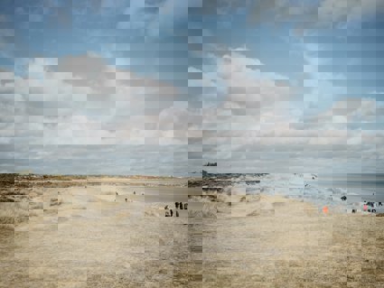
Studland
Studland beaches are one of the most popular beaches in Britain
The National Nature Reserve
The south east Purbeck National Nature Reserve (NNR) covers an area of 631 hectares and comprises of a variety of habitats which include five kilometers of beach, dunes, woodland, bogs and lowland heath. In fact this is one of the largest tracts of heathland in southern Britain with all six species of British reptiles present with nightjars and Dartford warblers as well as the carnivorous plant the sundew and the globally rare masonry wasp.
The Studland slacks contain some of the richest population of dragonflies and damselflies in Britain. These are some of the attributes among many affords Studland and Godlingston Heath status of NNR and Site of Special Scientific Interest (SSSI). The area is owned and managed by the National Trust's Purbeck Estate with assistance in the management of habitat and monitoring of species by Natural England.
The natural processes
The geology of South Haven Point is a combination of Oakdale clays to the north which lie against the Ferrung sandstone which constitutes the geology of the shore to west of the peninsula in Poole harbour. It is against this that the formation of Studland heath and sand dunes had a base to create itself.
The area of Studland heath has only been present during the last six hundred years where the accumulation of sand started to build up along the coast of south haven point. This process extended the expanse of dunes due mainly to marram grass stabilising the dunes enriching the soil and facilitating the area for the succession of heaths and woodland.
Human impact
Studland beaches are one of the most popular beaches in Britain at any one time in summer there can be as many as 25,000 people on the beach a day, evidently there is an impact.
The impacts include:
-
Dune erosion and destabilisation
-
Footpath erosion
-
Litter and dog mess
-
Fire
-
Species disturbance
Strategies to combat these include:
-
Board walks on the dune ridges and routed paths
-
Dog mess bags and bins
-
Fenced off dune regeneration areas
-
Sited barbeque areas near visitor centre.
The effectiveness of these strategies is one that can be investigated as part of student's studies.
As Studland is a SSSI and a NNR it is therefore a very sensitive area, the dune and heath land are easily eroded by humans, the plants and animals too are also sensitive. It is important that when sampling through the dunes care is taken to lessen the impact of students in the environment.
Site overview
Coastal processes and ecosystems - Studland Bay
Introduction
-
Why is Studland a SSSI and National Nature Reserve?
-
What natural processes affect the beach and dunes?
-
What are the interactions between humans and the natural ecology?
-
Does tourism have a detrimental effect on the dunes?
-
What management strategies are in place ?
-
Are management/conservation measures effective?
Project/hypothesis ideas
-
How does the vegetation change from the shore?
-
How does the soil compaction rates changes throughout the dune ecosystem?
-
Do the guided footpaths have a detrimental/positive affect on species, erosion and compaction?
-
Do the unofficial footpaths have a detrimental/positive affect on species, erosion and compaction?
-
Does the soil humidity change throughout the ecosystem?
-
How do some of the activities in the Studland NNR impact upon the management issues dealt with by the National Trust?
Tips/pitfalls
-
Ensure that all staff and students take care of the delicate dunes and its inhabitants when sampling
-
Make sure that all sites are labelled and site descriptions made, especially if sharing data
-
Make sure that all groups measuring profiles start from the same distance from the water edge
-
When measuring species cover using quadrats ensure that students look underneath vegetation canopy to get full species cover, remember plant coverage can be over 100%
Data collection
Measure:
-
Dune profiles (vegetation, PH, wind speed etc.) footpath erosion (ridges and slacks); quadrats (Managed and unmanaged); path quadrat transects and compaction
-
Tourist activity - litter, people numbers, environmental quality. Conditions - soil ph with distance from the sea
Calculate:
-
Dune cross section, species distribution, variance in PH, humidity
-
People counts compare secondary/primary data
Review - Statistical
-
Measuring the strength of the association (seven to 30 samples) - Spearman's Rank correlation coefficient
-
Measuring the categorical association X2 test
Review - Presentation
-
Dune profiles/cross section
-
Kite diagrams
-
Path profiles
-
Bi polar analysis