Swanage - Coastal management
Swanage is located on the south east corner of the Isle of Purbeck
Swanage is located on the south east corner of the Isle of Purbeck, and its coastline is therefore under the jurisdiction of Purbeck District Council. As Swanage is one of the few developed areas of coastline on the Isle of Purbeck, it is considered economically viable to carry out coastal defence works to protect the town from flooding and erosion. Coastal defence works have been carried out in the area since the nineteenth century.
Today, Swanage has 1.8km of coastal defence works, mainly concrete or stone sea walls and timber groynes. The sea wall and groynes to the south of the bay were put in place in the late nineteenth century. Further coastal defence works were added in the 1920s and 1930s, in the form of an extension to the sea wall and timber groynes. Unfortunately, although effective in the area they were constructed, these works starved the beach further to the north of sediment and the scheme therefore had to be extended in the 1960s.
During the winter months, landslips still occur in the cliffs around Swanage as rainfall lubricates the impermeable marl beds within the cliffs, causing the Purbeck limestone beds on top of them to slip onto the beach below. In the 1980s, rock armour was put in place at the base of the cliffs and groundwater drained from the rock to improve stability and reduce the frequency of slippage.
In the late 1990s, a review and consultation based on the existing coastal defences was undertaken in order to develop a strategic framework for the long term management of the coastline. The aim of the review was to determine the most suitable method of retaining sediment, dissipating wave energy and thus reducing the risk of flooding and slippage whilst still maintaining the beach.
The most cost effective method was found to be the replacement of the 1930s groynes and replenishment of the beach sediment. Eighteen timber groynes were put in place in 2005, constructed out of certified tropical hardwood and some material salvaged from the pre-existing groynes. In November of the same year, 90,000 m3 of sand was deposited on the beach. The works were finally completed in June 2006 at an estimated cost of £2.2 million. The beach will need to be recharged with around 40,000m3 of sand every 20 years.
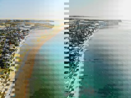
Site overview
Coastal processes, tourism, management
Key points
-
Why are sea defences needed in Swanage?
-
Why has beach replenishment been necessary in Swanage?
-
Has replenishment been a success?
-
What are the socio-economic and environmental effects of the replenishment scheme?
Project/hypothesis ideas
-
Too many visitors to a honeypot site can do as much damage as natural erosion
-
How do you think global warming might affect this coast in the future?
-
The sea is not the only factor responsible for the landforms of the Dorset coast
Tips/pitfalls
-
If possible visit the site during stormy weather conditions to see the power of the sea
-
Take spare camera batteries and film
Data collection
-
Photographs
-
Field sketches
-
Cost-benefit analysis of sea defences
-
Beach profiles - before and after scheme
Review - Statistical
-
Environmental quality before and after replenishment
Review - Presentation
-
Profiles
-
Bi-polar surveys
-
Longshore drift graphs
File nameFiles
File type
Size
Download