Swanage - Flood alleviation
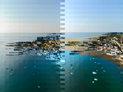
The town of Swanage lies on the east coast of the Purbeck peninsula in Dorset, at the mouth of the Swanbrook River
The town of Swanage lies on the east coast of the Purbeck peninsula in Dorset, at the mouth of the Swanbrook River. The catchment area ranges from Nine Barrow Down, Harmans Cross to the Swanage Plateau where there are several tributaries leading to the Swanbrook itself and covering a total catchment area of 15.2 km2.
Swanage lies at the mouth of the channel. The underlying geology ranges from chalk at Nine Barrow Down to limestone at Swanage Plateau with clays in the lower reaches of the valley. Therefore after heavy rain the land is saturated and the water is forced down the Swan Brook and through Swanage. This meant that anything obstructing the flow would contain the water upstream and flood the surrounding area. A high tide would have also meant the water would not dissipate quickly leaving land and properties sodden.
During the 19th century after a series of heavy rainfalls, and the threat of floods the Victorians constructed a straight outfall culvert from St Mary's church under Station Road, to an outfall underneath the Mowlem on the sea front. More buildings and roads in the 20th century meant there was less ground percolation, and more surface run off meant that the Victorian flood defences could not cope with the amount of water. As a result a new flood alleviation scheme was required to protect homes and businesses.
Time Line of the events and construction of the flood alleviation scheme
-
1990: Swanage was flooded, an area covering most of the lower part of Northbrook road, Kings Road and Victoria Avenue was under water, and the car park and King Georges field were under more than seven feet of water. The town had to be closed to traffic and many people were evacuated from their homes by boat
-
1993: Flood scheme jetty built at the end of Victoria Avenue to stop flooding in the future
-
1997: Flood scheme completed
-
2000: Swanage Flood Alleviation Scheme finished three years ago, it was supposed to stop the town from flooding ever again. Vandals interfered with the sluice gates in King George's field and so prevented them from being used in a flooding event. However the rest of the scheme worked well and Swanage was saved from major flooding
The construction of the scheme included:
-
Two reservoir bunds on the outskirts of town and a shallow bund at King Georges field
-
Widened and straightened channel adjacent to the original channel of the Swan Brook
-
Additional channel underneath Victoria Avenue to the additional discharge point at Banjo Pier
-
Telemetry sensors to measure water depths along the channel, which are linked and monitored by the Environment Agency
-
Automatic and manually controlled sluice gates at strategic points to stop and direct the water flow away from the businesses in the town centre
Swanage has not flooded since 2000 (due to vandals), but if there was torrential rainfall over several days on a spring tide it is hard to say if the flood alleviation scheme would be successful, this is one of the worries of local people with homes and businesses adjacent to the river.
The fact that the Banjo Pier is 60 metres long to discharge the flood water above the high tide mark on the beach, means there is a degree of sand building up against the south side of pier. This in turn means the north beach's natural sand replenishment is restricted.
Site overview
Fluvial Systems - Swanbrook River
Key points
-
The Swanbrook drainage basin
-
Why was flooding an issue in Swanage?
-
What is the aim of the flood alleviation scheme?
-
Is the channel more efficient after canalisation?
-
How does canalisation affect the morphology of the river?
-
Has canalisation been an effective solution to flooding?
-
Has the Banjo pier affected beach processes in Swanage?
Project/hypothesis ideas
-
How and why do velocity and channel area vary downstream?
-
How and why does the wetted perimeter vary with distance throughout the flood alleviation scheme?
-
How does canalisation affect the flow characteristics compared to an unmanaged section?
-
How does the Banjo Pier affect the beach/sand profile?
Tips/pitfalls
-
Make sure that all sites are labelled and site descriptions made, especially if sharing data
-
Make sure that all groups start measuring from the same side of the bank
-
Keep tape out of river so it is not dragged downstream effecting results
-
When measuring depth turn the rule side on so that the river flow does not affect readings
-
Have at least two people record results in case they are lost/ dropped in the river etc
-
When choosing a dog biscuit for the velocity test ensure that it is not the meaty ones as they go soft and stick to the inside of your pocket. Also make sure they are the brightly coloured (why when dogs are colour blind?) so they can be seen floating down the river
Data collection
Measure:
-
Width, depth, wetted perimeter (at channel and at bankfull), and velocity of channel
-
Measure areas of managed and unmanaged sections of channel
-
Beach profiles and longshore drift
Calculate:
Cross section/wetted perimeter and efficiency
Depth of beach with distance north of Banjo pier
Environmental Quality Surveys at sample points. Cross-sectional area, discharge, hydraulic radius (efficiency)
Review - Statistical
-
Spearman's rank - velocity and cross sectional area
-
Spearman's rank - efficiency and cross sectional area
-
Spearman's rank - bedload size and efficiency
-
Z test - differences in man-made and natural channels
Review - Presentation
-
Cross sections of river
-
Annotated sketches of sample areas
-
Beach profiles
-
Bi-polar surveys
File nameFiles
File type
Size
Download