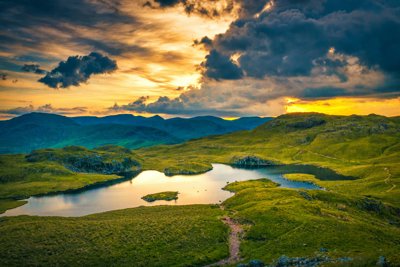
Managing the Lake District National Park
Richard joined the Lake District National Park Authority as Chief Executive in June 2007. Previously he was Regional Director in the North West for Natural England, a role he took up in October 2006. Richard worked for one of Natural England’s predecessors, English Nature, for 15 years.
Richard is a Geography graduate from Sheffield University where he also gained an MPhil in Coastal Geomorphology. In January 2016, Richard was awarded an honorary degree, Doctor of Letters, by the University of Sheffield for his work in National Parks. A Fellow of the Royal Geographical Society, away from work Richard is a keen climber, runner, cyclist and skier. We spoke to Richard about his role as CEO at the Lake District National Park and the response to the extreme flooding experienced in December 2015.
How does the Lake District National Park Authority operate?
I am CEO of the organisation and my role is essentially focused on looking after the National Park. The Lake District National Park Authority is a small organisation. It is similar in role to a local authority, or district council with the simple aim to ‘look after’ the area. We do so over various registers: planning for the park and its development, looking after the Park Management team (so, employing rangers etc.) and also offering services that can support visitors (visitor centres, information centres, and website content).
How do you manage both local and national responsibilities?
Although the National Park itself is a huge place (2000km² so yes very big!) it is very much a ‘local’ place too. It is brilliant to be responsible for a local area. Of course, as a place of significant natural beauty is it also valued as a place of national importance. So then, it is of national and international importance to care for the park. My job is to balance these two scales. I do much work to maintain relationships outside of the organisation; particularly with the Government. Unlike the vast National Parks in the US, for example, the Lake District is a very ‘real’ place where people live and work.
I work hard to balance both local and national perspectives. For example, managing local aspirations to develop and advance communities and economies, with National interest in conserving this special landscape with consideration and sensitivity. Essentially, it means no two days in the office are the same in my job.
How have the flooding events (December 2015-January 2016) affected the park?
The park has suffered extensive damage, and has affected the people who live and work in the park immensely. Annually, we usually have around 16 million visitors a year. So the damage compromises visitor experience too. As we work to recover from the flooding our main focus is to get infrastructure back up and running, but also managing stakeholder expectations of how long that will take. Some of the most extensive damage is to the road network. The main road that runs through the national park is the A591; this road connects the North of the park to the South – it has been destroyed through the floods. Pooley Bridge, which stood over the River Eamont at the northern end of Ullswater, collapsed on December 6 2015. The bridge was erected in 1764 and was Grade 2 listed, so that’s a loss of a historically significant structure.
How will you balance initial recovery with plans to make the park more resilient to future flood events?
As we recover, the task ahead is to repair not only the infrastructural damage, but to make the landscape more resilient to the changing climate and future events. This will include, for example, making wider culverts under the new roads. These will be able to handle higher volumes of water. Also, there is a need to build wider bridge structures so that more water can pass beneath them.
As a result of recent extreme flooding, there should be a national debate around the role of land management in uplands. Specifically, this should be focused on exploring how land is managed in the uplands and how it could be managed differently so that we might improve resilience to future large scale events. It is my view that there are diverse land management practices that, if employed, have the potential to build resilience to future flooding. This includes: the planting of more trees in uplands, maintaining blanket bog habitat, and growing longer and coarser vegetation. Also: naturalising some of the modified and straightened river systems within the Lake District National Park.
Of course, this presents challenges for the valuable and productive agricultural and sheep farming culture within the Park. Our task then, is to adapt business models and farming practices so that as well as the production of wool and meat, farmer’s practices aid flood risk mitigation. Some of these changes have already been implemented and that has been driven by a desire for improved wildlife and biodiversity in the Lake District. The more recent floods (December 2015 – January 2016) took place rather soon after the 2009 floods. I think the frequency has certainly emphasised the need to focus on reducing flood risk as a result of, and in collaboration with, diverse land management practices. Throughout, questions of carbon systems and storage, along with biodiversity, must remain at the fore of decision making.
Are you concerned that the recent floods may impact tourism and public perceptions of the National park as a place?
The images and reports documenting the damage to the National Park by the floods send out the message that we are closed for business. Therefore, it’s important that we counter-act this perception by reassuring people that we are open for business. Indeed the impact of the flood, whilst substantial, is relatively localised comparative to the size of the National Park. For example, fells and footpaths are still open and accessible and we’re encouraging visitors to enjoy the park. Indeed, there are opportunities to experience the park differently with the A591 temporarily closed. It has created an opportunity for some fantastic cycling and unique viewpoints, particularly of Dunmail Raise between Thirlmere and Ullswater, in a relatively traffic free environment. Short term then, there are opportunities for visitors to see their favourite National Park in a different light.
How has your disciplinary background in Geography assisted your role at the National Park?
Every job I’ve had has relied on my background in Geography. Everything I do, in dealing with the National Park, has a basis somewhere in Geography. From the social geography around housing and visitor economies, to the physical geography that explain and help us to understand how our rivers operate and how they are responding to the weather issues and flood we’ve just experienced. To coin a phrase, geography is written through the stick of rock that is my job. Ultimately, I think, it makes a real difference to your perspective and how you approach issues if you have that grounding in geography. When you’re responsible for a place as valuable and important as the Lake District National Park it’s important to have that geographical perspective.
Key Words
National Park
The National Parks of England and Wales are areas of scenic landscape that are relatively undeveloped and are designated under the National Parks and Access to the Countryside Act 1949.
Carbon System
The Carbon Cycle is the biogeochemical cycle that describes the movement of carbon as it is recycled and reused throughout the biosphere, including carbon sinks.
Culvert
A culvert is a structure that allows water to flow under a road, railway track, or trail from one side to the other. It is typically embedded by soil, and made from pipe, reinforced concrete or other material.
Lesson Ideas
Providing students with a map of the Lake District National Park students should research the flooding that occurred in 2015 and annotate the map with key events and notable damage sustained and possible areas that will be repaired, or reinforced against future events. Encourage students to use data and figures in their annotations.
Students work in groups, with each pupil acting as a stakeholder in the Lake District National Park e.g. farmer or local business owner. Students should hold a mock debate over land use and plans for the park and attempt to reach a solution. Encourage students to balance social, environmental and cultural commitments as they reach solutions in their discussions.
At the end of this group work, in class discussion, ask students to think about how a Geography degree, and their geographical knowledge, would help them to manage a place as large and varied as the Lake District National Park.
Links
Richard was interviewed in January 2016
- Fieldwork
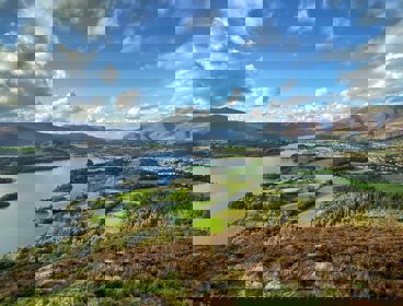
Lake District
The geography, geomorphology and geology of the National Park, with links to sources of further information and details about the fieldwork that can be carried out in different areas of the park
- Podcast
Dr Anjana Khatwa and the UNESCO World Heritage Jurassic Coast
Talking fossil hunting, geology and landslides on this UNESCO World Heritage coastline