London is a difficult city to pin down on a map. Apart from its size, there is also its complexity.
We need to consider the various stages that it has gone through too: from early settlement, through the Roman period, and beyond. The arrival of the Industrial Revolution and the development of the railways allowed London to grow, and facilitated the connecting up of many smaller towns, which became subsumed into a bigger whole. There is no single map of London that can do it justice; so many maps need to be considered.
Starter
Hand out or display a blank map of the UK. Ask students to identify ‘London’ on it by marking it on.
How accurate are they? Collate the results.
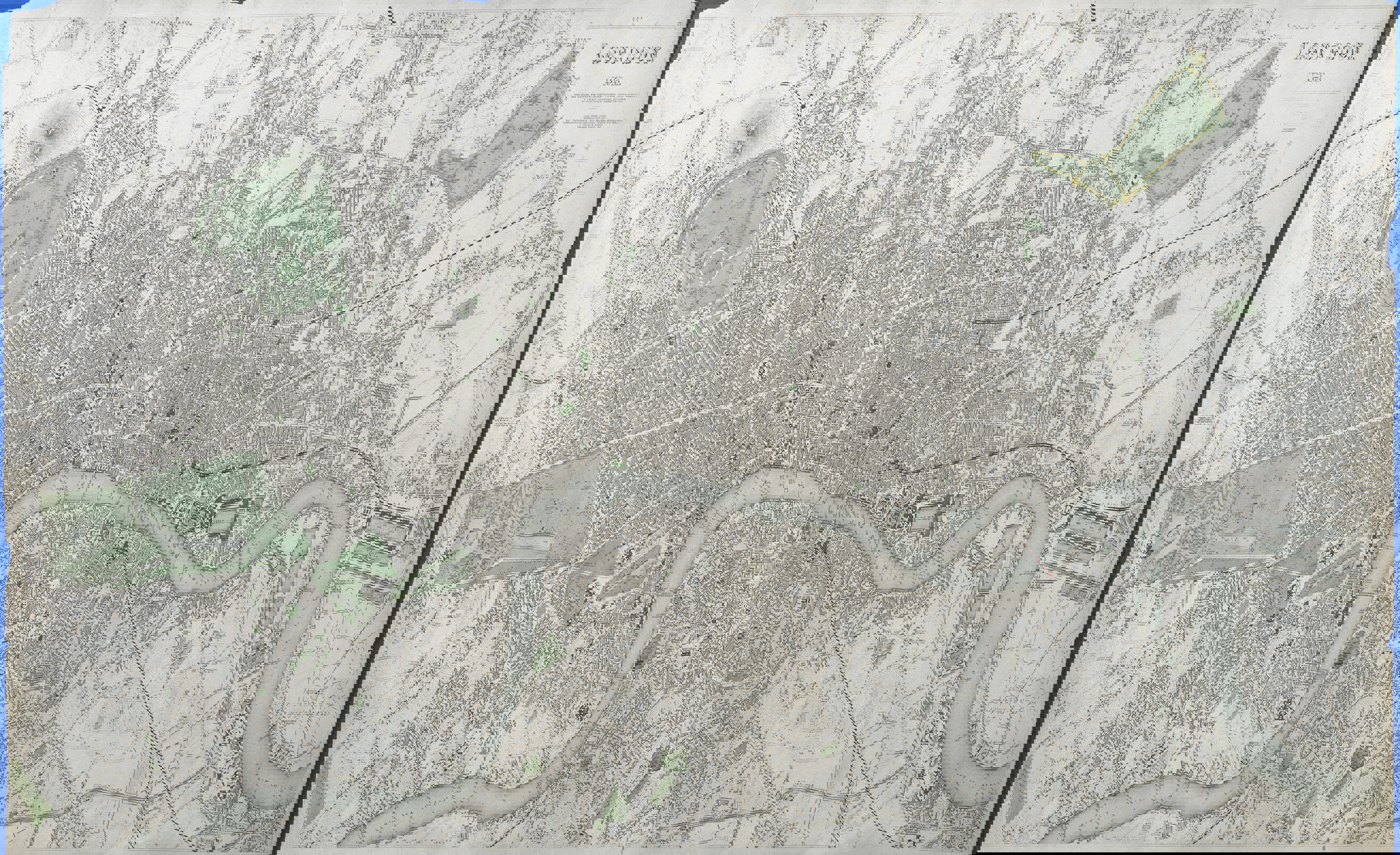
Locate London as it is today.
Use a digital mapping tool such as ArcGIS Online / Google Earth / Digimap for Schools to zoom into London and reveal its complexity.
What are the most distinctive features of the map?
Move slowly out from the centre and ask students the questions: “Where does London end? How will we know?”
Discuss what signs students would look for that the city had ended, as seen on the map? These should be recorded as evidence of urbanisation.
Main Activity
Watch the video: London Evolution Animation.
Use the London Evolution sheet to record observations as the seven minute film moves through a number of historic periods.
Discuss what remains of these ‘past Londons’ in the present day? Remind students that places can change within a short space of time.
Carry out an image search using an internet search engine on the term: ‘London Maps’ and explore the different variations in the first 50 (or if time permits 100) maps – what are the ‘constant features’ that are in most of them?
Use the Image search sheet to collate these, and prompt discussions on what maps are most commonly created.
Remind students that maps do not always show what we think they show e.g. the London Underground map is a distortion of Geography. Visit the Map Tube website.
Plenary
How have maps represented London over the years?
If time permits, students are given a map to explore further. This could also be used as homework or extension task if appropriate. Maps to consider showing here include:
Booth’s Poverty Map – refer to modern day maps which explore similar ground such as Illustreets, Ollie O’ Brien’s recreation of Booth’s map. Visit O’Brien’s website, and also Lives on the Line. Visit the Mapping London website
Visit the Mapping London site of Oliver O’Brien and James Cheshire who work for CASA at UCL. The site has a HISTORIC maps section. This contains a range of fascinating maps and visualisations
John Snow’s Cholera map – modern day health variations in the city – this has now been remade in ArcGIS Online. Visit the ArcGIS website
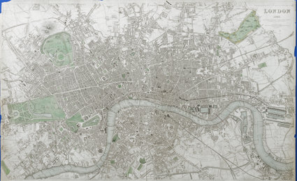
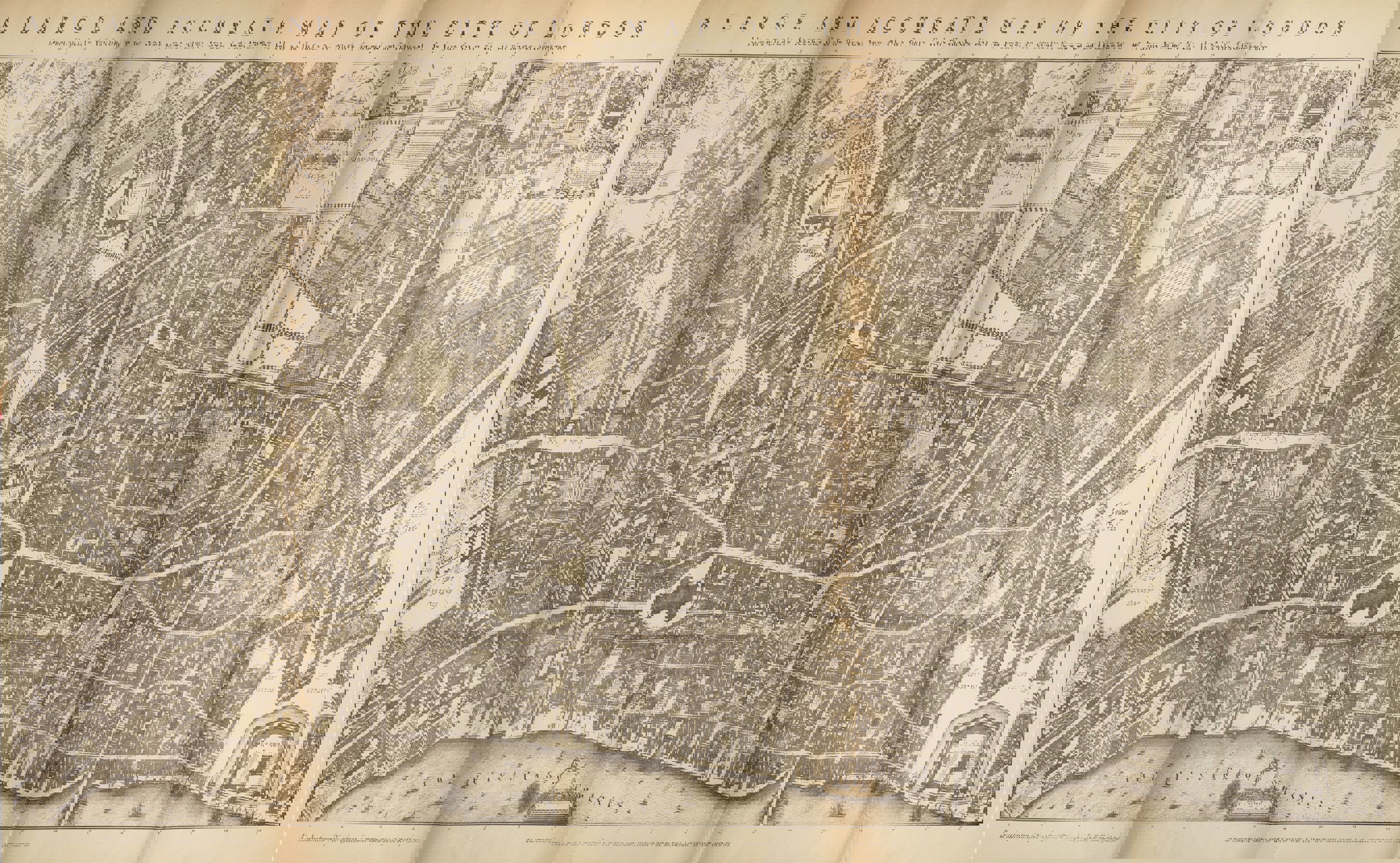
Royal Geographical Society (with IBG) historical maps collection. There are four maps of London from the 17th to 19th centuries which can be downloaded as JPEG form. They are attached along with these teaching resources. There is also an accompanying document (see downloads section) with reference numbers of the maps so more details on the maps can be obtained from the RGS-IBG website
Students add their ideas to a mapping wall which should be set up ready for the teaching of this unit to act as a mood board for the unit. This can be modelled using the Pinterest board that has been created for the unit, and can be viewed here. Investigations by students – possible curation of Pinterest boards or some similar enquiry based project on the maps of the past to show how the city has changed, and is represented
Further reading
The TV programme: Secret History of our Streets – made by the Open University. Visit the Open University website - you could possibly produce a version for a local street
‘32 Stops’ by Danny Dorling explores the lives of people living along the Central Line.
File nameFiles
File type
Size
Download