Lesson three: Practical task
This session will help students understand the issues surrounding collecting data on volcanoes and will look at virtual fieldwork on the Chilean volcanoes. Students will also get to complete a decision making exercise on the location of data collection sites on the volcanoes.
Aims
-
To understand the conditions faced by volcanologists during the accessing and collection of data during fieldwork
-
Develop the decision making skills which help decide where would be appropriate locational sites for volcanic plume analysis on a volcano
-
To develop an understanding of the methods used to monitor other volcanoes, focusing on the example of Mt Erebus in Antarctica
Starter
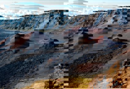
This starter is designed to give you a virtual insight to volcanic fieldwork based on the ascent of the Chilean volcano Puyehue which is currently undergoing an eruptive phase. You should be able to understand the conditions facing the volcanologists and gain an understanding of the type of equipment needed to carry out volcanic plume analysis.
Task one: For each site the tag cloud should include descriptive words to give a clear indication of what it was like at each site. Concentrate on the volcanic products, climate, and the physical environment.
(Read this document about how you could produce your own transect (with photographs), onto Google Earth using portable devices such as iPads and iPhones.)
Task two: create a PowerPoint presentation of the transect using your descriptive words to give an introduction into the conditions faced on the ascent of Puyehue.
It is possible to link the tag cloud information to the transect you have created. Alternatively, use the images in the transect of Puyehue and place these into a PowerPoint.
Task three: Create a kit list for an ascent of the Puyehue volcano. For each piece of kit, justify its use on a volcanic slope to show how they help overcome potential hazards.
Main Activity
The focus of this lesson is to decide on suitable areas to conduct fieldwork. Site justification is an important part of research, and your choice of site could affect the validity of your results.
This task looks at the sites for selecting data for collecting plume data.
In this decision making task, you should look to assess each site option, shown in the resource, “Site Selection in Villarrica for data collection” as a possible site for collecting plume data.
For each site consider the advantages and disadvantages, and then give an overall conclusion in summary.
You should consider, distance from plume, direction of prevailing wind, the relief and accessibility. Also consider which site would return the most effective data?
Plenary
To summarise the fieldwork based activity on the Chilean volcanoes this activity gives you an insight into fieldwork on a different volcano.
Mt Erebus is a cone shaped volcano in the harsh climate of Antarctica.
Read the Erebus fieldwork overview and look at the photographic casebook of fieldwork on Mount Erebus.
Create a table for each method to summarise:
-
Method
-
What information is collected?
-
How does this information help reduce hazards?
What considerations need to be taken into account when studying volcanoes or volcanic deposits, in the field?
Further work – volcano experiments with a difference
Have a look at this website. This resource helps create models which differentiate between eruptions at divergent and convergent plate boundaries.