Scaling geographical heights
This lesson focuses on the key physical and human features of the UK, as well as the weather and climate of the UK’s constituent countries
Key questions
What are the key physical features of the UK?
What are the key human features of the UK?
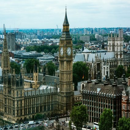
What does the UK look like from the air?
What is the typical climate of the UK?
How do weather patterns vary between the North, South, East and West? How do mountains and the sea affect regional weather?
How do physical and human factors affect agricultural land use / farming?
Where are the major cities located and why?
How are the regions of the UK linked up by transport routes? How have these developed over time?
Additional Resources
-
Great Britain Road Atlas
-
Various UK maps from a school atlas
-
OS Explorer Maps (1:25000) OL17 (Snowdon); OL6 (Scafell Pike) and 392 (Ben Nevis);
-
ruler and calculator
Web Links
-
View a variety of physical and human landscapes in UK identified through aerial photography go to RGS-IBG Britain from the Air
-
For a map showing all UK rivers go to Project Britain
Learning Objective
To locate key topographical features of the UK, describe and understand key aspects of the UK’s physical and human geography and use Ordnance Survey maps.
Starter
Link with ‘Britain from the Air’ website (see web links) ‘Exploring the Landscapes of Britain’: open sensory questioning based on nine aerial photographs: what do you see, what might you hear, how does the photo make you feel? Write descriptive words on interactive whiteboard. Explore the online gallery and striking aerial images of Britain with pupils and discuss.
Main Activity
Use the UK Climate Factsheet (see downloadable resources) to explain the climate of the United Kingdom, this document can be displayed on the interactive Whiteboard so pupils can see images and read the text.
Climate: the UK’s climate varies according to season and location but, on the whole, can be described as mild with few extremes. The overall climate is called temperate maritime. This means that it is mild with temperatures not much lower than 0ºC in winter and not much higher than 32ºC in summer. It also means that it is damp and is subject to frequent changes. The main influences on our climate are the Atlantic Ocean, our northern latitude, and the warming of the waters around the land by the Gulf Stream (a warm current of the northern Atlantic Ocean).
July and August are normally the warmest months in England. Around the coasts, January and February are usually the coldest months. May, June, September and October generally have pleasant temperatures and less rain. July and August are the warmest months, but they are also the wettest. The sunniest parts of the Britain are along the south coast of England.
Rain is fairly well distributed throughout the year, with late winter/spring (February to March) the driest period and autumn/winter (October to January) the wettest. The Lake District is England's wettest region, receiving an average of 130 inches (330 centimetres) of precipitation each year. The western and northern hills receive about 40 inches (102 centimetres) of rain, while the east coast receives about 20 inches (51 centimetres).
Use the Mountains and Rivers Factsheet (see downloadable resources) to highlight the location of the UK’s key physical features. This document can be displayed on the Interactive Whiteboard so pupils can view the maps and images, and read the text.
The UK Landscape is very varied, ranging from the Grampian Mountains of Scotland to the lowland fens of England which are at or below sea level in places.
Scotland and Wales are the most mountainous parts of the UK. A ridge of hills, the Pennines, runs down the centre of northern England. Many coastal areas are low-lying, especially in the east and south of England. These include the wetlands of the Somerset levels, which regularly flood during heavy rain.
Most of the UK is made up of gently rolling hills with isolated areas of high ground such as Dartmoor in the south-west of England or the Mourne Mountains in Northern Ireland.
Being a relatively small Island, the UK's rivers are not very long. The Severn, its longest river, is just 338 km in length, beginning in Wales and entering the Atlantic Ocean near Bristol in England. Other major rivers include the Thames, which flows through Oxford and London, and the Trent and Mersey rivers, which drain rainfall from large areas of central England. The River Tweed in Scotland is 155 kms long and the River Bann in Northern Ireland is 122 kms long.
In teams of 3, pupils create a topological map for a road journey for the ‘The Three Peaks Challenge’ starting from London on the Three peaks log and blank outline of the UK activity sheet (see downloadable resources) to show the following stages of a trip from London to the Three Peaks (Snowdon, Scafell Pike and Ben Nevis).
-
London – Birmingham
-
Birmingham – Shrewsbury
-
Shrewsbury to Snowdon
-
Snowdon – Liverpool
-
Liverpool –Lancaster
-
Lancaster – Scafell Pike
-
Scafell Pike – Carlisle
-
Carlisle – Glasgow
-
Glasgow – Ben Nevis
Each team produces a journey log including distances, directions, duration of travel, physical and human geography encountered and writes a weather forecast for one of the Three Peaks on the Weather Forecast template (see downloadable resources).
Extension
Using the OS Explorer Map for one of the Three Peaks, describe in detail the route of the climb from the starting point: Pen-y-Pass car park (Snowdon): SH647555; Hollow Stones Route (Scafell Pike): NY186084; Glen Nevis Visitor Centre: NN122729.
Use grid references, map symbols, compass directions, scale and contours to give details of distance, direction and steepness of the climb.
Plenary
Carry out weather forecast roleplay in small groups and then as a whole class activity. Add the information gathered in today’s lesson to the ‘UK Class Map’ display.
File nameFiles
File type
Size
Download