Investigating provision
Aims
-
To compare the connectivity and accessibility of transport systems in different areas, for example two urban areas (perhaps with different functions which may affect provision) or between an urban and rural area
-
To investigate and compare public transport provision in different areas
-
To examine how transport provision affects commuter preferences
-
To examine usage of public transport and to relate this to the feasibility of maintaining a particular route or service
-
To examine vehicle flows at particular intersections and to identify diurnal, weekly or seasonal patterns. To investigate the need (location, time) for improved provision
-
To conduct route quality surveys and to determine how route quality affects the choice of route taken
-
To carry out a survey of car parking: the number and type of car parks and their locations, the quality of provision, car parks at honey pot sites and usage (occupancy against capacity)
-
To focus on accessibility and parking in the CBD
-
To investigate the suitability of provision for picking up and dropping off students outside the school
-
To analyse the provision, usage, connectivity and safety of local cycle networks
-
To focus on the accessibility and use of footpaths and pavements by pedestrians
Equipment
-
A counter or tally charts
-
Base maps of the sites
-
Quality indices or scoring systems
-
Secondary data, for example timetables, fare information, archive and current route maps, user statistics and local newspaper articles
Investigating route-ways and connectivity
By car
-
On a base map of the area, mark on roads of different type and label or colour code them
-
Annotate with traffic information, for example areas prone to congestion or accident ‘hot spots'
-
Travel the routes and annotate further with information about the quality of the route, for example road condition or flow. It may be useful to compare journeys along the same route under different weather conditions
-
When travelling the routes, average the journey times at different times of the day
-
Different routes to a particular destination could be compared, or various routes into and out of a settlement
-
Questionnaire information could also be incorporated by surveying the routes people take and their reasons for their choices
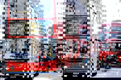
Public transport
-
Examine the timetables and mark the routes onto a base map of the area
-
Identify areas that are not served and measure the distance required to travel to the nearest service
-
Examine usage levels by recording occupancy related to capacity on different services
-
Survey the ‘type' of passenger in terms of age, gender and occupation
-
Conduct questionnaires to survey the perceptions of passengers using the service. What are their opinions on the regularity, punctuality and reliability of the service, journey time, fares and the condition of the bus or train? Compare their views with car users travelling the same route
-
The route can be analysed further by comparing the distance of the route with the most direct route which could be taken. This gives an indication of the ‘detour' distance (the ‘extra' distance covered by taking public transport as opposed to a journey by car). The extra time can also be approximately calculated
Site provision (for example the provision of pick up and drop off bays)
-
Map the provision and add annotations, sketches and photographs to your map, identifying key feature such as turning circles, parking bays, bus areas and disabled provision
-
Observe and record the volume of vehicles accessing the site at key times of the day and identify any issues or problems that arise
-
Conduct questionnaires amongst car drivers, bus drivers, local residents and site staff to determine the range of opinions about the quality of the provision
-
Interview the manager of the site (or head teacher), questioning them in particular about their methods for addressing any issues that arise
-
Make your own suggestions about possible management techniques
Investigating car parking
-
Map the car parks in the study area and colour code them according to their type (surface or multi-storey), size and charged (this could be broken down into fee categories)
-
Examine occupancy and capacity levels by surveying at different times of the day and / or seasons
-
Assess the quality of the provision, taking into account:
-
Cost
-
Lighting and safety / security (you may be able to obtain secondary data on crime and vandalism)
-
Access and layout
-
Proximity to services
-
Amenities, for example toilets
-
Aesthetic and environmental quality, for example smell, graffiti, litter
-
It may be necessary to take a sample for large areas
-
-
Conduct questionnaires to determine the perceptions of users, and compare these findings with your own assessment of the site
-
Use your findings to evaluate the effectiveness of the provision and identify any problems or issues that might arise
-
Comment on existing and proposed management solutions and suggest your own initiatives. It may be possible to arrange an interview with a representative from the local council
-
You could investigate the car parking provision from the perspective of a specific user group, for example overheight vehicles, disabled provision, coaches, pedestrians
Considerations and possible limitations
-
Large scale studies can be time consuming and lend themselves to group work. There is also a cost element with driving many different routes or using public transport
-
Large urban areas should be sampled rather than undertaking the whole site
-
Calculating car park occupancy can prove difficult - cars are always coming and going, so counts are always only an estimate at best
Investigating issues and management
Aims
-
To identify traffic hot spots for congestion or accidents, and existing or potential management solutions
-
To investigate the plans for a new development, for example a bypass, a new road layout, a new runway or airport terminal or the closure of a railway station or line. The likely impacts could be analysed and the case for or against the development investigated
-
To study road safety in different residential areas, and the possible methods to improve it
-
The usage and effectiveness of park and ride provision
-
To focus on issues arising in the CBD, for example the effectiveness of pedestrianised areas and one way systems, public perceptions of them and their management. To compare the effectiveness of different measures in different places, e.g. two different CBDs
-
To study the impact of a quarry, industrial estate or retail development on local traffic conditions
-
To investigate the impact of a school or football stadium on localised traffic flow and residential access, or the impact of coaches to a major attraction or event
-
To investigate the prevalence of traffic offences (for example speeding) on a route, using statistics and evaluating the effectiveness of measures to reduce them
-
To study traffic flow management techniques in large supermarket car parks
-
To focus on environmental themes for an investigation, for example, car occupancy levels, car sharing schemes, the impacts of congestion charging or toll roads, electric buses
Equipment
-
Noise DB meters
-
Traffic counters and tally sheets
-
Base maps, cameras and sketching materials
-
Secondary data - for example, information on proposed development, newspaper articles, accident statistic, historical maps and photographs to show the area before and after development, information on toll and congestion charges
Methodology
-
Map the area and make field sketches/take photographs of the sites being investigated
-
Annotate maps, sketches and photographs with key features and information about the issues and highlight the management techniques already in place
-
Assess the usage of the site using methods such as traffic counts (type and number at different times of the day), surveys of the occupancy of park and ride buses and car parks, etc
-
In congestion hot-spots, try to find out when and why congestion takes place, the length of queues and the length of delay
-
Research secondary information about the issue or the proposed development, and try to obtain statistics of congestion or accidents before and after management strategies were introduced to the site
-
Undertake questionnaires of local residents and road/public transport users to assess their opinions on the development. Local residents could be asked to make a mental map of their perceived areas of ‘high risk', for example the most dangerous' roads in their immediate neighbourhood
-
Further primary data may also be required for certain investigations, for example environmental quality surveys or noise surveys (for example decay with distance from an airport)
-
Investigate existing management strategies that are being adopted to reduce the impact or risk resulting from the development. Evaluate the effectiveness of these strategies and make suggestions of your own for further improvements
Considerations and possible limitations
-
Large scale studies can be very time and labour intensive, and as a result are perhaps best shared amongst a group
-
Keep your investigation to an achievable scale and maintain the focus
-
Traffic counts in busy places will be very hard to achieve successfully on your own
-
It may prove difficult to obtain secondary data, for example the volumes of traffic before a development (needed for comparison). However, the local council will be a good starting point, as a detailed investigation will need to have been undertaken before the development was started
-
Remember the good points! New developments often bring positive impacts in terms of employment and economy, local industry and property prices