Ed Parsons on how geography drives productivity
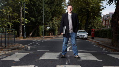
Ed Parsons is a Geospatial Technology Advisor and an advocate for geography. For two decades, Ed was Google’s Geospatial Technologist with responsibility for leading Google’s mission to organise the world’s information using geography.
In 2024, Ed was awarded the inaugural Society’s Professional Geography Award for excellence in the use of geography in professional practice.
As part of our series spotlighting geographical experts and thought leaders in industry and government, here Ed discusses technology optimism, his dislike of the term geospatial, and why geography helps drive positive change.
“When the term geospatial is used, it’s fundamentally describing geography”
I describe myself as a digital geographer. I'm proud of the fact that I’m a geographer that makes use of digital tools to help people understand their world and to make better decisions or to get around. I've always been a technology optimist. Our lives are better today than they were 50 years ago, and they keep improving. That's mostly because of technology.
When I started at Google two decades ago, it coincided with the emergence of the smartphone and the web. It was the early 2000s and I don’t think anyone realised how much of a role geography was going to play. Google Maps made geography accessible to everyone. The power of geography is now widely available – most of us now have geographical tools in our pockets which help us to understand the world around us.
This gives us great opportunity, the power to not get lost and the confidence that brings. But this comes with its challenges; maps delivered just to solve transactional tasks mean that all we’re seeing is a small part of the world that’s only relevant at the time. With this focused mapping we lose the bigger picture and with that we lose connectivity of our position on the planet.
Geography enables you to see and understand that bigger picture. When you unfold a map, like an Ordnance Survey map, and look at the whole thing, you get a sense of the full landscape which you don't get when you're just looking at the map on your phone.
There's a war in the Middle East that is fundamentally driven by human and physical geography. You don’t get to understand that geography if you just look at arrows and blue lines on your phone. Ed
Although I advocate for digital geography, I wish that the term geospatial had never been coined. I don't know where it came from – after all what does geospatial mean? Other industries haven’t started renaming what they do as they started using digital tools. Accountancy is accountancy. It's moved from paper ledgers to spreadsheets to complicated computer models of the economy, but we haven't given each one of those a different term.
When the term geospatial is used, it’s fundamentally describing geography.
Another term being used is GeoWeb. But what really is that? Things like Google maps – or Deliveroo – any similar application has a geographical element and uses the web to deliver services. Geo is a horizontal technology – it’s the same with AI too.
During my final years at Google, like most technology companies, we became fixated on AI, and the growth of large language models, like Chat GPT. But AI is a broad church – those developing large language models need a range of skills – and they’re not computing skills. It’s the skill of being able to ask questions and ask those questions in an intricate way – prompt engineering.
There will always be geography in AI. For example, if you ask a large language model to generate a map, it generates an image of a map. It's something that looks like a map and it has a legend in the title, but it doesn’t understand the content of the map because it's creating a picture of what it thinks the map is.
Are geographers better at working with AI for geographical questions? Theoretically, they should be, but there is an issue because of the way large language models have developed and the way that we have encoded geographical information in the past. What’s needed are the skills and knowledge to make geographical data work better for AI systems, so teaching AI to describe and to explain – just as geographers do.
We are deploying a lot of technology to make productivity processes more efficient, be they in the public or the private sectors. We can help drive productivity by planning the locations of businesses, hospitals, or sports centres better and making networks more efficient.
At the moment, I’m involved in the location of fast-food restaurants, and a lot of the behind-the-scenes work goes on modelling the planning of these stores using massive amounts of geographical information and knowledge so that the investment decision is sound. The best evidence comes from geography.
If we look at a public project like Crossrail and the Elizabeth Line, these are good examples of positive economic impacts by fundamentally changing geography. Connecting east to west across London has had massive economic benefits that outweigh the costs.
Eight years ago, it would have taken you two hours to get across London – now it takes 20 minutes. That’s an enormous impact that came about by not only describing the challenge but also explaining why it exists and what can be done.
We should be confident saying that what we do as geographers is important. Our challenge and opportunity is to be much more confident in highlighting how geography underpins huge amounts of societal, economic, and environmental processes and changes.
Join us next month for our next thought piece from an influential professional geographer.
- News

Professional spotlights: hear from geographical experts in industry and government
We’re starting a new series – Professional spotlights – where you’ll hear from geographical experts and thought leaders in industry and government. This time, we speak to Olive Powell, Head of Geography and Geospatial at the UK Office for National Statistics (ONS).
Tuesday 5 May 2026 - RGS news

Disaster Risk Management Professional Practice Group launches webinar series
The Royal Geographical Society’s Disaster Risk Management Professional Practice Group is launching a four-part webinar series to accompany the publication of Geographical Perspectives on Disaster Risk Management (Wiley).
Thursday 30 Apr 2026 - RGS news

National Apprenticeship Week 2026
National Apprenticeship Week runs from 9-15 February, celebrating the apprentices, employers, training providers and organisations who make apprenticeships such a vital part of the UK skills landscape.
Monday 9 Feb 2026