Earth Observation research enables use of satellite data to reduce impacts of wildfires
King’s College London’s (KCL) research on Fire Radiative Power (FRP) has enabled space agencies to adjust and develop satellites and instruments to better measure fires worldwide. This has greatly improved scientists’ capacity to monitor, map and quantify the nature, trajectory and impact of wildfire activity and other forms of landscape burning in real-time and at a global scale.
Issue
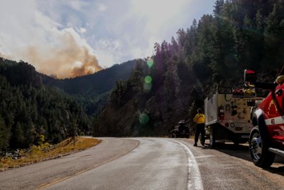
Landscape fires are an increasing problem in many areas worldwide. On average, an area as large as India is burned every year. Whilst some fires are seen as an ecological necessity, others put lives, homes and infrastructure at risk, lead to ecological damage, and release smoke whose particulate matter greatly degrades air quality and leads to hundreds of thousands of early deaths annually in fire-affected regions – mostly in developing nations.
Approach
Taking leading roles within the Natural Environment Research Council’s National Centre for Earth Observation (NCEO), KCL’s researchers have contributed to significant advances in monitoring the changing state of our planet through use of satellite instrumentation. KCL research underpins a number of Active Fire Radiative Power (FRP) products which measure the emitted heat signal of active fires to provide information in real-time as a fire is burning. This enables satellite data to be converted to actionable information, capable in some cases of supporting real-time monitoring, decision-making and early warning systems, including for air quality forecasting.
Impact
KCL research has had major impacts on the specification and design of space-based instruments, enhancing the capacity of international operational agencies to use satellite data to map, quantify and monitor global wildfires in near-real time for better wildfire management and response.
KCL researchers now lead the development of a Global Fire Assimilation System (CAMS) operated by the EU’s Copernicus Atmosphere Monitoring Service which provides the public and decision-makers with global monitoring of atmospheric composition. In 2019, GFAS data had 96 global users, with 369 from non-researcher entities using GFAS to bring fire emissions into their own air quality warning systems.
More information
Institution: King's College London
Researchers: Professor Martin Wooster
Share this resource
This is an open access article under the terms of the Creative Commons Attribution License (CC BY NC 4.0), which permits use, adaptation, distribution and reproduction in any medium or format, provided the original work is cited and it is for non-commercial purposes. Please contact us for other uses.
How to cite
Royal Geographical Society (with IBG) (2023) Earth Observation research enables use of satellite data to reduce the negative impacts of global wildfires. Available at https://rgs.org/earthobservationwildfires Last accessed on: <date>