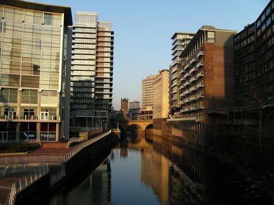
Improving urban environments by revitalising degraded rivers
Downloads
New methods and techniques for monitoring and restoring urban rivers have improved river water quality, ecology, biodiversity and the environments surrounding rivers during urban regeneration schemes. This was especially the case for river and waterfront environments left polluted or degraded in former industrial areas.
Challenge
Over 50% of the world’s human population lives in cities, for whom rivers are a source of drinking water, sanitation, transport, and open space for relaxation and recreation. River corridors also provide important resources for wildlife.
However, urban and industrial development have led to severe degradation of urban water courses. Previously hazardous or environmentally degraded parts of towns and cities have increasingly been opened up to new development and urban regeneration by local authorities. This requires effective restoration and management of urban rivers and waterfronts in order to provide improved water quality and wildlife habitats, and better flood risk management.
Solution
Professor Angela Gurnell (Queen Mary, University of London) and Professor Geoff Petts (University of Westminster) undertook work for the Environment Agency to develop a toolkit, known as the Urban River Survey, for urban planners and river managers to more effectively assess rivers and make decisions about the best way to make improvements. The toolkit introduced several new techniques that integrates environmental indicators with land-use planning, water management, public access and the visual amenity of river corridors.
Working on the highly degraded urban catchment of the River Tame in the West Midlands, Professors Gurnell and Petts showed in detail how the channelling of rivers by engineering works adversely affected water flow, sediment movement and water quality. Their research, which draws upon river processes, ecology and chemistry, has become the foundation for best practice in urban river restoration design.
Benefits
Better decision making and governance
The Urban River Survey has been used by local authorities in London to undertake project appraisals, ecosystem services assessments, habitat assessments, relative water quality assessments and catchment management plans for river restoration schemes in Mayes Brook Park and the River Wandle. It was also adopted by Severn Trent Water, the Environment Agency and local authorities in the West Midlands, and Birmingham City Council used it as formal planning guidance for developments in river corridors and brook courses in the city.
The Environment Agency’s National Environment Assessment Service (NEAS) adopted the Urban River Survey as routine practice in 2013, allowing their ecosystem services tool ECOSTATUS to describe and quantify, pre- and post-implementation, the impact of river improvement schemes on river ecosystem services, and to assess the aggregate impact of those schemes on the ecosystem services provided by entire urban river systems.
Combining systems / data
The Urban River Survey’s river quality indicators have been added as a data layer in iGIGL (Geographical Information for Greater London), used by a wide range of users, including the Greater London Authority and Environment Agency, for monitoring London rivers.
The survey has also undergone several refinements in related projects, including a citizen-science based Modular River Survey and the development of a GIS-based catchment planning system.
Raising awareness and improving understanding
As a result of the new toolkits and methodology, local communities have become more involved and engaged with their local waterways, such as the Thames 21 project to improve the flora and fauna of the Thames river banks in London.
Further reading
This case study was originally published by the Society in 2011 and was updated in 2019.
Share this case study
This is an open access article under the terms of the Creative Commons Attribution License (CC BY NC 4.0), which permits use, adaptation, distribution and reproduction in any medium or format, provided the original work is cited and it is for non-commercial purposes. Please contact us for other uses.
How to cite
Royal Geographical Society (with IBG) (2019) Improving urban environments by revitalising degraded rivers. Case study. [online] Available at: https://rgs.org/revitalisingrivers Last accessed on: <date>